The White Fence, issue #115

NOVEMBER 2025

Editorial

Dear Friends, It is my great pleasure to introduce you to a relatively new citizen of Sackville. Ontario-born Christian Corbet comes from a long line of notable ancestry hailing from Guernsey, Channel Islands. He moved to Sackville in 2014. In this issue of The White Fence we are grateful to Christian for sharing his research on one of Sackville’s fine older homes, Broadmoor Manor, 382 Main Street. Christian is an independent creative, a sculptor, painter, and portraitist, who has worked in several media, including oils, watercolour, bronze, clay, and textiles. He has received commissions for his work since the mid-1990s from bodies as diverse as the Royal Canadian Navy and, as he informed me, “the person next door.” Commissioned pieces include a coronation portrait of HRH King Charles III and a portrait of Dame Jane Goodall. His work can be found in private, public, and corporate collections in Canada, Great Britain, and Europe, examples being The Canadian Museum of History and the Crown Collection. In many of these collections he is the first and only Canadian to be so honoured. As well, he has published in numerous arts journals. In Part 1 of this issue he discusses the architecture of Broadmoor Manor and in Part 2 he will provide an account of the people who have lived in this venerable house over the years. I met Christian Corbet by chance on one of my regular “exercise walks” from our house to the Campbell Carriage Factory. We introduced ourselves and when I learned he was researching Broadmoor Manor you can imagine how happy I was to learn that he would share his efforts with The White Fence. I jumped at the chance to inform him that the results of his work on this historic home would be of great interest to the readership of this newsletter. Without hesitation, he mentioned that he would be most happy to forward the results of his work to us for The White Fence. What follows is a detailed account of a special home in Middle Sackville dating back to the early twentieth century.

Enjoy!

—Peter Hicklin

Broadmoor Manor, Part 1

Edmund Burke’s Queen Anne Revival in Sackville, New Brunswick, Canada: Form, Finish, and a 1913 Reinvention

by Christian Corbet

Introduction

Broadmoor Manor in Sackville, New Brunswick, occupies a singular position within Atlantic Canada’s domestic architecture. Commissioned in 1907 and built in 1907-08 by J. W. S. Black and designed by his brother-in-law, the eminent Toronto architect Edmund Burke, the house exemplifies late Victorian Queen Anne Revival sensibility translated to an Edwardian Maritime context: richly textural surfaces, asymmetrical massing, animated rooflines, and a social program that displays privilege and hospitality. The building’s 1913 expansion—adding an enlarged dining room, a dedicated library, and an advanced principal bedroom suite with ensuite and balcony, as well as an uncommon bomb shelter— registers an early-twentieth-century shift toward privacy, hygiene, and modern convenience without sacrif icing Burke’s picturesque exterior language. The property’s remarkable fenestration (50+ windows) and circulation (30+ doors), and the period note that the fish scale wall shingles were originally painted red, further index an architecture of light, air, and theatrical presence.1 What follows is a close architectural reading of Broadmoor Manor’s exterior and interior, a reconstruction (from description and typo- logical precedent) of its spatial organization, and a consideration of the 1913 alterations as both a stylistic and social modernization. The essay situates the house against Queen Anne domestic design across Canada—especially in Toronto and the Maritimes—and outlines how Burke’s authorial hand negotiates regional materials and climate. It is intended as a scholarly account for historians and preservationists.

Sackville, the Black Family, and the Cultural Program of a House

Sackville’s late nineteenth century prosperity, linked to regional trade, education, and transport routes across the Tantramar marshlands, created a milieu in which ambitious houses served not merely as shelter but as social instruments. Commissioning a house from Edmund Burke—best known for his Toronto practice and, later, the firm Burke, Horwood & White—signaled cosmopolitan aspiration. In this light, Broadmoor Manor is legible as an architectural calling card: its exuberant silhouette and expansive front verandah cultivate visibility and hospitality; its differentiated interiors choreograph gradations of publicness, from formal reception to family retreat typically to the second and third floors.2

Edmund Burke and the Canadian Queen Anne

In Canada, Queen Anne Revival is less a medievalist reconstruction than a flexible palette: irregular massing, steeply pitched and intersecting roofs, gables and dormers of varying scales, projecting bays, textural shingle patterns, and porches with turned posts or classical hybrids. Burke was adept at modulating these ingredients to local climate and social habit. His houses are typically kinetic in silhouette yet careful in proportion: elevations break into planes without losing composure; fenestration varies in rhythm but remains anchored by a few steady verticals (chimneys, stair windows).3 Broadmoor Manor, read in this register, shows Burke orchestrating asymmetry as a composed collage: each protrusion has a counterweight; dormers answer gables; the verandah unifies otherwise busy façades.

Site, Orientation, and Environmental Fitness

The house’s position in Sackville’s breezy, maritime environment favors cross-ventilation and considerable daylighting. The quantity and diversity of windows—well over fifty—suggest a deliberate environ- mental strategy consistent with pre-mechanical comfort: tall double- hung sash for stack effect; bay windows to capture lateral light; dormer lights admitting sun deep into third floor rooms; and two formal doors along verandah and side porch promoting summer airflow.4 The over 400 square foot veranda doubles as environmental device—deep shade at ground level and a rain buffer at wall surfaces— and social stage, mediating between parlour and garden and over two season social space.

Exterior Language: Massing, Roofscape, and Surface

Asymmetrical Massing and Roofline

Broadmoor’s massing reads as additive rather than monolithic: a principal block enlivened by side ells, canted bays, and gable-fronted projections. The roofscape is a virtuoso exercise in Victorian/ Edwardian plasticity: rare 5 intersecting gables with variable pitches, shed and gable dormers, and cricketed valleys that cast a play of shadow across the third floor walls. The composition is intentionally irregular, but because Burke calibrates ridge heights and dormer alignments, the overall silhouette remains controlled rather than chaotic.5

Chimneys as Vertical Counterpoints

The prominent three red brick chimneys —several and emphatically scaled— function as visual pilasters against a restless roofline. They pin the eye, punctuate the long roof planes, and proclaim the status of the hearth as center of domestic life. Their corbelled caps (as typical in the period) project a modest, articulate profile above the ridge, a punctuation mark at each firebox cluster.6 Red bricks were imported from Scotland; the 1913 extension chimney was fully replaced in 2010.

Shingles, Siding, and the Polychrome Tradition

Queen Anne practice luxuriates in surface variety. At Broadmoor, decorative gable shingles—exist in both fish-scale and hexagonal patterns—register as a lacework above the flatter wall fields. The historically noted finish—shingles originally painted red—aligns with a broader Victorian polychromy that used strong hue to unify busy textures and increase legibility at distance.7 In later eras, a light-overdark or two-tone scheme (for example, white lower story, blue upper story) would read as a simplif ied, twentieth-century reinterpretation; but in the nineteenth century, saturated colour helped organize the eye across multiple materials and shadow lines. Note, original colour scheme on cedar shingles was red and replaced to colour blue in 2017.

Windows and Doors: Articulation and Number

The abundance of windows is not merely quantitative. Their variety of type (tall sash, oriels, faceted bays, dormers) sets up alternating registers of narrow/wide, projecting/recessed, transparent/opaque. This produces a lively facade while maintaining a useful interior logic: high-ceilinged reception rooms require tall sash; bays enlarge dining or sitting rooms; dormers enable staff or children’s rooms in the roof. The 30+ doors indicate a complex circulation network— paired parlours, service passage, verandah access points, and sleeping porch/balcony egress— typical of houses where movement between public and private realms was carefully managed.8

The Verandah as Social Threshold

Broadmoor’s wrap-around verandah with turned columns with spindle slats frieze in keeping with the style is a social diaphragm: it offers controlled visibility, hospitality, and climatic respite. It binds disparate projections into a continuous horizontal—a datum—from which the gables rise like sails fitting a design suitable of the Maritime lifestyle.

Interior Organization: Hierarchies, Processions, and Finishes

The Arrival Sequence and Hall

Queen Anne interiors frequently turn on an axial hall offset by a staircase that sponsors ceremonial movement without enforcing strict symmetry. At Broadmoor, its intimate entry vestibule checks drafts, opening to a lobby that fans circulation to parlour, library, kitchen, and dining room. The stairs, placed to catch a moderate window at the half-landing (with sitting bench), would distribute light down the well and dramatize ascent.9

Public vs. Family Realms

The plan negotiates front-of-house display and rear family life through subtle thresholds: wide doors, cased openings, and changes in ceiling height, and coffered ceilings, and finish. Front rooms carry rich finishes—birch hardwood floors, subtle decorative plaster, three mantelpieces of wood surrounds, arched doorways—while rear rooms shift to painted trim, simpler cornices, and pragmatic built-ins in service areas.

Fireplaces, Built-ins, and Material Grammar

With multiple chimneys, four f ireplaces anchor the principal rooms. Period practice supports grate-type fireboxes with Doulton Lambeth tiled surrounds with the interiors possessing cast iron friezes of social life-giving depth and warmth. Nook by window shelving and bookcases in the library articulate the house’s social rituals— reading, dining, visiting.

The 1913 Expansion: Modern Comfort within a Edwardian Envelope

Enlarged Dining Room

The extended dining room speaks to formality and entertainment. By 1913, service choreography was increasingly hidden: a butler’s pantry with pass-through to the dining room, improved serving surfaces, and discrete bell systems or call buttons. A larger room allowed a refectory or extension table, additional seating, and buffet/sideboard walls for service.10 Butler’s pantry originally was located in the now thrice-renovated kitchen.

A Purpose Built Library

The addition of a library underscores rising middle-class and professional emphasis on self-cultivation. Bookcases to ceiling height grace the exterior wall; a substantial elevated fireplace—with wall safe—provides winter comfort, northeast light and avoids glare. Reading chairs cluster near bays; a business desk once occupied the room’s center, its placement rationalized by window orientation and hearth. Note, today the former library now houses a forensic studio.

The Modern Suite: Bedroom, Ensuite, Balcony

The new principal bedroom with ensuite bath and balcony exemplifies early twentieth-century domestic modernity: running water, sanitary tile, ventilation through windows, and outdoor access for health— part of a contemporary discourse in which sunlight and fresh air were thought prophylactic. The balcony also serves as a private belvedere overlooking grounds, separating the owners’ leisure from veranda sociability below.11 Note, before the rise of treelines and housing, a clear vista was had of Silver Lake and surrounding farming and residential lands.

The Bomb Shelter

A bomb shelter in 1913 is notably atypical in Canadian domestic architecture. Whether conceived as fortified cellar, storm refuge, or anticipatory defense in an era of geopolitical anxiety, it suggests an owner attentive to emerging modern risks. Architecturally, such a space implies reinforced masonry, interior placement below grade, and limited openings; its presence adds a rare layer of security programming to a high-style house.12 Note, in the early 1960s an additional bomb shelter was added to the opposite side of the residence.

Integration with Burke’s Exterior

Despite programmatic change, the expansion respects the original lexicon: matching shingle coursing, compatible window proportions, and roof tie-ins that extend rather than contradict the picturesque roof silhouette. The result is less a visible annex and more a seamless phase two of the initial idea.

Interior Organization Back Wing: Practicality and Finishes

The plan negotiates a back wing of house display and practicality through subtle thresholds: small doors, cased openings, and 7-foot ceiling height, painted tongue-in-groove panelling and paint finish. A summer kitchen once carried an additional wood stove, pantry, and resident drive door (for access to carriages and cars). A full eat-in service kitchen and butler’s service areas. Outside the summer kitchen resided a washer room with access to outdoor clothesline and coal room with delivery door. On the second floor, accessible by an open staircase, additional servants quarters and storage.

Colour, Finish, and Maintenance: Reading the Red

The note that the shingles were originally painted red is more than anecdotal; it helps decode the intended visual unity. In a façade of competing textures—shingles, clapboards or drop siding, bracketry —monochrome or near-monochrome fields stabilize the eye. Red, in particular, registers at distance and in fog—an advantage in coastal climates—and produces a warm base under the cool Maritime light. Should conservators later conduct paint analysis (microscopy of paint stratigraphy), one would expect to find an early iron-oxide-rich red.13

Comparative Position: Broadmoor among Canadian Queen Anne Houses

Compared to Toronto exemplars— where Burke refined picturesque massing in prosperous neighborhoods—Broadmoor is both faithful to and locally inflected from that idiom. In the Maritimes, where salt air and winter storms are sterner, the verandah becomes more substantial, the roof pitches a touch steeper, and shingle use more protective than merely ornamental. In Halifax and Saint John, late-Victorian houses exhibit similarly animated rooflines, but Broadmoor’s combination of window abundance, door count, and the 1913 programmatic leap (library + modern suite + shelter) distinguishes it as unusually forward-leaning.14 Note: with over 9,000 square footage Broadmoor competes with the average size of Queen Anne style houses ranging from 1800-3000 square feet.

Conservation and Fabric Integrity

Maintaining the house’s character followed by these actions has been exercised:

1. Envelope and Joinery. The multiplicity of openings increases vulnerability to moisture and air leakage. Conservation measures included weather-stripping, window sash repair with original wavy glass when available (as most windows have been replaced), window replacement, and verandah decking maintenance to prevent splash back at the base walls.

2. Shingle Fields and Colour. Over 95% of the original wood shingles are still present. A semi-heritage repaint took place in 2017 to a lighter colour causing greater tonal values to accentuate the fish scale patterning.

3. 1913 Interiors. The library and ensuite represent high-value heritage spaces. Tile, built-in book shelving and full restoration of fireplace mantle have undergone careful conservation.

4. Waterboarding. Replaced with replica cut moldings.

5. Roof Shingles. Once slate tile, later replaced by cedar shingles and later by asphalt shingles.

6. Kitchen. Expanded by removing doorway to summer kitchen with added powder room and laundry.

7. Side Door Closet. Door removed and made into pantry.

8. Double Horseshoe Driveway. Front visitor section remains intact and asphalt applied 1970s. Back residential section removed circa 1965 and made into partial patio gardens.

Reconstructed Floor Plans (Analytical Narrative)

Ground (First) Floor

• Entry/Vestibule at a slightly recessed bay under the veranda roof, buffering winter air.
• Main Hall running laterally, with the stair rising along an interior wall to catch a landing window; cased openings lead to front Parlour (east) and Sitting Room (south).
• Dining Room (Extended, 1913). The extension produces a longer table axis and incorporates a bay for sideboard or serving alcove.
• Library (1913) originally set to benefit from steady morning light (north/east), with fireplace on an interior wall for flue efficiency, built-in cases on the perimeter.
• Service Entry discreetly located off the kitchen with secondary stair to former third floor servant rooms. Note: though it once housed two bedrooms, it now is one full studio space.
• Verandah Doors (two or more) distributing flow to outdoor rooms; 30+ doors overall reflect redundancies across parlour pairs, service routes, verandah egress, and French door partitions.

Second Floor

• One Principal Bedroom Suite (1908) oriented to front garden parterre views; with ensuite dressing room and shoe closet and separate suite closet.
• Four Secondary Bedrooms (children/guests) accessed from a central corridor off the stair hall; bathroom added in 1913 to extension. Also, servants’ bedroom recessed off corridor off principal bedroom accessed by narrow hallway with half cylindrical wall adjacent to doorway and built in seating.
• Walk-in Linen Press (closet) nested in the central corridor.

Studio/Third Floor

• Four Dormer-lit rooms once for staff, storage; the consistent dormer sizes suitable for former habitable bedroom spaces.
• Flues consolidated toward ridge lines; one knee-wall storage along eaves.

Cellar

• Bomb Shelter (1913) consolidated near interior, enclosed by thicker masonry; adjacency to former furnace room typical but separated by fire-rated partitions; root cellar or larder rooms at cooler corners. Note: basement has been opened up and completed as habitable studio space.

Stylistic Continuity Across the 1913 Work

The 1913 alterations could easily have betrayed the original Queen Anne envelope; instead, they appear to extend its logic. The enlarged dining room does not read as a graft because window proportions mirror earlier bays; the library’s hearth lines up with existing flues; the bedroom suite’s balcony is scaled to the verandah language below. This continuity implies a designer sensitive to Burke’s authorship— possibly under his guidance or by a competent hand conversant with his grammar.15 Note, JWS Black worked closely with his brother-in-law Edmund Burke on the design of Broadmoor.

Conclusion

Broadmoor as Artifact and Living House

Broadmoor Manor demonstrates how a high-style Victorian/Edwardian house can absorb early modern domestic innovations without losing its identity. The 1913 expansion recognizes new ideals of privacy, hygiene, and study while maintaining he picturesque massing and surface complexity characteristic of Burke’s Queen Anne. Its extraordinary windows and doors are not extravagances but instruments of climate mediation and social choreography. The original red- shingle campaign (later overpainted) tells a story of polychrome unity in a textural façade. For scholars, the maintenance of envelope, verandas, and historic interior, and for Sackville, New Brunswick, and over all Canada it remains a cultural landmark that bridges local tradition and national architectural currents.

FOOTNOTES

1. Specific details concerning Broadmoor Manor’s commission by J. W. S. Black, its design by Edmund Burke, the 1913 expansion (dining room, library, bedroom with ensuite and balcony, and bomb shelter), the count of 50+ windows and 30+ doors, and the original, red-painted shingles are drawn from former and current owner-supplied description (conversation, 1971- August 2025).

2. On the social role of late-Victorian domestic architecture in Atlantic Canada, see Harold Kalman, A History of Canadian Architecture, vol. 2 (Oxford University Press, 1994), 774-788.

3. For Queen Anne Revival characteristics in Canada and Burke’s practice, see Leslie Maitland, Neoclassical to Postmodern: Styles of the Canadian House (Ottawa: Parks Canada, 1990), 64-77; Kalman, History, 730-736, 772-782.

4. On pre-mechanical environmental strategies (windows, cross-ventilation, porches), see G.J. Keys, “Climate and Domestic Form in 19th-Century Canada,” Journal of the Society for the Study of Architecture in Canada 14, no. 2 (1989): pages 27-41.

5. For asymmetrical massing and roof composition in Queen Anne houses, see Maitland, Styles of the Canadian House, pages 66-71.

6. On chimney design, brick corbelling, and the hearth’s social symbolism, see Witold Rybczynski, Home: A Short History of an Idea (New York: Penguin, 1987), 76-93.

7. On Victorian polychromy and painted shingle fields, see Owen Jones, The Grammar of Ornament (London: Day & Son, 1856), plates on polychrome principles; and Patrick Baty, The Anatomy of Colour (London: Thames & Hudson, 2017), 166-179.

8. For door and window counts as indices of plan complexity and social choreography, see Bill Bryson (ed.), At Home: A Short History of Private Life (New York: Doubleday, 2010), 112-128 (discussion of circulation in Victorian houses).

9. On stair halls and ceremonial movement, see Mark Girouard, The Victorian Country House (New Haven: Yale University Press, 1979), 129-147.

10. Victorian/Edwardian dining ritual and service spaces: Judith Flanders, Inside the Victorian Home: A Portrait of Domestic Life in Victorian England (New York: W. W. Norton, 2003), 205-229.

11. On the emergence of the hygienic bathroom and bedroom suite, see Barbara Penner, Bathroom (London: Reaktion Books, 2013), pages 54-77.

12. Domestic shelters in the early twentieth century are rare; the functional description here draws on general principles from structural masonry practice and period civil- defense prototypes. See J. B. White, “Domestic Shelters and Early 20th-Century Security,” Architectural History Review 22 (2002): pages 45-59.

13. On historic paint analysis methods, see Kelly Streeter and Frank Welsh, “Microscopical Analysis of Architectural Finishes,” in The Paint Detective (Philadelphia: APT Bulletin, 2001), pages 23-34.

14. For Maritimes Queen Anne comparisons, see Peter Pacey, Victorian Architecture in Halifax (Halifax: Formac, 1987), 88-103; and Gregory Marquis, “Late Victorian Housing in Saint John,” SSAC Bulletin 15, no. 3 (1990): pages 2-11.

15. On continuity between original campaigns and later phases, see Steven W. Semes, The Future of the Past: A Conservation Ethic for Architecture, Urbanism, and Historic Preservation (New York: W. W. Norton, 2009), pages 104-21.

BIBLIOGRAPHY

Baty, Patrick, The Anatomy of Colour. London: Thames & Hudson, 2017.

Bryson, Bill (ed.), At Home: A Short History of Private Life. New York: Doubleday, 2010.

Flanders, Judith. Inside the Victorian Home: A Portrait of Domestic Life in Victorian England. New York: W. W. Norton, 2003.

Girouard, Mark, The Victorian Country House. New Haven: Yale University Press, 1979.

Jones, Owen, The Grammar of Ornament. London: Day & Son, 1856.

Kalman, Harold, A History of Canadian Architecture. 2 vols. Oxford: Oxford University Press, 1994.

Keys, G. J., “Climate and Domestic Form in 19th-Century Canada.” Journal of the Society for the Study of Architecture in Canada 14, no. 2 (1989): 27–41.

Maitland, Leslie, Neoclassical to Postmodern: Styles of the Canadian House. Ottawa: Parks Canada, 1990.

Marquis, Gregory, “Late Victorian Housing in Saint John.” SSAC Bulletin 15, no. 3 (1990): pages 2-11.

Pacey, Peter, Victorian Architecture in Halifax. Halifax: Formac, 1987.

Penner, Barbara, Bathroom. London: Reaktion Books, 2013.

Semes, Steven W, The Future of the Past: A Conservation Ethic for Architecture, Urbanism, and Historic Preservation. New York: W. W. Norton, 2009.

Streeter, Kelly, and Frank Welsh. “Microscopical Analysis of Architectural Finishes.” In: The Paint Detective. Philadelphia: APT Bulletin, 2001.

White, J. B. “Domestic Shelters and Early 20th-Century Security.” Architectural History Review 22 (2002): 45–59.

Announcements

New Publications from the Tantramar Heritage Trust

Great Gifts for Christmas 2025

The Earliest Houses In New Brunswick’s Earliest Town

Written by Paul Bogaard, with Ben Phillips, and launched in September, 2025. The book details the results of over 20 years of research into Sackville and area’s oldest houses. The 315-page publication details in depth the structural and aging investigations that were researched on several dozen local houses. The book is a treasure trove of information, all assembled into a chronological sequence of styles that established the early settlement of the Township of Sackville. Price: $35

Fifty Years a Sailor

Edited by Sandy Burnett, with Al Smith and Paul Bogaard, and launched in December, 2024. The 136-page publication covers 50 years (1853-1904) of adventures at sea by Sackville sea captain Stephen Barnes Atkinson. At the request of his daughter Caroline, Stephen Atkinson wrote his memoirs in 1904. His memoir has been lightly edited and organized into chapters, with ships’ portraits and photographs added and accompanied with maps and informative appendices. Price $25

Both books are available from the Tantramar Heritage Trust office, 29B Queens Road, Sackville, or at Tidewater Books.

The White Fence, issue #114

SEPTEMBER 2025

Editorial

Dear Friends,

In this issue, David McKellar presents us with the history of a house: Botsford House, in Westcock. Individual houses are interesting in themselves but equally compelling are those families who built and lived in them. In this case, David expands on that “house history” to include the community and the families of Westcock. Get your notebooks ready, because David has not left any details out! The families Cole, Estabrooks, Millidge, Milner and, of course, Botsford, among others, figure prominently. The Mud Bank Farm (as the Botsford house was known), along with the former Marine Hospital built by Amos Botsford in 1790, were notable properties in the Westcock area; this article not only features these historic properties but especially the people who lived there. David’s account is filled with local stories and facts. Be prepared for an exciting trip into Westcock’s past!

Enjoy!

Peter Hicklin

The House on Botsford Lane, September 2025

The House on Botsford Lane
and the Families that Lived There

In memory of Maurice “Jake” Parkin Fisher, 1924-2011

by David Graham McKellar

In a secluded corner of Westcock sits the House on Botsford Lane, a house that, over the years, has been home to a Speaker of the Legislature, a High Sheriff, a sea captain, a judge, a master mariner, a druggist, a foundry manager and a blueberry farmer.

Botsford Lane is located off the Old Hospital Loop Road, named after the old Marine Hospital that burned down in 1945, a hospital for sick and disabled mariners landing at the old Port of Sackville. Prior to that, it was the Westcock House (“Acacia Grace”) built by Amos Botsford. The Old Hospital Loop Road has two entrances off Highway #935. There are two marsh roads that run off the bottom of the loop. The one closest to town is Botsford Lane and the other is Westcock Marsh Road. Today neither has a signpost.

This is a multigenerational story of the families that lived on this historic property at “Mud Bank Farm” – Sarah ‘Fanny’ Botsford (1849-1918) memorialized this name in the attic of the house in the mid-1860s.

Sarah Botsford’s inscription in the attic of the house.

Westcock

The geographical name Westcock was probably derived from the Mi’kmaq name of Oakshaak which may mean ‘high ground overlooking a marsh.’ Many readers may not be aware that Westcock had been an Acadian settlement for many generations before the arrival of the Planters in the early 1760s. Acadians apparently called it Veska and a “port de mer” or seaport that allowed convenient water access to Port Royal.1

There is a record of a voyage in 1731 by Robert Hale where he makes reference to seeing a “wigwam on the beach” and, at about 2 miles distant, a small village of three to four French houses called Worshcock up the Tantramar River.2,3 It is possible that a Mi’kmaq summer village may have been located at Wood Creek which divides Wood Point and Westcock. Historically this is a known trackway up through Frosty Hollow and on to Memramcook. Bill Hamilton wrote a related article on the significance of these portage routes.4

A 1755 sketch by J. Hamilton entitled ‘View of the Point of Beausejour and Bute of Roger with a Distant View of Weskawk’ depicts several dwellings and a cleared area. As well, a 1755 map by Capt. Lewis portrays seven houses in Westcock.

In 1755, General Monckton was engaged in the ‘Grand Dérangement’ at Chignecto, and he sent a corps of New Englanders to destroy the Acadian dwellings at Tantramar. The conflagration of the homes of the unhappy Acadians extended to Westcock and Wood Point so that when the work of destruction was done, only heaps of ashes remained of the Acadian homes.5

Other spellings of the area include Worshcock (1731), Ouaskoc (1746), Wascok (1747), 8eehekak (1751), Westqua (1755), Westcock (1756) West Coup (1756) and finally Westcock (1792).6

In 1762 when the Sackville Township was created, it was divided up in three sections: Westcock Village, Middle Village and Upper Village. Various historical maps indicate a Sackville Town Platt was envisaged within Westcock and its remnants can still be seen in the property boundaries today.

Westcock Landing

The earliest records indicate that this area was the location of a major landing location on the (then) Tantramar River. We also know that a small boat ferry was operated from here to Westmorland Point, now Aulac, as the primary method of traversing the marsh.7 There may have been a French road from Fort Beauséjour across the Tantramar Marsh to Westcock Landing. This marsh road was likely used as an alternate route when weather conditions were such that the exposed coastal route was too dangerous. The ferryman would take you directly across the river and the traveller would have to walk across the marsh.8 We also know that the first store for provisioning ships was located here. The earliest grant maps show the Westcock Landing as a unique one-acre lot. The surrounding parcel of land was integral to the Landing and would have probably consisted of several buildings and dwellings.

Isaac Cole

Isaac Cole (1726-1771) was one of the original grantees and had married Sarah Estabrooks (1728-1770), a sister of Valentine Easterbrooks, on the 25th of September, 1746. Apparently, Isaac Cole and his wife Sarah never came to the Sackville area.

The first-mentioned land transaction for this property was noted in “Sackville Land Sales” where it was recorded that “Isaac Cole of Warren in the County of Bristol and the Colony of Rhode Island and Providence Plantations in New England, Gentleman, sold to Valentine Easterbrooks [Estabrooks] of Sackville in the County of Cumberland in the Province of Nova Scotia [which became New Brunswick in 1784], Gentleman, land in Sackville, June 9th 1769.”9

Valentine Estabrooks

Valentine was born in Swansea Massachusetts on 13th of September 1722 and married Tabitha Dorcas Beverly (1724-1818) on the 18th of December 1747 in Rhode Island. Valentine arrived in Nova Scotia from Newport, Rhode Island, in the sloop “Sally” (or “Lydia”?) with other settlers in May 1760.10

Valentine was appointed a member of the committee authorized to partition the Township of Sackville. He took part in five meetings of this committee but there is no record that he built or lived in Westcock. There are documents indicating that he purchased the Right of Isaac Cole and he also settled on a Right granted to James Olney as his tenant. Valentine died eight years later on the 23rd of October 1770 and is buried in the Four Corners Burying Ground in Upper Sackville.

Recently, the current owner of the House on Botsford Lane discovered a buried 1757 King George II 6 pence silver coin. Was this dropped by Valentine or by an unknown English officer?

James “Squire Jim” Estabrooks

Squire Jim was born in 1757 in Rhode Island of Dutch-English ancestry. After his education, James engaged in farming and ran the General Store (may have been the store at Westcock Landing). The first record of the store is when Amos Botsford bought it from Jonathan Burnham in 1792. He became one of the leading and most influential citizens within the community. He served the County of Westmorland as a Justice of the Peace and a Justice of the Inferior Court of Common Pleas. Estabrooks sat continuously for eighteen years in the New Brunswick Legislative Assembly.

On April 26,1790, James Estabrooks deeded to Amos Botsford for 10 pounds 10 shillings “all my marshland in Westcock Marsh in said Sackville, being one and one half shares originally granted to James Olney, and purchased from his heirs, also one other Right or Share granted to Isaac Cole and sold by him to my late father, Valentine Easterbrooks Esq., the whole being distinguished by Rights number 23, 38 and 40 in Letter A Division, and also one Town Lot late of my father No. 55 in the Town Platt in said Sackville.”11

James Estabrooks was married first to Cynthia Seaman (1764-1784), the daughter of Gilbert Seaman and Martha Alger on the 8th of May, 1783, in Sackville Township. Cynthia was 20 years of age when she died in 1784. James then married Sarah Lawrence (1767-1810), daughter of William Lawrence and Sarah Hulda Seaman, between 1784 and when their first son Valentine was born in 1787 in Sackville Township. James and Sarah had three sons and five daughters. Sarah died in 1810 in her 43rd year. His 3rd wife was Mary Brewer whom he married on the 18th of June 1821.

It appears that James lived in Westcock prior to 1790 but we know he eventually lived in the Easterbrooks House on Folkins Drive in Upper Sackville in the early 1800s.

Amos Botsford

United Empire Loyalist Amos Botsford was a lawyer, judge, landowner and political figure in New Brunswick. He was born in Newton, Connecticut Colony, in 1743. He studied law, was admitted to the bar and taught law at Yale. In 1770, he married Sarah Chandler (1752-1820). Because Botsford remained loyal to Britain, his property was confiscated and, in July 1779, he left Connecticut. In 1782, he was sent to Nova Scotia with a group of Loyalists from New York state where Botsford, as a Loyalist Agent, helped identify possible areas in the region for Loyalist settlements. In 1784, he moved to Dorchester, New Brunswick. Botsford was named Clerk of the Peace, judge for the Inferior Court of Common Pleas and registrar of deeds for Westmorland. He was chosen as Speaker for the first legislative assembly and performed that function until his death in Saint John in 1812.

He first lived on Botsford Island, later known as Dorchester Island, for six years, from 1784 to 1790. Then he moved to his newly acquired property in Westcock, where he built Acacia Grace. It was a grand New England style “manor” surrounded by swaths of agricultural lands with sweeping vistas of the Bay of Fundy.

Amos Botsford’s 1796 map of Sackville Town Plat with sketches of dwellings.

Stephen Millidge

Stephen Millidge (1761-1803) was a son of Major Thomas Millidge (1727-1816) and Mercy Barker (1729-1820) who settled in Digby, Nova Scotia, where they received a large land grant. This was thanks in no small part to the efforts of family friend and fellow Loyalist, lawyer Amos Botsford.12,13 Stephen arrived in Westcock as early as 1787 from Digby; Millidge was a merchant-trader, storekeeper, High Sheriff, and Deputy Crown Surveyor.

Amos Botsford had two daughters, Ann and Sarah. Sarah married Stephen Millidge in 1790 and they had six daughters and one son: Ann, Mary, Elizabeth, Caroline, Jane, Phoebe and William. The Millidges had a provision store at the ‘Landing’ below the House on Botsford Lane on the Tantramar River. Various maps show the location of the ‘Landing’ as the small square one-acre lot owned by Sarah’s father Amos Botsford. It was the store Amos Botsford bought from Jonathan Burnham. Stephen and Sarah were the storekeepers, but the building seems to have remained in Amos’ name.

We know that Stephen Millidge, Amos Botsford’s son-in-law and his family lived in an earlier house just to the north and closer to the Landing. The inspection of modern-day LiDAR done by the New Brunswick provincial government reveals what could be the original foundations of this house. This  confirms the information shown on the copy of the 1796 Sackville Town Plat plan where the owner (Amos Botsford?) drew in key dwellings.

Stephen built their new house in the location of the current House on Botsford Lane in 1801 but all that is left today is probably the foundations for the house and chimneys and some structural parts of the west ell or wing of the current house. The main part of the house would have been probably 1½ stories, as was common in the early 1800s, with a main door facing east towards Fort Beauséjour. Sixty some years later in the mid-1860s, Blair Botsford made major house renovations.

Stephen Millidge died in 1803 “from a cold” [stroke?] taken during a long winter drive. The widow and only son went to Digby in 1807 to attend some law business. As they were landing from the ship into a small boat, it capsized and they were both drowned. The wail that arose when the poor girls heard the news was heart-rendering. Their uncle and aunt did all that was possible to comfort them. Room was made for them at Westcock and there they remained until provided with homes of their own.”14,15 The daughters ranged in age from 5 to 16 when their mother died. In the span of just a few years they had lost both their father, mother and brother.

The epitaph on Stephen’s gravestone in Westcock Cemetery reads: Departed this Life in the Blessed Hope of a Joyful Resurrection, Stephen Millidge Esq, who died Sept. 16th, 1803, in the 42nd Year of his age leaving an affectionate wife and seven children. Erected by Jane F and Eliza Millidge as a tribute of grateful respect to the memory of a Beloved and Lamented Father.

Location of Stephen Millidge house prior to 1800 and later house on Botsford Lane.

William Botsford

William Botsford (1773-1864) was a very successful lawyer in Saint John and the only son of Amos Botsford and his wife Sarah ‘Sally’ Chandler.

The relationship between William and his father was known to be strained and it was only with great reluctance that William relocated to Westcock in the summer of 1807. Perhaps William Botsford lived initially in the Millidge house in 1807 after the tragic death of his sister Sarah that same year. Maybe after the death of his father Amos in 1812 William and his family relocated to the family home.

We know that William in 1831 inherited the estates in Westcock from his father’s estate. The 1851 census has William aged 78 living with his sons William Hazen (aged 48) and Amos (aged 46), his nieces Francis Murray and servants Amelia Thompson and R. Stuart. In the 1861 census, William (88) is living with his sons William (58; farmer), Amos (55; speculator), Fanny (25; gentlewoman), Mary Berr (40; housekeeper), labourers Joseph Atkinson (58) Robert Russ (19), William Wegmore (18) and domestics Joanna Edgass (18) and Elizabeth Cook (17).

Judge William Botsford and his wife lived on his country estate in Westcock where he assumed the role of country squire and gentleman farmer. He died on his family estate on the 8th of May 1864.

Blair Botsford

On the 3rd of June, 1843, William Botsford and his wife Sarah Lowell Hazen deeded the property on Botsford Lane to their youngest son Blair Botsford (1821-1887) who was 22 years of age at the time. The total property was 300 acres “being near the head of the Great Marsh in Sackville”. The Walling Map of 1862 shows the homestead with Judge B[otsford] printed beside it – it is known that the map consisted of data collected from the 1840s to when it was published in 1862. Blair and Sarah had seven children: Sarah ‘Fannie’ (born 1849), LeBaron (born 1850), Mary (born 1852), Elizabeth (born 1859), Maud (born 1861), Murray (born 1864) and Alice (born 1866).

Blair Botsford was the High Sheriff of Westmorland County for 30 years. The 1851 census indicates that they were living in Dorchester. It shows Blair and Sarah with two of their children, Sarah age 2 and LeBaron age 1, along with two domestics, Catherine Atkinson age 20 and Susan Perr age 14. By the 1861 census, the family was still in Dorchester and had grown to five children and they had one domestic, Mary Mahoney aged 20. The 1871 census shows all seven children plus his mother-in-law Alice Cogswell living in Westcock. In July 1880, Blair became the first Warden of Dorchester Penitentiary. I expect the family decided to sell the Westcock house in early 1879 while the prison was being built. The 1881 census has the family living in Dorchester with only three children still at home: Maud (age 19), Alice (age 14) and Murray (age 16), as well as Sarah’s mother Sarah ‘Alice’ Cogswell (age 85) and one domestic Rebecca Campbell (age 68).

Blair in the mid-1860s undertook a significant renovation of the original house built by Stephen Millidge. The main part of the house was transformed to a more modern design which included a full second floor and the addition of a full 3rd floor attic. The main entrance was moved to the south side of the house from the side facing the Westcock Marsh which resulted in a very large entry hallway and 2nd floor landing which were probably the size of rooms in the original house design.

Paul Bogaard and Ben Phillips plan to publish a separate article on the dendroarchaeological dating of the Botsford/Fisher House and will have a more detailed analysis of the house construction and renovations. The present-day house was constructed no earlier than 1866.

Blair Botsford died in 1887 and his wife went to live with her son Murray Botsford (1864-1991) and his wife Lena Chipman (1870-1956) in Halifax.

William Milner

William was born in Wood Point in 1832. He was the son of William Milner (1802-1832) and Amy Snowdon (1808-1892) of Wood Point. William’s father died the year he was born and it appears that his mother remarried to Simon Outhouse. William lived with his uncle Joseph Milner and aunt Elizabeth Snowdon who had no children of their own.

He married his first wife Dorcas Clark of Wood Point in 1852. They had 2 children: Ida May (born 1870) and George (born 1857). Dorcas died in 1858 at age 32. In 1864, he married Dorcas’ younger sister Eliza Clark. He and Eliza had two children: Thomas K (born 1865) and William E (born 1870). Eliza died at age 34.

In 1874, William married Helen Chapman, a widow living in Rockland. The Milners had nine children: Thomas (born 1866), William (born 1871), Mary (born 1875), George (born 1878), Amy (born 1879), Laura (born 1881), Frances (born 1884), Lyle (born 1888) and Constance (born 1890).

On the 23rd of July, 1879, Blair Botsford and his wife Sarah Cogswell sold their homestead on Botsford Lane to Capt. William Milner and his wife Helen Clarice Chapman for $4000. They were listed on the deed as lot numbers 19, 29, 30, 35 and 36 on the Palmer Plan. In 1881, William sold his home in Wood Point to his former brother-in-law Stephen Clark and purchased the House on Botsford Lane from Blair’s estate for $1,190.16

The 1881 census shows that the family settled in their new homestead in Westcock along with one domestic, Mary Snowden aged 15. By the 1891 census, sons Thomas and William had left home. The 1901 census shows that the daughter Mary and son George had moved out of the family homestead and that their daughter Laura (then aged 20 years) was living with her parents along with her 1 year old twin sons Irvin and Roy. Her husband Roy Ford may have died by that time.

William was both a Master Mariner and a farmer. He was the ‘master’ and owner of multiple ships. When he retired, he moved to a home on Squire Street in the town of Sackville. He died in 1913 at age 91 and is buried in the Westcock Cemetery.

Mary Crane Milner

Mary Crane Milner (1875-1943) was the eldest daughter of Capt. Willam Milner (1832-1913) and his wife Helen Clarice Chapman (1845-1933). The Crane connection is from Mary’s maternal grandmother Mary Jane Crane (1820-1904), daughter of William Crane (1785-1853), who worked first as a clerk to Stephen Millidge at the “store” at Westcock Landing.

Mary married Angus McQueen Avard on the 4th of October 1891; she was 24 years old. In 1902, William Milner bought the old Marine Hospital through a special grant from the provincial government. This had been originally built by Amos Botsford in 1790. A few months later he sold the hospital to his son-in-law Angus Avard. It is possible that the Avards lived there for a time. On the death of her father in 1913 the House on Botsford Lane became hers.

The 1901 census shows Mary and her husband and one son Gordon living in Sackville. By the 1911 census, the family was at the Botsford Lane homestead and had two domestics: Thomas Litteer (age 16) and Philip Essey (age 63). Mary and Angus had four children: Gordon (born 1900), Lewis (born 1902), Helen (born 1904) and Angus (born 1909). The names of these children can still be read on the attic walls of the House on Botsford Lane.

In the 1921 census, Mary and Angus are living with their daughter Helen and son Angus, James Avard (Angus’s brother) and a servant, Cynthia McKing aged 75. The 1931 census has Mary and Angus along with James Avard, Angus’s brother, and servant Marion Tower living in the house. Mary died on the 18th of June 1943 and, prior to her death, she sold the Botsford House on the 26th of March, 1943, to Joseph B. Gass and his wife Clara.

Joseph ‘Joe’ Blair Gass

Joe Gass (1892-1980) was born on the 20th of September 1892, in Sackville Parish, the son of William Arthur Gass (1868-1954) and Edna May Patterson (1866-1901). In both the 1921 and 1931 censuses, his occupation was shown as a drug clerk. We know that Joe’s first cousin was Dr. Charles Leon Gass who bought the Corner Drug Store in Sackville in 1923. Perhaps, as a drug clerk, he was an employee of Dr. Gass.

Joe married Hazel Jane Hicks (1895-1919) about 1918. They had one son Arthur William Gass in 1919 who died in infancy and it appears that Hazel may have also died in childbirth (?). Joe’s second wife was Clara Christina Bury (1901-1998); they married on the 20th of September 1922 in Moncton. They had two children James Henderson Gass in 1923 and Mary Ruth Gass in 1933.

The Gass family purchased the House on Botsford Lane on 26th of March, 1943, a few months prior to Mary Crane Milner’s death.

Jake Fisher and his children at the family home.

Maurice “Jake” Parkin Fisher

Jake was born on the 21st of April 1924 in Sackville, the son of Charles Maurice Parkin “CMP” Fisher (1891-1983) and Mary Kathleen “Kay” Fawcett (1894-1974). Jake’s grandfather was William Shives Fisher (1854-1931) who was married to Mabel Shaw (1860-1940). William Shives Fisher owned the Enterprise Foundry in Sackville. The Fishers were a Loyalist family. Lewis Fisher (1740-1816) and Mary Barbara Till (1749-1841) arrived in Fredericton (St. Anne’s Point) in September 1783 with their three children: Eliza (1777-1850), Henry (1780-1855) and Peter (1782-1848). Peter wrote the original “First History of New Brunswick” in 1825.

Jake married Margery Ross Campbell (1925-2005) the daughter of Samuel ‘Sam’ Ross Campbell (1882-1970) and Marion Davidson Goldsworth (1891-1956). Jake and Margery married on the 18th of March 1950 in Montreal (Westmount) and had five children: Judith (born 1951), Michael (born 1952), Susan (born 1954), Alan (born 1956, died 1976) and Ian born in 1959. All the children were born on Park Street in Sackville. When the House on Botsford Lane was bought in 1962 by Jake and his wife Margery, it had been abandoned and had no electricity nor plumbing. The old dug well can still be seen outside the kitchen door covered by a huge grindstone, probably quarried at Wood Point.

Susan Ross Fisher and her siblings also left their mark in March 1966 in the attic of the House on Botsford Lane (see below left).

Margery passed away on the 11th of June, 2005, and Jake died on the 13th of August 2011.

The Fisher siblings’ mark in the attic.

Zackery ‘Zack’ Fisher

Zack was born in 1991 and is the son of Malcolm Fisher and Debbie Doncaster. Zack’s 2nd great-grandfather is William Shives Fisher. Zack bought the House on Botsford Lane in 2012. Zack and his wife Joanna Wilkin have done considerable renovations to the house and yet retained the original architecture of the place. They have two sones, Weston and Jay.

List of Owners and Occupancy of Mud Bank Farm
1672-1755 Acadians
1760-1769 Isaac Cole and Sarah Estabrooks
1769-1770 Valentine Estabrooks and Tabitha Beverly
1770-1790 James “Squire Jim” Estabrooks and Sarah Lawrence
1790-1790 Amos Botsford and Sarah Chandler
1790-1803 Stephen Millidge and Sally Botsford
1803-1807 Sally Botsford
1807-1843 Judge William Botsford and Sally Chandler
1843-1879 Blair Botsford and Sarah Hazen
1879-1913 William Milner and Helen Chapman
1913-1943 Mary Crane Milner and Angus Avard
1943-1962 Joe Gass and Clara Christina Bury
1962-2011 Jake Fisher and Margery Campbell
2012-present Zack Fisher and Joanna Wilkin

Historical Significance

Mud Bank Farm played a key maritime and agricultural role from the earliest days of Westcock which included indigenous people, Acadians, Planters and finally the Loyalists. Equally important are the people who lived both on this farm as well as in the House on Botsford Lane and this was their story.

Via the Tantramar Heritage Trust’s Alec R Purdy History and Genealogy Research Centre, the Trust maintains an extensive library of genealogy and local history and is located at the Anderson Octagonal House on Queens Road. Those interested in researching your family history can check out the Research Centre website https://tinyurl.com/ymvb4cjf.

The Trust maintains an Ancestry family tree “Descendants of Early Tantramar Families” which is publicly available through Ancestry – https://www.ancestry.ca/family-tree/tree/159890669/. All the families mentioned in this article can be found in this family tree maintained by the Tantramar Heritage Trust. Any errors or omissions in this family tree please email the Trust at tantramarheritage @gmail.com. The main structure of this tree is based on the genealogical research done by Ken Tower and his father over many, many years.

Acknowledgements

I’d like to recognize Marilyn Keller (née Wheaton), a volunteer genealogist with the Trust, for her assistance in ensuring that the family history of these families is as accurate as possible and for her encouragement. A special “thank you” to my multiple reviewers who helped me craft this article in memory of Maurice “Jake” Parkin Fisher (1924-2011) and The House on Botsford Lane.

Endnotes
1. Atlas of the Acadian Settlement of the Beaubassin 1660 to 1755: Tintamarre and Le Lac by Paul Surette, 2005, Tantramar Heritage Trust.
2. Journal of a Voyage to Nova Scotia made in 1731 by Robert Hale of Beverly, Historical Collections of the Essex Institute Vol. XLII, No. 3, page 231, July 1906.
3. Extracts from Journal of a Voyage to Nova Scotia in 1731, The White Fence #109, April 2024.
4. Paddling Through History: The Portage Routes of Siknikt/Chignecto by Bill Hamilton.
5. History of Sackville New Brunswick by Dr William C Milner (1934).
6. Geographical names of New Brunswick by Alan Rayburn for Canadian Permanent Committee on Geographical Names, 1975, page 287.
7. A Westmorland County ‘Ferry’ Tale by Eugene Goodrich, Westmorland Historical Society, Vol 57, Issue 1.
8. The Old French Road Across the Tantramar Marsh by Colin MacKinnon, The White Fence #35, April 2007, Tantramar Heritage Trust.
9. New Brunswick Museum Archives.
10. “The Rhode Island Emigration to Nova Scotia” by Ray Greene Huling, The Narragansett Historical Register, vol. 7:2, April 1889. pp. 101-136.
11. Westmorland County Record, Volume A-1.
12. Letters to Sally: An Early Sackville Love Story by W. Eugene Goodrich, The White Fence #58, December 2012.
13. Stephen Millidge: The Surprising Story of a Sackville Loyalist by W. Eugene Goodrich, Tantramar Heritage Trust.
14. Memoir of LeBaron Botsford by His Niece Francis Elizabeth Murray, 1892.
15. Dendroarchaeological Dating of the Botsford/Fisher House by Paul Bogaard and Ben Phillips, unpublished draft manuscript.
16. The Wood Point Sea Captains by Bill Snowdon, unpublished draft manuscript.

References
The Struggle for Sackville by Amy Fox and Paul Bogaard, 2012. Tantramar Heritage Trust.
The Botsford Men of Westmorland County by Lorna Milton Oulton, Tantramar Heritage Trust.

VOLUNTEER OPPORTUNITY

Interested in Becoming a Museum Guide with the Tantramar Heritage Trust?

The Tantramar Heritage Trust is looking for enthusiastic volunteers to be trained Museum Guides at our museums: Boultenhouse Heritage Centre and Campbell Carriage Factory Museum.

Who can be a Museum Guide?
Anyone who has a passion for history and is a good communicator can apply. Membership in the Tantramar Heritage Trust is encouraged but not necessary.

What will you do?
You’ll work with other guides to meet and greet visitors and show them around the museums. At the Boultenhouse Heritage Centre you’ll explain the significance of our complex of three historic buildings, relive the era when Sackville was a busy seaport and shipbuilding centre, guide them through the “Makers and Sellers” exhibit heralding Sackville’s industrial and commercial past, share the story of the founding of Sackville Township and the seafaring Anderson family, introduce them to our ever expanding Research Centre along with viewing special exhibits. At the Campbell Carriage Factory Museum you’ll guide them through the only Carriage Factory Museum in Canada, a unique museum and an exceptionally fine example of 19th century manufacturing. All aspects of manufacturing of wagons and sleighs can be explained, along with the fully functioning blacksmith shop.

When and Where?
Additional guides are most often required in spring and fall at both museums when school groups and groups of seniors visit. The Campbell Carriage Factory Museum is seasonal, usually open from mid May to the end of October, but our summer staff is only available for part of that time. It would be nice to have the museum open for one or two days weekly during the shoulder season, particularly in September and October.

Commitment
The amount of time you volunteer is completely up to you. Our Executive Director Karen Valanne will be coordinating deployment of guides as needed. A likely scenario is for her to have a listing of volunteers that could be “on call” when needs arise.

Benefits to you
• Gain an in-depth knowledge of local history and historical interpretation
• Be part of our dedicated museum team
• Help educate our visitors about our Town’s unique history
• Receive training and access to our museums interpreter’s guidebooks
• Receive a volunteer name badge

Interested?
If you’re interested in becoming a Museum Guide, please contact Karen Valanne, Executive Director, by email tantramarheritage@gmail.com or phone 506-536-2541or drop by the Trust’s office at 29B Queens Road, Sackville, NB.

Announcements

EXHIBIT OPENING
Tracing the Ghosts of Rockport by Kellie Mattatall
Friday, September 19, 7-9 pm
Boultenhouse Heritage Centre, 29 Queens Rd
This fall, the Boultenhouse Heritage Centre will host Tracing the Ghosts of Rockport by artist Kellie Mattatall. Through a series of semi-abstract oil paintings and luminous cyanotypes, the exhibition reimagines the abandoned homesteads of Rockport, NB, weaving together memory, place, and history.

These works breathe life into vanished houses and explore the traces they leave behind in the landscape and in community memory.

Drop by to meet the artist and enjoy light refreshments. (Afterwards, go next door to Marshview Middle School to view the Fall Fair fireworks at 9 pm!)
————
Blacksmithing Demonstrations
Saturday, September 20, 10 am to 5 pm
Campbell Carriage Factory Museum
The Campbell Carriage Factory will be open for tours and blacksmithing demonstrations. This is our last official open day this season, but you can contact us to arrange a visit until early November.
————
Annual “Taste of History” Fundraising Dinner
Sunday, September 21, 6:30 pm
Sackville Legion
The theme for the Trust’s annual dinner is “Sackville’s Earliest Houses.” The meal is a turkey dinner with all the trimmings. Tickets are $50, which includes a $25 tax receipt. Seating is limited and you can purchase your ticket by contacting Karen at 506-536-2541 or tantramarheritage@gmail.com.

The White Fence, issue #113

march 2025

Editorial

Dear Friends,

Our home, the Isthmus of Chignecto, is highly vulnerable to flooding. The construction of flood mitigation ponds in Sackville over the past few years to collect floodwaters during severe storms is clear proof of this. In this issue of your newsletter, Al Smith documents historic floods in the area spanning a period of 158 years. He details for us five significant flooding events in the Tantramar area, including four press reports, dating between 1759 and 1972 (and a close call in October, 2015!). Al’s account is not only a review of past historic flooding events; it is also a warning. Read it carefully.

Over the years, your newsletter has often dealt with issues of navigation; this issue is no exception. In the previous century, Sackville had a seaport with a wharf on the Tantramar River at Dixon’s Landing (now buried in Fundy mud) and maintained important trade with cities along the eastern seaboard. Even navigating up the Tantramar River in the mid-nineteenth century had its hazards.

Colin MacKinnon has uncovered reports in newspaper accounts of sailing disasters on the Tantramar River between, and including, the years 1876 and 1902. These stories and dramatic reports of the dangers of seafaring life inform us of the risks that were involved when one chose a life at sea and the important role oceanic trade played in Sackville’s history. After all, we have a museum in Sackville (the Boultenhouse Heritage Museum) dedicated to shipbuilder Christopher Boultenhouse whose father and son Charles were both sea captains.

To complete this issue, Al Smith takes us back to “What’s in a Name,” a feature column we carried in earlier issues of this newsletter, and explores the origins of the name Landing Road, which led to the Port of Sackville (yes, you read correctly!). Read on and discover more of the interesting past of life at sea and on the Isthmus of Chignecto.

Enjoy!

Peter Hicklin

The Fundy Storm of October 1, 1917

by Al Smith

Greatests Tides Since the Famous Saxby – Marsh Between Sackville and Aulac Like a Sea: All ICR Traffic Hung Up on Account of Bad Break in Roadbed: Men Work All Night.

October 1, 1917 flood on the Tantramar showing 80-100 men repairing the railway. Al Smith’s postcard collection

So read the headline of a major news article in the Tuesday, October 2, 1917 edition of The Chignecto Post newspaper. Many years ago my neighbor Marg Stevenson gave me an old postcard that she had discovered in her historical house (the “Bell House”, currently 245 Main Street). That postcard was a photo of a flood on the Tantramar Marshes showing railway crews repairing the washed out rail bed. The postcard was not dated, but with the help of Donna Sullivan in the Mount Allison Archives, it was soon determined to be a photo taken of the damage caused by a severe Fundy storm on October 1, 1917. So with the recent high interest in shoring up the dykes in the Chignecto Isthmus I thought it was timely to research this major storm of 108 years ago.

Historically, there have been a number of storm tides that have caused severe damage to coastal communities and infrastructure around the Bay of Fundy. The low coastal marshes at the head of the Bay were especially vulnerable to Fundy storm tides. The first recorded severe storm, a combination of windstorm and high tides, was on November 3-4, 1759. That storm broke down dykes throughout the Bay of Fundy and at Fort Cumberland (Beauséjour) on the Tantramar Marshes; 700 cords of firewood were swept out to sea from a wood storage area that was at least 10 feet higher in elevation than the tops of the dykes.1 That storm tide was estimated to have been six feet (1.8 meters) higher than normal.2 As a result of that storm, when the first New England Planters arrived in 1760-61 they found broken Acadian dykes, damaged aboiteaux and dykelands flooded with salt water.3

Possibly the most famous and destructive Fundy Storm was the Saxby Tide (better known as the Saxby Gale) of October 4-5, 1869. Much has been written about this major storm that broke dykes and flooded the entire marsh regions at the head of the Bay. On the occasion of the 150th Anniversary of that major event, the Tantramar Heritage Trust held its annual “Taste of History” dinner in September 2019 with a Saxby Gale theme, including an original play. That severe storm  overtopped dykes, breaching them in numerous locations, drowned cattle and sheep and washed away portions of the newly-established railroad bed. Two fishing schooners were lifted over the dykes of the Tantramar marshes and deposited five kilometers inland.4

More recently, the Groundhog Day storm of February 2, 1976, with gale force winds and a deep low pressure system, caused significant damage along the coast of Maine where tides rose more than 2.5 meters (8 feet) above predicted levels for that date. Fortunately, the storm occurred at a time of lower monthly tides (neap tides). If it had occurred during a spring tide (full or new moon) the amount of damage would have possibly rivaled that of the Saxby Gale.5 Here in the Tantramar it was mostly a very severe wind event.

So let’s go back to the storm of October 1, 1917. Curiously there has been very little written about this significant Fundy storm. Desplanque and Mossman in their published Storm Tides of the Fundy6 do not mention it. Fortunately, both Sackville and Amherst newspapers recorded details of the storm and we have a local photograph record. The Sackville Tribune edition of October 4, 1917 reported the following.7

Turbulent Tides Break Dykes and Do Great Damage
The Loss Will Amount to Many Thousands of Dollars

Beginning last Monday [October 1], at about noon, exceptionally high tides prevailed around the shores of the Bay of Fundy and its tributaries. So very high did the tides rise that the famous Saxby tide of many years ago was forcibly recalled. Very great damage, the extent of which is very difficult to estimate, has resulted.

Thousands of acres of dyked land has been inundated, thousands of tons of hay have been destroyed, considerable damage has been done to the roadbed of the Canadian government railways, and altogether the ravaging of the tide have proved most serious.

Reports from Albert County, Minudie, Amherst Point and other places drained by a tidal river or estuary flowing into the Bay of Fundy, state that the damage has been very great and will prove a very serious loss to hundreds of farmers who can ill afford this burden at this season of the year. Perhaps the most serious aspect of the case lies in the scarcity of labor necessary to repair the broken dykes. Great ragged gaps have been torn in the big dykes and it will take many hundreds of men many weeks to repair the damage. The extreme scarcity of men who know how to dyke makes the task which confronts the marsh owners one of the most serious which they have been called upon to face for many years.

The first high tide was Monday about noon. The dyked lands which stretch to the east and south of Sackville were soon a surging sea. Trains were held up in Sackville, Amherst and Moncton and other points and much inconvenience was suffered by many passengers who, for one reason or another, were eager to proceed on their way. For more than twelve hours no trains passed through Sackville. The washout for nearly a mile immediately west of Aulac was of the most serious character. The road was completely washed away and left the rails attached to the sleepers suspended at various angles and in very bad shape. Hundreds of men were immediately placed on the job and work on repairing the damage begun. One tide subsided and then another came doing still more damage, still the work on repairs went on, when possible. At length the tides eased away and did not rise so high. Yesterday [October 3] the trains went very slowly over the damaged railway and it is expected within the next few days everything will be operating as usual.

The future looks rather dark, however, inasmuch as another very high tide is predicted in three weeks time. The dykes can not be repaired within that time so a repetition of inundated marshes and damaged roadbed may be expected. There have been various reports of horses and cattle being drowned in the flood but, as far as The Tribune knows, there is no truth in such. During the highest tide, the main highway between Sackville and Aulac was covered with three feet of water and presented a very strange sight. Many people viewed the floods from various points of vantage and marveled over the turbulent torrents surging over the low-lying lands. The very high winds on Monday made the tide higher than it otherwise would have been.8

View towards Aulac – notice the washed out sides of the railway. Mount Allison Archives, Anderson family fonds 8317/10/8

Sackville’s second newspaper The Chignecto Post was also published twice weekly on Tuesdays and Fridays so they had the first chance to report on the storm. The Post’s issue of Tuesday, October 2, 19179, reported extensively on the flood. “At noon yesterday it would probably have been possible to make the trip between Sackville and Amherst by boat” as the roads between the two towns were flooded to a considerable depth and even the road to Sackville’s Public Landing had a foot or more of water covering it. They also reported that many rail passengers were arriving at the Sackville ICR station and practically every automobile in town was engaged transporting them from Sackville to Middle Sackville and across the marsh (i.e. across the High Marsh Road) to Pt. de Bute and on to Amherst. Despite the efforts of one hundred men working around the clock repairing the railway, traffic moving south did not resume until Tuesday evening or Wednesday. The railway from Sackville to Moncton remained open; however, the marshes between Dorchester and Memramcook were also badly flooded.

The Chignecto Post also reported that “stacks of hay have been torn from their foundations and a quantity of late hay has been submerged. At least in a few cases, potatoes and grain have been covered with water and it has been reported that a number of marsh barns have been flooded off their foundations”. There were also reports of drowned cattle but the newspaper was unable to verify that.

The Chignecto Post issue of Friday, October 5, 1917, had a follow-up article that contained quotes from an Amherst News reporter who visited the site the day after the Fundy storm tide:

“Standing on the track this morning [October 2] at Aulac nothing could be seen on the seaward side, but a wide expanse of rising water. Dykes were covered with the flood. Stacked hay floated over the marshes in vast quantities. An hour or so before high water the tumultuous sound of in-pouring tide through the broken barrier [dyke] forbade speech. The westerly wind yesterday caused all the damage. The waves rolling in [had] gouged out the gravel from between the railway ties in great masses, and hurled the debris thirty and forty feet on the leeward side of the track. Twenty minutes of high tide and the railway was made impassable.

“Talking to an old railway man this morning, the newsman was informed that nothing like it had ever been seen before in this section of the country. Of course the Saxby Gale was infinitely worse but the high tides on a Sunday, seventeen years ago, [1900] failed to do half the destruction. The railroad business then was only tied up for a few hours.”10

Local marsh owners gathered in Dixon’s Hall in Sackville [Amasa Dixon building on the corner of Main and York Streets] on the evening of October 9, 1917, to consider the question of repairing the dykes and aboiteaux. The meeting was chaired by Albert Anderson. Work had already begun repairing the dykes and it was hoped that it could be completed before the next period of high tides. The Canadian Government Railways had offered to contribute $500 towards those repairs and it was expected that the Province would also help with the costs.11

So, including the year 1900 flood, referenced above, there have been at least four occasions when the seawall dykes have been overtopped by Fundy storm tides. Granted the present seawall dykes are much higher than those dykes that existed during the Fundy storms mentioned above, but so is sea level rise. According to Desplanque and Mossman sea level has risen more than 25 centimeters (circa 10 inches) between the Saxby Gale of 1869 and 1999 when they published their paper on Storm Tides of Fundy.12

So by using their calculations of an increase of 2 mm/year of sea level in the Bay of Fundy is, today, approximately 30 cm higher than it was in 1869. Add to that the increased intensity of storms, especially tropical storms with very high wind velocities. Should such a deep low- pressure system (like a hurricane or tropical depression) coincide with a period of high monthly tides, then the potential for dyke damage and flooding is much higher.

Tantramar flood October 1, 1917. Mount Allison Archives. Donald F. Taylor fonds 7601/2/125

Southeast view from the railway wit Cole’s Island in the background. The main road between Sackville and Aulac is completely submerged. Donald F. Taylor fonds, 7601/2/125

On October 29, 2015, the Fundy tides nearly overtopped the dykes.13 The Canadian National Railway line between the Tantramar River Bridge and the Aulac River is the “dyke” that protects the main Tantramar Marsh from tidal flooding. Tidal waters in recent years have come perilously close to lapping the rails. Historical storm tides have caused major damage in the past and as Desplanque and Mossman concluded in their 1999 article:

“With continuing global sea level rise and regional crustal subsidence, the possible recurrence of destructive storm tides has grave implications for property owners and settlements in the Fundy coastal zone.”14

Endnotes

1. Desplanque, Con and Mossman, David; Storm Tides of the Fundy, Geographical Review, Vol.89, No. 1, January, 1999, pp 23-33.
2. Ibid.
3. Milligan, D.C., Maritime Dykelands — The 350 Year Struggle, 1987, page 5, ISBN 0-88871-085-2
4. Desplanque, Con and Mossman, David; Storm Tides of the Fundy, Geographical Review, Vol.89, No. 1, January, 1999, pp 23-33.
5. Ibid.
6. Ibid.
7. The Sackville Tribune newspaper back in 1917 published two issues weekly, on Mondays and Thursdays, so even though the storm occurred on Monday, October 1, they did not get a chance to report on it until their next issue on Thursday that week.
8. The Sackville Tribune, Thursday, October 4, 1917, Mount Allison Microfilm Library—Micro 5227.
9. The Chignecto Post, Tuesday, October 2, 1917, Mount Allison Microfilm Library—Micro 5454.
10. Ibid.
11. The Sackville Tribune, Thursday, October 11, 1917.
12. Desplanque, Con and Mossman, David; Storm Tides of the Fundy, Geographical Review, Vol.89, No. 1, January, 1999, pp 23-33.
13. Jeff Ollerhead lecture to Tantramar Seniors’ College, February 13, 2023.
14. Desplanque, Con and Mossman, David; Storm Tides of the Fundy, Geographical Review, Vol.89, No. 1, January, 1999, pp 23-33.

A Treacherous Passage

Navigating the Tantramar River to the Port of Sackville during the Age of Sail

by Colin M. MacKinnon

During Sackville’s “heydays” in the age of sail, not only did we have a thriving shipbuilding industry but also a busy seaport. Newspapers throughout the later half of the 19th century frequently posted columns under the titles “Shipping News” or “Marine Intelligence” where the whereabouts of local ships and captains were noted either entering or leaving ports-of-call or having been “spoke” (seen by another ship) at sea. Some of these news articles also mentioned marine accidents: vessels lost or close calls. The following excerpts mention a few such incidents at the Port of Sackville (Figure 1).

Figure 1. A small schooner tied up at the Sackville wharf at low tide.

But first, some background. The approach to the “old” Sackville wharf, built at Dixon’s Landing in 1840- 1841, consisted of navigating six kilometers of the narrow and circuitous Tantramar River. At high tide, this waterway was about 500m at its mouth; however, as one followed the river upstream, this width gradually diminished to only about 200m at the dock (Figure 2).

Figure 2. Navigation chart for the Tantramar River and the Port of Sackville. Courtesy of Phyllis Stopps.

I assume that most sailing vessels ascended the river on a rising tide and departed on the ebb. Thus, navigating the river, with such a narrow margin for error, must have tested the skills of the ship captains and crew. By the early part of the 20th century the course of the Tantramar river was to change. Our pre-1900 maps of the area show a large oxbow in the river, as described above, it encircled most of the 250 acre (100 ha.) Ram Pasture Marsh. The “Ram Pasture” would have been an island except for a narrow neck of land that connected it to the adjacent Coles Island Marsh. This is the situation that the mariners encountered in the following accounts, but it’s not what we see today (Figure 3).

Figure 3. Present course of the Tantramar River by-passing the old Sackville wharf. Google Earth 2024

By the late 1800s, this neck of land was getting narrower due to erosion, such that the course of the river was changing. Over time, the volume of water that flowed around the Ram Pasture and past the old Sackville wharf was decreasing. By the 1920s, the main river ceased to follow its old route around the oxbow as the old bed of the Tantramar was being steadily infilled with tidal silt.

The so-called “new wharf”, completed in 1911 and situated 500m downstream of the old wharf, was built at a precarious time when these changes were taking place. One can visit the “new wharf” today, although the majority of the structure is now entombed in marsh mud (Figure 4).

Figure 4.
Top: Sackville’s so-called “new wharf” completed in 1911. Archives of Public Works Canada.
Bottom: View of the same wharf site today. The old river bed has been filled with silt with only the tops of the dock’s bollards sticking out of the saltmarsh.

At the time these changes were happening, local merchants complained about the loss of shipping and the infilling of the river by the wharf. However, prominent farmers saw an opportunity to rejuvenate more dykelands through a process called “warping” or “tiding” as the now shortened length of the river would allow a greater load of “rejuvenating” tidal silt to be flushed up the river on each rising tide.

In 1896, an eyewitness to these events was dykeland authority George J. Trueman, who made the following observation:

“North-east of Cole’s Island the Tantramar curves out, then doubles back on itself, leaving a point of land joined to the mainland by a narrow neck sixty feet wide. High tides swept over this and rendered the point unfit for cultivation. The water going up the river kept its old bed, but no sooner would it get around to the upper side of the neck than it would rush back over the neck to return again by way of the main river. This gives one an idea of the rapidity with which the water rises as it runs up the river. This neck was cut off in 1893 by two of Sackville’s enterprising farmers and in 1894 there was twenty feet of mud deposited in the old channel. Several acres of marsh will be made from the reclaimed point and the old river bed. If a canal were cut through the Ram-pasture neck, a similar curve further down, a much larger piece of marsh would be given to the country. Unfortunately, the wharves are situated on the curve, and such a change would necessitate their being moved to another part of the river. So great is the rush of water back over this neck when the tide is flowing in, that several hundreds of dollars have been spent by the government to prevent the neck from wearing out of itself.” (The Marsh and Lake Region at the head of Chignecto Bay, 1899, p. 100).

The following four accounts provide a glimpse of the perils in navigating the Tantramar River and negotiating the wharf. The first article, from 1876, actually pertains to the loss of cargo by my great great grandfather, Capt. Seth Mark Campbell (1818-1880) and the brig “Magdala” (Registry No. 59,175). The second piece is about the 160-ton schooner “Ella Maud”, commanded by Captain Patterson. The “Ella Maud” (Registry No. 80,867), was built at “Joggins Mines” in 1885. By 1890, the vessel was owned by Frederick W. Sumner of Moncton. I am uncertain as to the identity of Captain Patterson but he may have been from nearby River Hebert or Shulie. The third story tells about the barque “Siddartha”, under Capt. C. Moore and a harrowing event while crossing the Atlantic only to reach port and get fouled up with the barque “Daisy” on the Tantramar River. The “Siddartha” (Registry No. 77,894) was a large ship (463 Net tons), built in Sackville by Edward Wood Ogden in 1880 and owned by E.W. & A. & W. Ogden and later by Josiah Wood. It measured 146.5 x 32.5 x 12.9 Ft. and carried the International Code Signal “T.W.R.S.”. The log book for this vessel, from 1893 to 1895, is part of the “Webster Manuscript Collection” held by the Mount Allison University Archives. The final story concerns Capt. Fred W. Cole, his mate Mr. Sterling, their swimming skills, and a close encounter with a near watery grave. The four news articles follow.

Brig “Magdalia” [Magdala,],
9 June 1876—“Capt. Seth Campbell, loaded at Sackville with hay, oats and spars for the West Indies. Got ashore in Sackville River [Tantramar River] and filled with water, damaging the cargo which has to be discharged. This happened the 6th inst.” (Diary of Gilbert Seaman, 1875-1885, edited by Susan Hill).

Schooner “Ella Maud”, 1885
“Capt. Patterson, master of the schooner “Ella Maud”, is having an unpleasant experience in our port. When he arrived here Monday morning, the berth at the end of one of the wharves was occupied by the barque “Eyr” and, as there was no harbor master to attend to such matters, the berth at the other wharf—the only one available for a loaded vessel—was taken by a wood boat, which arrived a few minutes before the “Ella Maud”. The only course remaining for Capt. Patterson was to lay his vessel with a cargo of 234 tons of coal and 494 barrels of oil outside of the wood boat, where he would be able to discharge except at a great disadvantage. The master of the wood boat on learning the state of affairs was willing to be accommodating, and give up his berth, but when he got ready to draw out from the wharf he found that his vessel had taken the bottom, and could not be moved. When the wood boat floated again she was hauled out, but the tide had neaped in the meantime, and the “Ella Maud” was unable to get to the wharf. When the tide ebbed she listed off from the wharf and filled, while her deck load of oil went overboard and floated away. The vessel which is nearly new—this being her third voyage—is considerably damaged, and will have to be partly discharged before she can be floated, and the work of discharging, owing to her position, will be attended with great difficulty. Capt. Patterson speaks gratefully of the kindness of the people who went to his assistance and did all they could to aid him, but, as a matter of course he is not very favorably impressed with the sagacity and enterprise of the merchants and ship-owners of Sackville who allow a port like this to be without a harbor master and without sufficient wharf accommodation. There certainly seems to be grounds for believing that those most deeply concerned are pursing a very foolish course in this matter, and one that can scarcely fail to be injurious to both public and private interests. Capt. Patterson has formed a favorable opinion of our river, and says that although he has had considerable experience in the navigation of the principal rivers of our coasts, he never had less difficulty in getting into any of them than he had in sailing up the Tantramar. But natural advantages will be of no avail unless suitable provisions be made for the safety and accommodation of vessels that come to our wharves, and if the present short-sighted policy be continued there will undoubtedly be an ever-increasing difficulty in persuading ship-masters to visit our port. The “Ella Maud” was surveyed yesterday by Captain Chas. Moore, Wm. Pringle and Ed. Ogden. They report she has received serious damage by straining. Her butts are started, covering board streak opened and the tide flows in and out of her. She is insured for $4,000 in St. John agencies. She is to be discharged into a wood boat as she lies, after which a second survey will be held.” (Chignecto Post, 15 October 1885)

Barque (bark) “Siddartha”, 1888
Report of the bark Siddartha, Moore, from Liverpool to Sackville.—Sailed Aug 19th, and had calms and head winds in the Channel for one week. Had moderate weather and westerly winds up to the 12th Sept, when we experienced a heavy gale from the north accompanied with terrific squalls and high sea, shipped considerable water about decks, etc. On the 19th Sept, went through a gale of hurricane force from south and shifting north, in which we lost lower fore topsail. Ship was hove to 12 hours and labored heavily, shipping seas and washing battens off hatches, etc. 20th, we passed bark Privateer, of St. John, from Liverpool to New York, with loss of canvas. Same day passed another bark with nothing set but a storm spanker. Weather fine. Thence into port had fine weather. Spoke German ship Wilhelm, from Bremen to New York, on the 8th, 21 days out.” (Chignecto Post, 2 October 1888)

“Shipping Items—On Monday morning a collision occurred in the river between barque “Siddartha,” Moore master, and barque “Daisy,” Lewis master, both bound up. The “Daisy” had her fore top gallant mast and jib-boom carried away.” (Chignecto Post, 2 October 1888)

Schooner “Mabel”, 1902
“A Narrow Escape: Capt. Fred W. Cole had a narrow escape from drowning on Sunday morning. He was navigating the schooner “Mabel” up-the-river when in consequence of the high wind, she touched on the bank. In order to get her off the Capt. and mate Sterling put off in a boat with a cage anchor. In throwing the anchor the rope in some way got caught around the Captain’s ankle. He called to Sterling to cut the rope but in trying to do so, the boat filled and sank and Capt. Cole with the rope around his ankle was carried to the bottom whence with considerable difficulty he managed to free himself and rise to the surface. Both men succeeded in reaching the schooner but had they not been particularly good swimmers, they would certainly have drowned.” (Chignecto Post, 21 August 1902)

What’s in a Name?

Landing Road

Landing Road, a short, dead-end roadway off Crescent Street, was once a busy access to Sackville’s public landing, where wharves, and at one time a shipyard were located. The road was likely built around 1840 and was located on a narrow finger of upland that reached out to the edge of the Tantramar River channel, at a site that was once known as Dixon’s Landing. At this site local merchants began developing a Public Wharf at the edge of the river in 1840. Completed the following year, this first public wharf greatly expanded capabilities for importing and exporting of goods. In 1849 Charles Dixon and his business partner Mariner Wood established a shipyard at the mouth of Bowser’s Brook, just north of the public wharf. Charles Dixon built eight vessels at that shipyard including the 1468-ton ship Sarah Dixon. Launched in September 1865 it was the largest vessel built in Sackville area shipyards. The Dixon shipyard site was later used by Capt. George Anderson and Edward Wood Ogden for construction of vessels.

The original 1841 Public Wharf was small with just a 50-foot frontage on the river so local merchants Amos & William Ogden along with Mariner Wood constructed the private Wood/Ogden Wharf just downstream from the Public Wharf. In 1877 that wharf was connected by a spur line to the main ICR line. With the completion of the NB & PEI railway in 1888 a second spur line was added along with a new section of wharf, known as the Railway Wharf, which greatly added dockage space for vessels entering the port. With the addition of the Railway Wharf combined with the older Wood/ Ogden Wharf still only gave a frontage of about 232 feet to conveniently accommodate one vessel at a time. Sackville was a busy seaport with 60-80 vessels entering and leaving annually. Shipping traffic continued steadily as in 1904-1905 70 vessels arrived but by 1909 it had declined to 45 vessels offloading 5000 tons of cargo.

The 1899 map of Sackville published by Stewart & Co. names the road Water Street. Following the Incorporation of the Town in 1903, the Town Council Streets Committee recommended the name Water Street “from Crescent Street to the Public Wharf”. That name may have been used for a couple of decades but the circa 1920 river breach and rerouting of the main channel of the Tantramar River resulted in the destruction of the port due to infilling by tidal silt. The road no longer went to the water but still went to the site of Dixon’s Landing. The name Landing Road was adopted and first appeared on the 1968 map of Sackville.

Town Council started looking at the old wharf site in 1933 for a Town Dump. It was established there sometime in the 1930s and remained there until 1977 when it was moved to a former gravel pit at Mount View.

Source: Smith, Allan D., Aboushagan to Zwicker—An Historical Guide to Sackville NB Street Nomenclature. Publication of the Tantramar Heritage Trust (2004).
Department of Public Works Canada; Report and plan from District Engineer Stead, February 23, 1912, National Archives of Canada, File 16258, document # 8932

Landing Road. Model of the Sackville wharves c1887 when they were active at the end of Landing Road. Model made by Peter Manchester and located at the Boultenhouse Heritage Centre, Parlour (Marine) Room, Sackville, NB.

Announcements

Annual General Meeting
Saturday, May 24, 2025, 2 p.m.
Campbell Carriage Factory Museum
Guest speakers: Dr. Cora Woolsey, Dr. Leslie Shumka, and John Somogyi-Cszimazia “The Boultenhouse Shipyard Archaeological Project
Join us for a short business meeting, presentation of the Volunteer of the Year Award, and a presentation from our guest speakers. Reception to follow. All are welcome.
————
2025 Memberships
Have you renewed your membership for this year?
It’s only $20 for an individual and $30 for a family or institution and means you won’t miss an issue of The White Fence.
Contact Karen at 506-536-2541 or tantramarheritage@gmail.com to check your status.
————
The White Fence Compendiums
Did you know we’ve published three compendiums of our newsletter, with 30 issues of The White Fence in each? They’re a great way to keep your newsletters nice and organized, easy to pick up and browse the many great articles on local history.
Ranging in price from $20 to $25, they make a great gift.
Available at the Boultenhouse Heritage Centre and Tidewater Books in Sackville.

The White Fence, issue #112

White_Fence #112

FEBRUARY 2025

Editorial

Dear Friends,

When I first came to Sackville in 1969, I recall seeing all the small barns on the so-named “Tantramar Marshes” and wondering why so many barns were present and no cattle (nor marsh!) of any kind were apparent anywhere. Well, here I am, fifty-six years later, able unequivocally to solve that conundrum. Soon after my initial arrival to this community, I started asking around about this and was told that those small barns were used primarily to store hay. This was at a time when horses, fueled by hay, ruled the roads. Beyond this, I never fully appreciated the history and background of the hay business in Sackville. But now I am pleased to inform you that, through this newsletter, we can describe the “legacy” of hay production in the Tantramar region and also, through the efforts of Kathy Trueman, quantify this activity that so benefitted our region.

Also, when I first came to Sackville, Alex Colville was a citizen of this town and taught at Mount Allison University. Mark Holton, who in an earlier issue of this newsletter regaled us with stories of early currencies, in this issue tells us about Colville’s 1967 designs on our coinage. After you read Mark’s story, check the coins you are carrying in your wallets and admire the designs depicted on them. You may no longer take them for granted.

Much of the population of the Maritime region live close to the ocean, a consequence of which is that our history is peppered with sea captains’ sailing stories. In this issue of the newsletter, Captain C.C. Dixon, originally from Sackville, recorded half a century of sailing the ocean waters through a book published in 1933, now in the Tantramar Heritage Trust’s library and reviewed herein by Jeff Ward. It is a harrowing tale so put on your seat belts!

To complete this issue of your newsletter, Colin MacKinnon introduces us to boot and shoe maker Edmund Kaye of Wilbur’s Cove, Rockport, NB, who practiced his craft in the late 1860s and early 1870s. It is a pleasure to welcome Edmund and his family to our heritage community and also express our gratitude to Colin for this most interesting introduction to the Kaye family.

We hope that the articles in this newsletter help you to develop a deeper appreciation for our marsh barns, currency, marine history and shoe making.

Enjoy!

— Peter Hicklin

Maritime Hay Producing Legacy

by Katherine Trueman

Haying on the Tantramar Marshes by Ruth Miller Henderson (1903-1987). Photo by Al Smith.

The following article appeared on May 28, 2003, in the Sackville Tribune-Post under the title Tantramar’s Rich Legacy of Hay Production and, that same month and year, in the newsletter of the Canadian Hay Association. It remains meaningful today as a significant part of Tantramar history. – Editor

The early hay industry in New Brunswick and Nova Scotia centers in large part around the tidal rivers of the Bay of Fundy, particularly in Chignecto Bay and the Minas Basin at its head. Acadian settlers first began using their land-reclaiming technology in the mid-17th century by dyking along small tidal rivers to develop agricultural land. Later settlers arriving in the latter half of the 18th century maintained and expanded this system of dykes and aboideaus and used the hay produced to supply a burgeoning export market that continued to grow throughout the latter half of the 19th century through to the 1920s. These dykelands included the Annapolis River area, the Memramcook Marsh, the Shepody/Petitcodiac areas in Albert County, the area in and around Minudie and the celebrated Tantramar Marsh near Sackville, New Brunswick.

Timothy hay from these areas was shipped along the eastern seaboard to feed the growing cities of New York and Boston, locally to the rapidly expanding city of Halifax, and further afield to Newfoundland where hay would have been in short supply. Hay shipments were also critical to supplying feed for the horses and ponies that worked in coal mines and logging operations. Early producers estimate that at least 100 tons a month went to Cape Breton for the horses and ponies working in those coal mines.1

While it is difficult to obtain exact figures for the number of acres of marsh or dykeland under cultivation, it is possible to get an approximation. The Handbook of the Dominion of Canada prepared by the Congress of Chambers of Commerce in 1903 reports on New Brunswick that: “There are considerable stretches of dyked land in the province on which large crops of hay are grown. The agricultural returns [which do not differentiate between “dykeland” and “upland”] show about one million acres under cultivation, about half of which is hay.”2 In 1907, Howard Trueman estimated in Early Agriculture in the Atlantic Provinces that in the Tantramar area “there are about 50,000 acres of marsh [dykeland]”.3 For an indication of production, the Canada Year Book 1905 shows that between 1871 and 1901 hay production in New Brunswick increased from 345,000 to 512,000 tons.4 A large portion of this productio5 would have been exported.

The high tides of the Bay of Fundy deposit fine nutrient-rich sediment along the tidal rivers. A layer of sediment 2-3 centimetres thick may be left following a single tide and, in some places, the accumulated depth of sediment, over time, reached more than 40 metres.5 Tides kept the tidal lands fertile and lush and the strength of the outgoing tides drained the marshes and provided an opportunity for salt grasses to take root in the deep red mud.6

The Acadians saw the potential of the extensive salt marshes and began to dyke them using aboideaus, hinged sluices that allow fresh water to drain off at low tide and close to keep out sea water at high tide. After dyking, the marshes were freed from salt by rainwater. Later settlers expanded the system of aboideaus and developed new ways of both re-silting and draining freshwater off the dykelands. These included the system of canals developed and used by the engineer Tolar Thompson in the early 19th century. Aboideaus still form the basis of the dyke system used today.

An aboideau (or sluice) is essentially a long rectangular box, originally made of hollowed logs and later of timber, with a hinged gate. The dimensions of an aboideau can vary with the volume of water it is expected to handle but they can be quite substantial in size measuring, for example, 16 m long, 5 m wide and 2 m deep. Construction of a dyke and aboideau could take several years and was often fraught with obstacles and frustrations. The positioning and anchoring of the aboideau was particularly critical. The aboideau would be located in a creek bed at low tide during a period of neap tides and then anchored into position with marsh clay and fine brush. Speed was essential to complete the task before the tide turned and carried the aboideau out to sea. In one case in 1804, a group of men working on the Aulac River in the Tantramar area did not succeed. The rush of the incoming tide dislodged the aboideau. Four of the men (all from the same family) jumped aboard to save the aboideau but were carried out along the river towards the Cumberland Basin and Chignecto Bay. They spent the night hanging onto the aboideau waiting for the currents to carry them close to shore. The following morning they grounded in Nappan (20 km down the Basin), sent word home of their safety and enjoyed the hospitality offered from those at a nearby farm house and later re-boarded the aboideau to ride the tide back up the Basin.7

The soil of the dykelands is characterized by a high nutrient content and many early accounts report that rich crops of hay were produced year after year without use of any fertilizers or manure. From well drained dykelands, producers could expect to obtain no less than two tons to the acre and, in some cases, upwards of three tons of fine, high quality timothy hay. Dykeland hay retains its green colour and retains its palatability longer than upland or high ground hay and this has always been an attractive selling feature of the product. If early settlers felt the need to reinvigorate the soil they would completely flood the land for a period and then go through the process of desalination. Dykeland was highly valued and continued to sell for higher prices than upland for many years. Prices peaked between 1890 and 1920 at $150-$200 per acre.8

Demand for hay grew rapidly between 1850 and 1920 as local mining and lumber operations prospered and cities expanded. One reason the export trade developed in the very early years along the dykelands was the relatively easy access to port facilities where hay would be loaded onto schooners. While few today recall this schooner trade, stories are retold. One early producer loaded hay at the Port of Sackville and traveled with the schooner to St. Martins, NB, a two-day trip. Because of a storm the two-day journey took less than one night.9

Photo of a c1890s era hay press being operated at Doncaster Farm Antique Farm Show during Sackville’s Fall Fair Weekend, August 2004. Photo by Jim Wheaton

The antique hay press shown above was donated to the Tantramar Heritage Trust by Roy Dixon in 2023. This photo by Paul Bogaard shows it being placed in the Carriage Shed at the Campbell Carriage Factory Museum by Al Smith and Bill Snowdon.

Critical to supplying the increased demand for hay was the introduction of the first hay presses (see accompanying photos) which allowed producers to package their product in easy to handle 100-150 lb bales tied with either 2 or 3 strands of wire. One producer recalls discussions about earlier methods used to package hay where hemlock saplings in a wooden frame were used; as much hay as possible was pressed into the frame and then the saplings were tied together to make a bale.10 Hay presses revolutionized this process even though, by today’s standards, these presses appear cumbersome. Common practice in the Tantramar area was to store hay loose in marsh barns during the summer and fall. In winter, teams of 5-6 men traveled from marsh barn to marsh barn throughout the area pressing hay. The press was hauled to the barns by a team of horses, sometimes requiring more than one team in heavy snows. Horses powered the early presses but as soon as gasoline engines became available they became the preferred source of power and also had to be hauled to the site using horses. The average press was operated by a seven-horsepower engine. An experienced team set up the press with the engine and began their work. Pressed hay was then moved to the closest rail siding (by bobsled and later truck) and loaded onto a boxcar.11 The team of 6 men worked as follows: one man to feed the press, one to tie the bales, one to weigh the bales and 2-3 to work in the mow moving the loose hay. If the mow had been well stacked it could be done with two men but the task required three if this work had not been done expertly.

The average marsh barn held 40 tons of loose hay and the average box car 18 tons of pressed bales.12 An experienced team could press between 370 and 400 bales a day.13 Often, but not always, a small caboose was hauled to the site along with the press and engine. The caboose had a small wood stove and provided a warm place for the men to rest, eat their lunch or wait for repairs. The price paid for pressing hay ranged from $1.00 to $1.75 per ton.14 Hay was moved from the barn to the rail siding and loaded into the boxcar for $.50 per ton.15 It is estimated that between 25,000 to 30,000 tons of hay per year were harvested and sold from the Tantramar dykelands during the peak years. This is in addition to the hay required locally for livestock.

Sometimes the same teams that pressed hay in winter were contracted to cut and stow hay in the marsh barns during summer. However, there were also people who specialized in the mowing and stowing of hay. One young couple, newly married, started such a business and operated for several years during the 1940s. They moved for the summer into rented accommodations away from their home place and close to the hay land. They employed five hired men and operated a one-horse rake machine, a five-foot mower, and several wooden wheeled carts along with the required teams of horses (usually two). The hay was mowed, raked and cured. It was then forked onto the wagons and moved to the barns where it was unloaded into the bays using a pitch machine. The horse that operated the rake was also used on the pitch machine. Eventually a hay loader was added to their business and the young wife managed the team for the loader (with two babies in a special box on the front). Hay in the bays was measured to calculate tonnage.

They managed to harvest and stow approximately 250 to 300 tons a season and received between $3.50 to $4.50 per ton. Hired men were paid around $.75 per day.16

A distinguishing feature of the Tantramar Marsh landscape was the large number of gray, weathered marsh barns that proliferated as part of the early hay industry. Most barns were 30′ x 40′ with a 15′ foot post. They were constructed on a set of blocks and the floors of the bays were poles set on stringers. This acted as a dryer when air flowing beneath the sills of the barn was drawn up through the mows of hay. Several hundred barns once covered the dykelands; most farms had at least one or two, many had between three and five, and some had as many as seven or eight.17 Today, only a small number of these barns remain.

The hay presses operated until as late as the early 1950s when field balers became available.18 The large number of presses in the area, even in later years, is notable. However, demand for hay changed dramatically by the end of the 1920s with the introduction of gasoline engines that replaced horsepower (although horses continued to be used in the woods until as late as the 1950s). By 1938, the price of hay had dropped as low as $4.00 per ton resulting in a corresponding decrease in the value of dykeland.19

The middle of the twentieth century marked the decline of what had been the golden age of the Maritime hay industry. However, this was not the end of the story but a turning point in the production and marketing of a local commodity. Today, dykes and aboideaus in New Brunswick and Nova Scotia protect 82,000 acres of tidal land.20 Timothy hay continues to be exported from the Maritimes to international markets in double compressed bales, small bales (50-60 lbs) and mid-sized bales (800 lbs).

Endnotes
1 Alice Trueman, “Point de Bute – A Reconstruction”. The reference comes from an interview she conducted with Raymond Trueman on January 27, 1973.
2 Congress of the Chambers of Commerce of the Empire, Handbook of the Dominion of Canada, pp.35.
3 Howard T. Trueman, Early Agriculture in the Atlantic Provinces, The Times Printing Company, Moncton, NB, 1907. pp 95.
4 Canada Year Book 1905, pp 79.
5 Maritime Dykelands, pp 1 and 7.
6 There is a distinction to be made between salt grasses (Spartina) and tame (or English) grasses (principally timothy and clover). The salt grasses were harvested as broadleaf hay from uncultivated dykelands in late September and early October. This hay was used locally until the 1970s. Timothy hay was harvested in mid-summer and used primarily for export.
7 Howard T. Trueman, The Chignecto Isthmus, pp 103-104.
8 Price depended on location and drainage and various prices are quoted. Howard T. Truman writes in 1907: “Marsh situated near the towns and well placed for drainage is worth upwards of $180 to $200 per acre,” pp 100. See also Maritime Dykelands The 350 Year Struggle, pp 3.
9 This occurred to local producer William A. Trueman sometime between 1897 and 1905.
10 Interview with Mr. Charles Anderson, January 28, 2003.
11 The introduction of the railway transformed the transportation of hay for export.
12 The smaller boxcars would hold approximately 12 tons of hay.
13 Interview with Mr. Charles Anderson, January 28, 2003.
14 Alice Trueman, Point de Bute, pp 15. One local producer recalls paying $1.20 per ton for pressing hay. Interview with Mr. Howard G. Trueman, February 8, 2003.
15 Interview with Mr. John Carter, February 5, 2003.
16 Interview with Mrs. Olive Allen and Mr. Walter Trenholm, February 23, 2003. Mrs. Olive Allen with her husband Mr. Ronald Allen, operated this business from approximately 1942 to 1948. Mrs. Allen was responsible for preparing meals for the hired men. They worked mainly with Mr. Albert Wheaton and also Ms. Willy Wood.
17 Interview with Mr. George Trueman, February 7, 2003.
18 Prospect Farm loaded the last marsh barn with loose hay in 1952. A field baler was purchased in 1953.
19 Many sources quote $6.00 per ton including Maritime Dykelands, pp 4. However, Mr. Aubrey Trenholm, local producer, recalls his father selling hay for $4.00 per ton in the 1930s.
Mr. Howard G. Trueman, local producer, also recalls selling
hay for $4.00 per ton.
20 Maritime Dykelands, pp 5.

References

Articles & Papers
A Century Gone By, Sackville Tribune Post, January 5, 2000.
Sackville Celebrated ‘Hayday’ in the Late 1800s, Early 1900s. Sackville Tribune Post, June 19, 2002.
The Port of Sackville, Sackville Tribune Post, October 9, 1996.
Trueman, Alice. Point de Bute – A Reconstruction, 1973.

Interviews
Ms. Olive Allen and Mr. Walter Trenholm, February 23, 2003.
Mr. John Carter, retired producer and equipment dealer, February 5, 2003.
Mr. Charles Anderson, local producer (worked as a member of a press team for five years), January 28, 2003.
Mr. Michael Green, Marshland Engineering Technologist, New Brunswick Department Agriculture, Fisheries and Aquaculture, January 28, 2003.
Mr. James Sloan, retired hay marketer, January 28, 2003.
Mr. George Trueman, Manager, Ridgeway Forage and Grain, January 29 and February 7, 2003.
Mr. Howard G. Trueman, retired producer, February 8, 2003.

Books and Government Publications
Annual Report of the Department of Agriculture of the Province of New Brunswick, 1940.
Bowser, Elaine et al. A Profile of the Tantramar Marshes, Sackville, NB, 1978.
Canada Year Book 1905. 2nd Series, Kings Printer, 1906.
Handbook of Dominion of Canada. Congress of Chambers of Commerce of the Empire, 1903.
Maritime Dykelands The 350 Year Struggle. Department of Government Services, Province of Nova Scotia, 1987.
Monroe, Alex. History, Geography & Statistics of British North America. John Lovell, St. Nicholas Street, Montreal, 1864.
Sears, W.W. and MacKay, D. This is Sackville. Tribune Press, 1968.
Sixty Years of Canadian Progress 1867-1927. National Committee for the Celebration of the Diamond Jubilee of Confederation, 1927.
Trueman, Howard T. Early Agriculture in the Atlantic Provinces. The Times Printing Company, Moncton, 1907.
Trueman, Howard T. The Chignecto Isthmus and Its First Settlers. William Briggs, Toronto, 1902.
Webster, J. Clarence. An Historical Guide to New Brunswick. New Brunswick Government Bureau of Information and Tourist Travel, 1947.

A Million Miles in Sail – A Commentary

The Tantramar Heritage Trust is in the process of receiving a new literary treasure for its library, the result of a book exchange between two valued members of the Trust: Al Smith and Jeff Ward. Here, Jeff presents us with an interesting review of the book which, later this month, should become part of the Tantramar Heritage Trusts’ library. There is an interesting story associated with this “exchange” which I felt should be noted for our readership as I consider it very interesting and relevant.

Recently, Al informed Jeff about our most recent book Fifty Years a Sailor, the memoirs of Sackville sea captain Stephen Barnes Atkinson. Jeff replied that he also had a book about sailing adventures entitled A Million Miles in Sail by John H. McCullough. (Please note that Jeff later informed me that the full title is A Million Miles in Sail, Being the Story of the Sea Career of Captain C.C. Dixon but, for the sake of brevity, I’ll stick with the short form.) They agreed to a book exchange: a copy of Stephen Atkinson’s memoirs to Jeff for a copy of Capt. Charles Dixon’s adventures to Al. Later this month, the Dixon book will be accessioned for the Trusts’ Research Centre. Al did some genealogical research and here is what he submitted:

“Capt. C.C. Dixon was the grandson of Sackville shipbuilder Charles Dixon and his wife Sarah Boultenhouse. A Million Miles in Sail was professionally written by English journalist Joshua H. McCullough, who writes the story in Capt. Dixon’s voice. The book was published in Britain in 1933. Ray Dixon had a copy of the book given to him by an aunt many years ago. I borrowed the book from Ray and read it over the Christmas break. It covers snippets of Dixon’s adventures on tall ships from 1881 to 1919. Commencing at a time when he was just 10 years old, he went to sea with his father Capt. Robert Y. Dixon. He eventually worked his way up to Captain and was the Master of two British barques: Arctic Storm and Elginshire. The book is a wonderful read and in addition to relating thrilling and dangerous episodes of his years at sea, he was a fellow of the Royal Geographical Society. His stories often relate to his exploring of remote islands in the South Atlantic, Indian and Pacific Oceans.”

This note from Al Smith was received by email on January 4, 2025.—Peter Hicklin

A Million Miles at Sea – A Belated Review

by Jeff Ward

A Million Miles in Sail is the memoir of Captain C.C. Dixon, a Boultenhouse descendent. The book was published in 1933 when the days of sail-powered transport had largely passed. Dixon’s memoir is one of a great many books published in the interwar period when it seems many old seadogs found a nee —and a market—to tell their stories to an eager audience.

Captain Charles C. Dixon (1873-1947).

Charles Chubbuck Dixon (1873-1947) was born in Nova Scotia to Robert Young Dixon and Hanna Augusta Chubbuck. He was their only surviving child, two siblings having died young. His parents were cousins, grandchildren of Edward Dixon of Sackville. Hanna’s father, James Chubbuck was a shipbuilder in Parrsboro; Hannah often sailed with her husband on his voyages, and Charles as well. Robert’s parents were Charles Dixon and Sarah Boultenhouse. As Al Smith notes in “What’s in a Name?” (The White Fence #100), Sackville’s Charles Street is named for the elder Charles Dixon. C.C. Dixon began life as a sailor, first as a deck boy of 10, and eventually worked his way up to captain.

One of the impressions that stayed me after reading the book is the constant sound of the wind. It is a windy book, and in a nice way. It’s a wonderful read, but it no doubt benefits by having been written by a professional writer, the English journalist John Herries McCulloch who writes in Dixon’s voice.

Herries does an excellent job of conveying a sense of the sea. He writes about one of Dixon’s first memories: “The most vivid recollection I have of my childhood days had a stormy setting on the ocean. It carries me back to the year 1881. I was in the S. Vaughn, a 900-ton barque that my father was taking from Liverpool to Valparaiso, Chile. We had worked out into the Irish Channel when dirty weather overtook us. It began, I remember, with a heavy wind from the south-east. In the Irish Channel this inevitably spelled trouble for windjammers…”. The vessel was pushed towards the shore, which would threaten her breaking up, so his father dropped a weather anchor. This kept the vessel off shore but the severe weather continued to pound so badly that the weather cable snapped and he was eventually forced to order that the masts be brought down: “Tide-rode as our ship was, the wind held the masts while the lee rigging was cut. This left them supported by weather rigging only; that was cut, and the main and foremast went safely by the board.” His father jury rigged a longer anchor cable and was finally able to control the vessel.

But without sails he had no power. All he could do now was seek assistance. “I remember how excited I was when Father came down to the cabin, after the cable had been lengthened, and wrote a message on a piece of paper. A pretty desperate message it was. The paper was placed in a cask, and the cask was rigged with a weight in one end and a flag on the other.” Remarkably, the cask was found the next day on the Irish coast and eventually the vessel was brought to safety.

In 1883 he was with his father on a voyage from Saint John to Manila aboard the Marabout of Saint John. They just missed the eruption of Krakatau in the Sunda Strait between the Indian Ocean and the Java Sea: “I shall never forget it, for we missed its vortex by a narrow margin, and I still carry clearly in my mind the dreadful scene of its aftermath—the frightening darkness, the sea of pumice-stone, the empty sea where the island should have been, and the altered straits through which my father had to pick his way.”

The book is filled with thrilling episodes like these. These sample chapter titles give a sense of this: Shanghaied in Rio, The Stormy Atlantic, Round the Horn, and The Sinister Sargasso. In one chapter, Forgotten Islands, he writes about obscure islands he visited during his epic career. Here’s a quote from the book about his experience when he took a calculated risk to visit Amsterdam Island, a thousand miles southwest of Tasmania: “It has tens of thousands of ocean all to itself. … Our sailing directions told us that there were some wild cattle on Amsterdam, and there they were, a whole herd of them. … They were a sight for the hungry eyes of sailors who had been chewing salt meat for months, and I decided there and then to try for one of the animals.” The sea was calm and the winds were low, so Dixon decided to let his ship, the Elginshire, drift as he and members of the crew rowed ashore. After a comical and yet terrifying encounter with a bull, he succeeded in shooting an animal and got back onto the rowboat with a load of fresh meat.

But they had lost time. “After noon had passed into evening, a wind had sprung up and the ship was nowhere in sight. We sped away to the eastward. An hour passed and no sign of the ship. Darkness fell. … it was quite dark now and I was steering by the compass. It began to look as if we might have to make our way to Australia in the lifeboat.” They decided to light flares, without success, and after exhausting their supply, they resorted to starting a fire. “A moment later we saw an answering flare. Were we relieved? …We didn’t get back too soon, for before midnight a gale was howling and heavy seas were sweeping the decks.” Thrilling stuff.

1967 and the Coins of Alex Colville

by Mark Holton

One cent, silver dollar, and five cent (nickel) pieces showing the Colville designs. Photo by Al Smith.

“I think in a sense the things I show are moments in which everything seems perfect and something is revealed.”1 So said Alex Colville, artist, teacher, painter, and printmaker who designed our 1967 coins.

The year 1967 was a very special year for Canada. It was Centennial Year, a year of celebration, of special events large and small and a year of tremendous optimism. Expo ’67, an international world’s fair, attracted millions to Montreal from around the world. Organized by Canadians, Expo was a huge success and did much to make us feel good about ourselves.

In addition to Expo, other noteworthy events took place elsewhere across Canada. The Order of Canada was inaugurated, Toronto won the Stanley Cup, and parks, museums, art galleries, libraries and other special cultural facilities were constructed, opened, expanded, re-dedicated and celebrated. No one noticed that we didn’t have computers, smart phones, flat-screen TVs, SUVs, push-button dialing, Wikipedia, fax machines, e-mail, laptops, robocalls, “fake news” and “apps” for everything from restaurant reservations to taxis. No one seemed to mind the rotary dial on their telephone or that most television programmes were still in black-and-white. The Polaroid instant camera was very popular while poutine and donairs were virtually unknown.

In 1967 our coins were still made of real silver2, our paper money was made of paper and few people carried “plastic.” Debit cards were unknown, likewise ATMs and online banking. Banks opened promptly at 10 am, closed precisely at 3 (except some stayed open as late as 6 pm on Friday) and gave us the expression, occasionally used pejoratively, “bankers’ hours”. Most of the leading people in public life were male, favoured dark suits, and, like Governor-General Georges Vanier, Prime Minister Lester Pearson, and opposition leader John Diefenbaker, were veterans of The Great War.

Ideas large and small were brought forward for celebrating our one hundredth anniversary. One idea was a special set of coins. Coins are seen and handled by everyone. They can be magnificent pieces of propaganda, and boosters of national pride and identity. If Canada’s Centennial was to be more widely celebrated then special designs on coins would be an excellent way to reach all Canadians. In 1964, the Minister of Finance announced a competition to select appropriate designs. A committee was established and after deliberation, selected in 1966 the designs of Alex Colville (1920-2013), an artist living in Sackville, New Brunswick, for the reverse of Canada’s coins. Colville’s designs featured not people, places or things but three animals—two birds and a fish.

“I think of animals as being incapable of evil and I certainly don’t think this about people. The idea of a bad dog is absolutely inconceivable to me, unless it has been driven crazy by people.”

After graduating with his Fine Arts degree from Mount Allison University, Colville joined the army. In his mid-20s, as a Canadian war artist in northwest Europe, Colville saw and documented the horrors of both the battlefield and the concentration camp. In April 1945, he spent several days making drawings at the Bergen-Belsen concentration camp. The chaos of war had a powerful effect on him as it did on the lives of all soldiers. Colville’s painting career would be marked by a desire for order and a distaste for what was irrational and evil. Animals, incapable of evil, would appear often in his art.

For his set of coins, Colville stated he “wished to use creatures which were common, which had certain moving or symbolic associations, and which had not been made trite by repeated and, perhaps, unthinking usage.” Like many of his paintings, Colville’s designs could be open to several interpretations. On the largest coin, the silver dollar, he presented the Canada goose in flight, “one of our most majestic creatures and also particularly Canadian”. With associations of “travelling over great spaces”, Colville admired the “serene dynamic quality” of the goose. The second-largest coin was the silver fifty cent coin and it bore the image of a wolf, “symbolic of the vastness and loneliness of Canada, and thus of our tradition and, to a degree, of our present condition. Yet the wolf is not a pathetic creature.” Representative of Canada, these animals also show a certain detachment.

These coins were struck in considerable number, over 6 million dollars and over 4 million half-dollars, but these coins were not as widely seen as the four most common coins. The twenty-five cent coin (the bobcat, 50 million made), the ten-cent coin (the mackerel, 60 million), the five-cent coin (the rabbit, over 35 million) and the one-cent coin (the rock dove, almost 350 million) were struck in quantity and even today, almost 50 years later, the occasional Colville coin is found in one’s change.

Each creature appealed to Colville for specific reasons. He selected the bobcat for the quarter because it is “expressive of a certain intelligent independence and capacity for formidable action.” The dime presented a special problem due to its small size, but the mackerel was “a simple and unambiguous image. … one of the most beautiful and streamlined fish, common on both coasts. The fish has ancient religious implications; I think of it as a symbol of continuity.”

The rabbit (a.k.a. Varying Hare, Snowshoe Hare or Snowshoe Rabbit) appears on the nickel. In the press release announcing the selection of Colville’s designs the artist remarked that the rabbit is “much loved by children, perhaps because of its vulnerability. It survives by alertness and speed, and is symbolically connected with ideas of fertility, new life and promise—it is thus a future-oriented animal.”

Finally, the cent. This was the first alteration in the design of the cent since 1937. This was also true for the dime and quarter. According to Colville, “…I wished to use a very common bird, but one with symbolic overtones. I selected the dove (rock dove)—very common, in cities as well as the country, as the pigeon, and having associations with spiritual values and also with peace.”3

Peace, comfort and order are what Colville found in animals, and the absence of evil. Also absent, but provided by the viewer, is the context or environment of each creature. Unlike the beaver on the regular five-cent coin, firmly rooted to his rock and surrounded by the safety of water, Colville’s creatures are suspended in space and in our imagination. The viewer is invited to complete the design with their own experience and knowledge, making the animal less alien, less the floating stranger. In his artistic career, from his student days at Mount Allison University in the early 1940s to his final years in Wolfville, Nova Scotia, art historian David Burnett estimates that one third of Colville’s paintings and half of his serigraphs “have animals either as their main subject or as a significant part of the image.”4 Burnett points out that by depicting animals, “Colville shows us an aspect of communication, an example of something united with its surrounding. By contrast they point to how we are frequently disoriented, uncertain and anxious.”5

Colville goes further. In a publication prepared for an exhibition with the Mira Godard Gallery in Toronto in March, 1987, Colville noted that “I see life as inherently dangerous. I have what is essentially a dark view of the world and human affairs. Living in the midst of hazards, I don’t see how any reasonably intelligent and experienced person can not feel anxiety. Anxiety is normality in our age.”

For what on the surface is simply the design of six coins, this is heavy baggage indeed. But we have the choice: admire them for what they are, images of well-known Canadian animals, fish and birds, or view them as something else, objects to be contemplated for what they tell us about ourselves and the world we live in. As Colville might say, his centennial creatures are indeed perfect, and revealed.

Endnotes
1 Quoted by John DeMont in “Alex Colville’s terrible beauty”, Maclean’s magazine, October 10, 1994, page 61.
2 Part way through 1967 the price of silver increased considerably and the Mint reduced the silver content of 1967 dimes and quarters from .800 to .500 silver. Silver in our coins disappeared in 1968.
3 J. R. C. Perkin, Ordinary Magic; a Biographical Sketch of Alex Colville, with reproductions of his more recent works. Hantsport, Nova Scotia: Lancelot Press Limited, 1995, page 72-73.
4 David Burnett, Colville. Toronto: Art Gallery of Ontario and McClelland and Stewart, 1983, page 157.
5 Burnett, page 178.

Edmund Kaye, Boot and Shoemaker of Wilbur’s Cove

by Colin M. MacKinnon

This past summer, while in Sussex, Nancy and I paid a visit to the Agriculture Museum of New Brunswick. One of the items that caught my eye was an interesting vintage sign that once advertised “M. L. Hines, Boot and Shoe maker”. Signs like this, showing symbols, were more common in the 19th century when literacy rates were lower and a business did all they could to attract clients. Using some “cut and paste” computer techniques, I altered my photo of the sign to suggest what “Edmund Kay”, a little-known Rockport entrepreneur, may have used (Figure 1).

Figure 1. Advertisement of the style that may have graced Edmund Kaye’s boot and shoe shop at Wilbur’s Cove, New Brunswick.

While perusing late 19th century census records for the Rockport area, I spotted a few “uncommon” names, or at least different from the more frequently encountered old peninsula names of Cole, Delesdernier, Maxwell, Lockhart, Tower and Ward. One such example was Edmund Kaye who, at age twenty-four, appeared there in the 1861 census. Also in the household at the time was his half-sister Nancy Hopkins (age 15). The location of his residence, and presumably cobbler’s workshop, is depicted on the so-called “Walling” map of 1862. The house was situated on a hill overlooking Wilbur’s Cove (Figure 2) with E.B. Dixon’s store across the road (Figure 3).

Figure 2. Situated overlooking Wilbur’s Cove, we believe the house in the foreground belonged to boot and shoe maker Edmund Kaye, later to be occupied by Alexander O’Brien Tower (1862-1933) and family. Photograph courtesy Silvia Ison collection.

Figure 3. Edmund Kaye’s residence (arrow) situated at Wilbur’s Cove, Rockport, New Brunswick (portion of the “Walling” map, 1862).

By the 1871 census, Edmund Kaye (age ~31) was listed as a “Shoe Maker” and a Baptist of Scotch descent. Oddly, however, within the household his half-sister Nancy is absent, being replaced by her younger sister, fifteen-year-old Melinda Hopkins (1855-1873) and a child Georgiana Murch (age 3). Both Nancy and Melinda were daughters of Walter Hopkins and Jane Kay of Westcock. On the 23rd May 1873, Edmund married Mary Jane Ward (circa 1842-1899), the widow of Rockport carpenter Daniel J. Ross (1832-1866). Mary was the daughter of grindstone-cutter (miner) William Ward and his wife Antrissa McFarland.

The importance of the Cape Maringouin peninsula to the stone trade is well documented but one of the more obscure sources about this industry is the store ledger books for Read, Stevenson & Co. They had an operation centered at Wilbur’s Cove from 1865 to the early 1870s. The original books are on file at the New Brunswick Archives in Fredericton (filed as: Read Stone Co. Ltd. MC224). Although they make rather dry reading, the documents are full of historical tidbits that can’t be found in any other place. The accounts record the day-to-day business of goods being bought, sold and exchanged as well as prices paid. Examples of a few brief entries regarding Edmund Kaye are shown in Figure 4.

Figure 4. Select entries from the Read, Stevenson & Co. store ledger pertaining to Edmund Kaye’s Boot and Shoe business at Wilbur’s Cove. New Brunswick Archives. Read Stone Co. Ltd. MC224

Although the information is sparse, it appears that Kaye purchased at least some of his materials needed for making foot-ware, as well as selling the finished products, through the Read, Stevenson & Co. store. Considering that the working wage for a labourer in 1870 was about $1.00 per day, a pair of boots from Edmund would have represented a week’s salary. An interesting detail revealed from the ledgers was how frequently stone workers purchased boot nails and sole leather for their own use. With working days spent walking over abrasive sandstone rocks and ledges, they presumably developed the necessary skills to repair their own boots.

Sadly, some genealogy accounts suggest that boot and shoe maker Edmund Kaye died in 1873. Although possibly just a coincidence, it is said his half-sister Melinda Hopkins died that same year. If he did pass away in 1873, we don’t know where Edmund is buried. He could have been interred in the large Rockport cemetery or, being Baptist, may be in the little “Cole Memorial” cemetery situated just a few hundred meters up the hill from his house. The little girl, Georgiana Murch, mentioned earlier in this story, remains a mystery and it is quite possible that “Murch” is a misinterpretation of the name (a rather common occurrence when transcribing census records).

Announcements

Heritage Day 2025
Saturday, February 15, 2025, 2 p.m.
Council Chambers, Tantramar Town Hall, 31 Main St., Sackville, NB

Before the Quarry Park opens officially, learn about the history of this remarkable place from Paul Bogaard. Everyone is welcome. A reception with light refreshments will follow.

For more information, email tantramarheritage@gmail.com or call 506-536-2541.

Presented in partnership with the Municipality of Tantramar, Tantramar Outdoor Club, and Chignecto Naturalists’ Club.

The White Fence, issue #111

White Fence #111 PDF

NOVEMBER 2024

Editorial

Dear Friends,

The grindstone industry is one of the earliest industries in the Tantramar region. In 1686, the Intendant des Meulles, accompanied by cartographer Franquelin, travelled to Acadia and produced a map of La Baye Françoise (Bay of Fundy). This detailed illustration showed the presence of a small island named I. aux Meules (translation: Grindstone Island; see Bogaard, 2022, p. 60). The most authoritative study on the subject of grindstones in our area remains that of Jim Snowdon (Cumberland Basin Grindstone Industry, B.A. Thesis, Mount Allison University, 1972). A recent compendium of sources and illustrations of the local grindstone industry is The Cumberland Basin Grindstone Industry compiled and edited by Paul Bogaard (Tantramar Heritage Trust, 2022). In this issue of The White Fence, Paul looks more closely at one of our local quarries and reveals plans to make the old Sackville quarry into a park to be enjoyed by us all. The “Quarry Park” will commemorate and celebrate several centuries of grindstones and quarrying in Tantramar.

Enjoy the adventure!

—Peter Hicklin

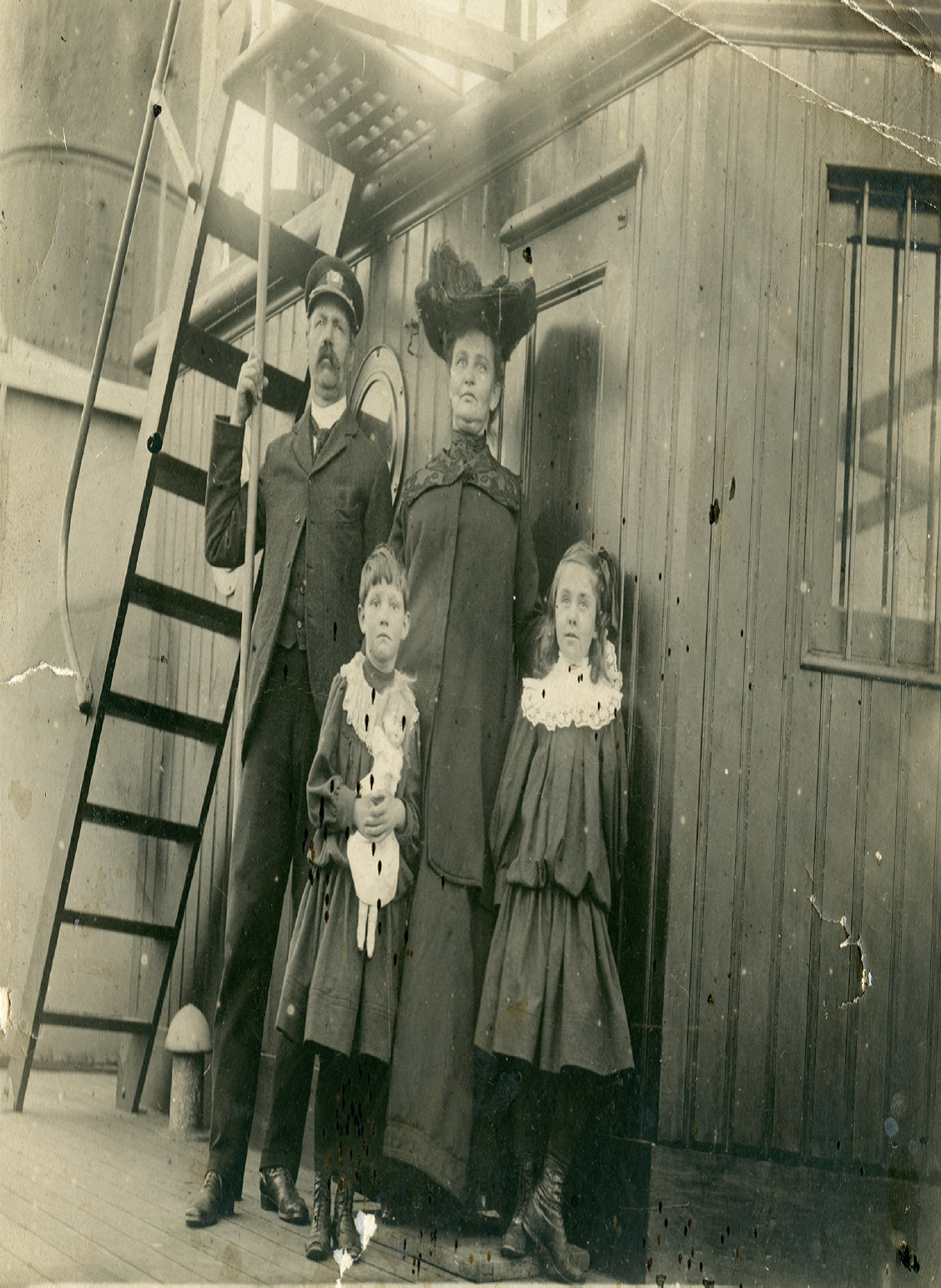
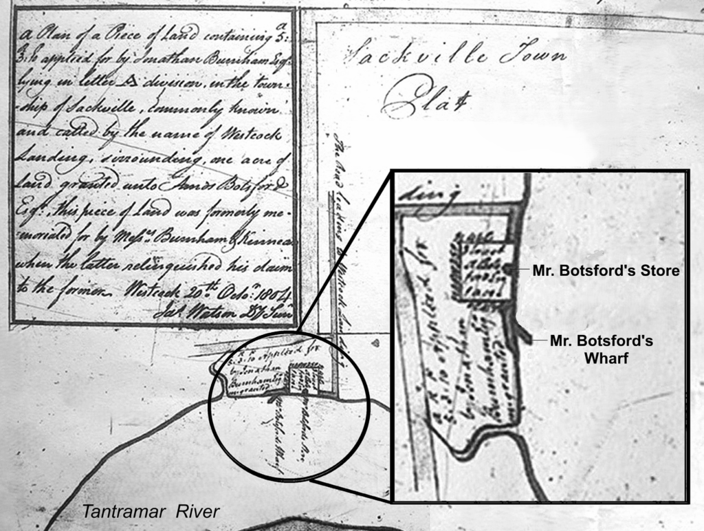
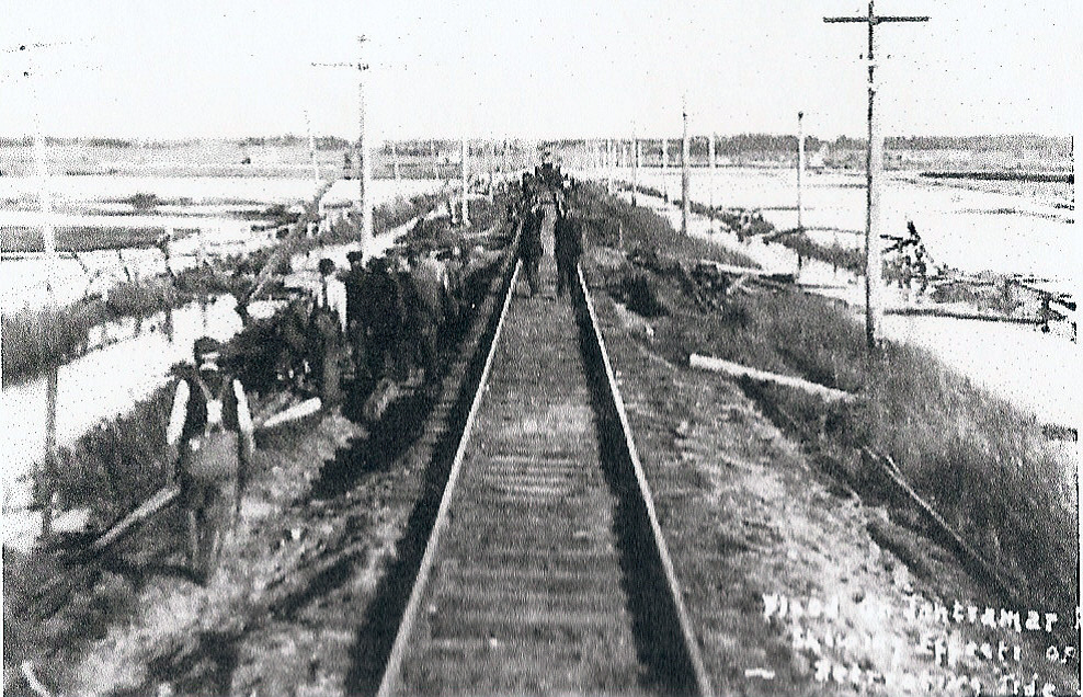
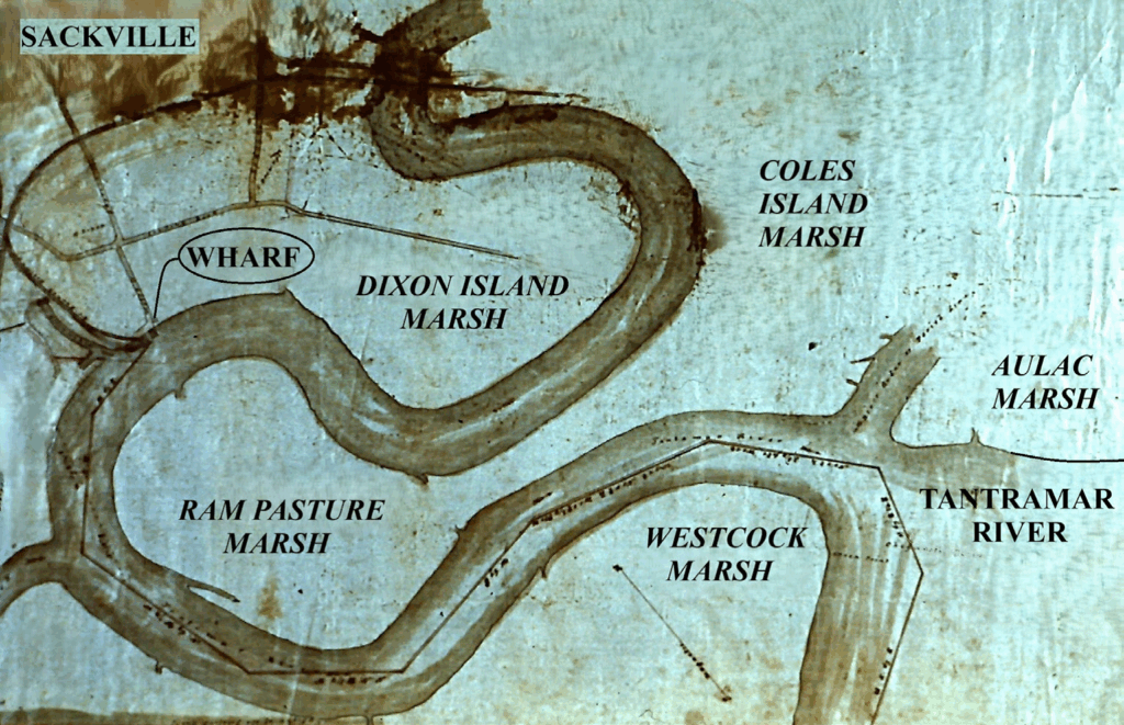
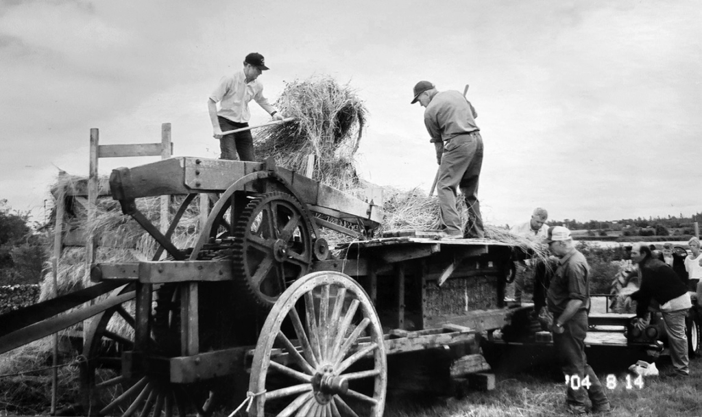
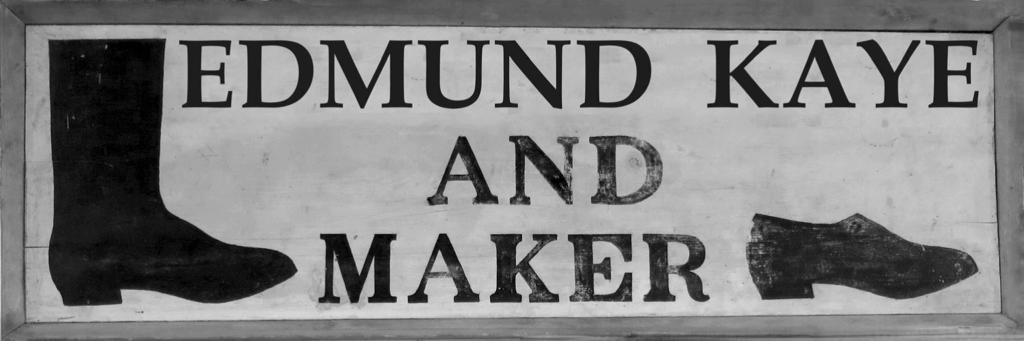
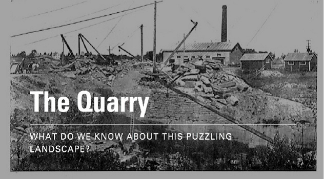
Courtesy of the NB Museum

The Quarry
Sackville’s Only Quarry Was Opened Three Times

by Paul Bogaard

“The Quarry” to become our newest park

Work has recently begun to develop the quarry area at the top of Quarry Lane as Tantramar’s newest Town park. “The Quarry” was acquired from Mount Allison; community partners have added their own support, plans have been made, grant money has been added to the Town’s own investment and this Fall work has begun on what will be its Charlotte Street entrance.

Part of this project is to provide interpretation, and this will require clarification of the past use of this site when it was an operating quarry. The hope is that this will enable us to read, and then interpret, the quarry landscape we now see. From an open pasture with a brook meandering through it, through the harvesting of tens of thousands of tons of fine red sandstone, followed by the re-growth of trees, shrubs and vigorous wild roses, Sackville’s only quarry presents us with a delightful if deeply puzzling landscape.

The challenge, as it turns out, is not only to appreciate how much the Charles Pickard era of quarry operations changed over its decades of activity but also to confirm, if possible, whether this quarry had already been opened by his father many years earlier. Then there is the later use of the quarry once it was owned by Mount Allison, which was extensive enough to change the face of the quarry all over again. It took all three eras of quarry operations, each of them handled quite differently, to produce the landscape we now enjoy, plus decades of Nature reclaiming her own.

Figure 1. Town’s new Quarry Park with entrances from Quarry Lane and Charlotte Street. From Google Maps

The quarry located up Quarry Lane is the only one within what was, until recently, the incorporated Town of Sackville, although I should probably begin by clarifying that claim. The boundaries of the “Township of Sackville” long ago, like the new municipality of “Tantramar,” extended all the way over to Dorchester and Shepody Bay and all the way down to Rockport and Cape Maringouin. This larger area encompassed many smaller quarries and at least two major ones – I’m thinking of the Westmoreland Olive Freestone Company in Lower Rockport and the Wood Point Quarry – both of which will figure in this story. Those two quarries were both opened up because of the commercial value of grindstones, beginning in the early 1800s,1 and only later shifted to producing building-stone when the market for huge grindstones went into decline. The quarry we associate with the Pickards at the top of Quarry Lane was only opened up after grindstones were no longer in demand and the motive was entirely focused on building-stones. But can we determine which buildings required the stone this quarry could provide? And for that matter, which Pickard opened it up?

The Pickard’s and Mt A’s first stone building

These two questions have been on my own mind for many years. My colleague at Mount Allison, Bill Hamilton, addressed these issues in the Flashback he published in the Sackville Tribune back in 2002.And let me say that Bill’s “An Overlooked Sackville Landmark” remains one of the best pieces written about this quarry, and one I recommend to you all. However, I remain unsatisfied with his answers to the two questions I have posed. He knew that because we discussed these two questions both before 2002 and thereafter. I urged him to consider that this quarry might have been opened to provide stone for Mount Allison’s first stone building constructed in 1883, and he resolutely maintained that it had not been opened before Charles Pickard discovered and opened it in 1898.

Figure 2. The 50 acres, approximately, purchased by Thomas Pickard from J.B. Bowser in 1869, From the GeoNB Map Viewer website.

Bill Hamilton was clearly right that Charles began the commercial operation that became the Sackville Freestone Company. After all, Charles Pickard had only been in his early twenties (and had just begun working at a dry goods store downtown) when the Stone College was built just down the hill from his father’s farm along York Street. Thomas Pickard purchased these 50 acres from the Bowser family in 1869,3 the same year he resigned as Mathematics Professor from Mount Allison. That was also the year his brother, Humphrey, resigned from being its first President. Humphrey Pickard had helped launch the Men’s Wesleyan Academy at Mount Allison thirty years before, and Thomas had served alongside him for much of that time.

Thomas was only fifty when he resigned and bought the farm, and both he and his brother had many years to develop further careers. His son, Charles, born in 1860, would have been nine years old at the time. It was the early 1880s before the leadership of the then College (and two academies) decided they would need an additional academic building, which for both practical reasons as well as the stature it should convey, they felt should, this time, be built of stone.4 But where to get the stone? Unfortunately, while Mount Allison’s Archives still retains the record of their decision to build their first stone building,5 the details of that plan had been handed over to a newly appointed Building Committee, and all records of this key committee seem to have been lost. Those records were kept inside the Stone College (or what came to be called Centennial Hall) which burned in 1933 destroying, ironically, most of the documents about its own construction.

Figure 3. Centennial Hall in the 1890s, and in the background on the right is the first University Men’s Residence. Courtesy Mount Allison University Archives

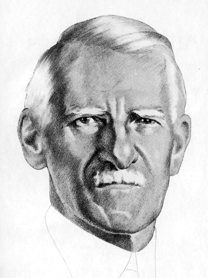
Figure 4. Thomas Pickard. Photo courtesy of Mary Baycroft

Figure 5. Thomas’s son Charles Pickard, pictures in about the years mentioned in the article. Photo thanks to Mary Baycroft.

Even more frustrating, the key issues of the local newspapers that normally carried stories about the erection of such an important new building have also not survived. While the St. John Telegraph made mention of it, the detail needed to clarify the source of building stone was not provided.6 Only the Argosy, the student journal on campus, carried more detailed accounts of the work at several stages of its progress. From those student journalists we learn that Mr. Donald of Moncton was given the overall contract for the work, and that “It is built of red sand-stone, trimmed with free-stone of a light olive or buff color.”7 That turns out to be an important clue because sandstone of different colour meant the stone came from two different quarries.8 And in this region, buff coloured sandstone all came from the Westmorland Olive Freestone Company.9

It is less clear where the red sandstone came from. The only quarry outside of Sackville that might be a plausible source is the one at Wood Point, but the timing for stone being excavated does not seem to fit with what survives of those company records, and ownership was changing right at that time. More importantly, the darker colour and coarseness of Wood Point stone does not match that of Centennial Hall.10 On the other hand, Bill Hamilton had recounted the story of the owner of the Pickard farm stubbing his toe in the back field and thereby discovering the family’s resource in red sandstone, which Bill assumed had happened to Charles fifteen years later.11 But there is an alternative story that seems to be relevant here.

Winthrop Bell, one member of the Bell family closely associated with Mount Allison, wrote up a detailed genealogy of his family, which included the Pickards with whom they had intermarried. He was himself too young to recall the building of the Stone College or to have much direct memory of Thomas Pickard, but he remembered Charles Pickard and stories from that family. One story in particular Charles told him was that when Winthrop first arrived at Mount Allison around 1900, “an experienced quarryman told him [Charles] he felt sure, from the sandstone outcrop in the brook at the foot of the old Thomas Pickard pasture, that he had there an exploitable supply of fine brown freestone.” The brook is known as Bowser Brook, which ran down through the middle of their farm, and, of course, the fine “freestone” came to be recognized as red. And this story clearly fits with Charles arranging to open up the quarry in the late 1890s. It is not, however, so much a story of Charles stubbing his toe as it is his assessing the prospects of beginning a commercial operation quarrying the sandstone already exposed along Bowser Brook. This seems just as likely to have been the stone still exposed from a one-time quarry operation some fifteen years earlier.12

There is more direct documentary evidence that a quarry had been opened and produced building stone at this earlier date. The Geological Survey of Canada sent down an experienced geologist to report on geological formations in our area in 1885, and he noted where they were being quarried.13 That date is, of course, crucial to sorting out this puzzle, because Mr. Ells reported that there was already one quarry operation within Sackville, about a mile from the centre. The centre at that point in time would have been where today we have our one central stoplight, and the quarry at the top of Quarry Lane is just about the right distance away. It was (and remains) the only quarry within the early bounds of Sackville, at a time when the “North Ward” used to end at the top of York Street right where the “rural” cemetery begins.14

So, it seems to me there can be little doubt that a quarry – “The Quarry” – was opened and provided red sandstone in the years prior to 1885. At that point Charles was just into his twenties and had just begun working for the Bowsers at their dry goods store on Bridge Street, while his father, Thomas, was actively engaged on the farm he had purchased from the Bowser family in 1869. So, while we may not have found either official Mount Allison documents nor specific newspaper accounts that name Thomas Pickard and his quarry as the source of the sandstone used to build Centennial Hall, the evidence we do have all points to this being not only plausible, but the only likely source for Mount Alison’s first stone building.

And there are other interesting bits of information, none of them definitive, but all suggestively pointing in the same direction. In the years immediately following the construction of Centennial Hall:

(1) 1884 was the year Thomas (now 65) invested in setting up the Sackville Spring Water Company to sell “spring” water from Bowser Brook to the Academies and others in town (as quarrying likely opened up even more springs, so abundant in this area);15

(2) 1884 was the year Charles (now 24) who had begun working in C. A. Bowser dry goods down in the Wood Block was already able to buy them out and run the store himself;

(3) 1885 was the year Thomas sold the farm that includes the quarry to Charles his son.16

Good fortune seems to have come the Pickard’s way, all at the same time, in the early 1880s.

Another consideration that has made the identification of Sackville’s only quarry as the source of red sandstone for Centennial Hall somewhat difficult is that this building burned down in 1933. Much of the stone façade remained and seems to have been retained; the upper portions were rebuilt using the existing stone, but the resulting discoloration made it more difficult to distinguish even the lighter buff stone from the red stone, especially on the south face. The east end still shows this difference in colour and makes it is easier to determine that the red could only be from the Pickard Quarry. This was what Gwen Martin, a geologist with the NB Dept of Natural Resources, concluded when she and I examined the building in the 1980s, and is what she wove into her account in For Love of Stone in 1990.17

That was Mount Allison’s first stone building. The second was the Owens Art Gallery built in 1894-95 entirely of the buff stone from Rockport. A year or two earlier a large men’s dormitory had been added to the campus at the corner of York and Salem, but as best we can tell it was constructed primarily of brick, with stone trimming at corners and around windows and doorways using, once again, the buff stone from Rockport. This residence burned down after only a few years but was immediately replaced in 1898-1900 by a dormitory of the same dimensions. And this time it is well documented to have been constructed using the red sandstone from the Pickard Quarry just up the hill.18 By this time, however, it was no longer Thomas Pickard’s quarry.

Charles Pickard and the Sackville Freestone Company

In 1885, Thomas sold his farm to his son Charles. And within a few years, as Winthrop Bell recalled, Charles had consulted with a well-respected local quarryman to determine if the red sandstone under the back field, right along Bowser Brook, was of sufficient quality and quantity to make its extraction commercially viable. Bill Hamilton, you will recall, thought that Charles Pickard began his operation in 1898. But there has been some confusion about the timing of this opening.

Figure 6. Plaque placed on Ontario Parliamentary Building constructed in 1892. From The Record, 1974

If we glance ahead to the early 1970s, records show19 that the folks responsible for the repair and reconstruction of the Ontario Parliament Building had reached out to Sackville to acquire the right kind of stone for their work. The stone from one quarry rarely matches that from another quarry and they were determined to make use of matching red sandstone. The plaque they mounted on this refurbished government building in Queen’s Park, Toronto says: To match the sandstone used in the construction of this building in 1892 Mount Allison University of Sackville, New Brunswick has made available additional stone from the university quarry for the building restoration in 1971/72. (See above.)

As we shall see, there is no reason to doubt that the “University Quarry” mentioned was the quarry operated by Charles Pickard. But could he have provided the original Ontario Parliament Building with stone in 1892 as this plaque seems to imply? Charles certainly owned the quarry ground by this time. However, it was one thing for his father, Thomas, just up the hill, to offer Mount Allison the stone they would need for their first stone building, but how would the Ontario folks even know about the stone being from Sackville’s only quarry? Did Charles open the quarry early enough for this significant project?

This mystery has been solved only recently by digging a bit deeper to find that Sackville stone was used “in the extension,” and historians of Queens Park list these additions as being added more than ten years after the Ontario’s legislative building was originally constructed. So, it clearly was a feather in Charles’ cap, and well within the time frame his operation could have provided the sandstone used. Many sources describing the Sackville Freestone Company list this project as an especially noteworthy achievement.20

The 1902 Special Edition of the Sackville Tribune confirms it was in the spring of 1898 that Charles Pickard began his operations and provided red sandstone for the Men’s Residence being rebuilt on campus, plus shipping stone by rail to St. John, N.B. By 1901 Charles had drawn in a few other investors and formed the Sackville Freestone Company.

The story of the quarry can be picked up at this point through a long string of articles, not only in Sackville’s Tribune but also in the “Sackville News” feature of the St. John Globe.21 Through the first decade of the 1900s, there survive at least two dozen in the St. John paper and a dozen from Sackville’s Tribune Post. I will endeavour to combine a selection of details from these overlapping articles under a few headings:

SEASONS: We learn that the quarry closed down each Fall, often with a supply of stone already excavated for the next year’s orders. It was not just the difficulty of working in winter; after all, Pickard’s own crew would often work for him in the woods lumbering through the winter. But stone excavated in winter – as yet unfrozen, underground, and still “green” with moisture – would then freeze when left above ground and burst or at least crack, ruining the sandstone block as either grindstone or building stone. The newspapers would often report the quarry’s steam whistle was sounding again, signalling its reopening in the Spring, after which stone could be safely excavated since it would have the chance to dry out.

Figure 7. Showing the way hand tools could break out blocks. Courtesy of Tantramar Heritage Trust

Figure 8. How steam powered drills could do the same. Courtesy of Tantramar Heritage Trust

EQUIPMENT: Much of the excavation of sandstone blocks could be accomplished using the same hand tools used in the past with muscle powered derricks-with-cranes lifting and moving the blocks. Horses could displace human muscle, and horse-drawn wagons and carts would move stone around and down to the train station. Within a year of incorporation, however, Pickard had erected a “powerhouse” supplying steam to drive stone saws, and drive drills, and to power the pumps that kept water from flooding ever-deeper cavities. There were short tramways to aid in shifting heavy blocks around the site, and 15 to 20 men employed to carry out this demanding work.

Business was good enough that by 1908 Pickard had constructed a second larger powerhouse with a larger boiler, added electric dynamos, and two “gang” saws for cutting blocks into the sizes required.22 By this time there were at least four derricks, one of them an astounding 82 feet tall, standing near the bottom of the excavation, reaching up through 40′ of good stone, 20′ of overburden, and then soaring another two stories high, its crane able to lift 20 to 30 tons. Orchestrating so many moving parts required one man atop a high platform signalling to workmen throughout the quarry.

Increasing employment for a time to 30 quarrymen (and luring away a seasoned foreman from Wood Point) they were able to excavate 5,000 to 8,000 tons in a season. In one year alone they shipped 50 railway cars filled with block stone all the way to Fort William (now Thunder Bay on Lake Superior). Diverse sources all concur that it was due to Pickard keeping his enterprise so well equipped, along with the high quality of the sandstone they offered, that led to the Sackville Freestone Company’s success.

Figure 9. The second Powerhouse and derricks that facilitated quarry operations. The dark diagonal from the lower right was the largest crane. From Company Prospectus, courtesy of the NB Museum

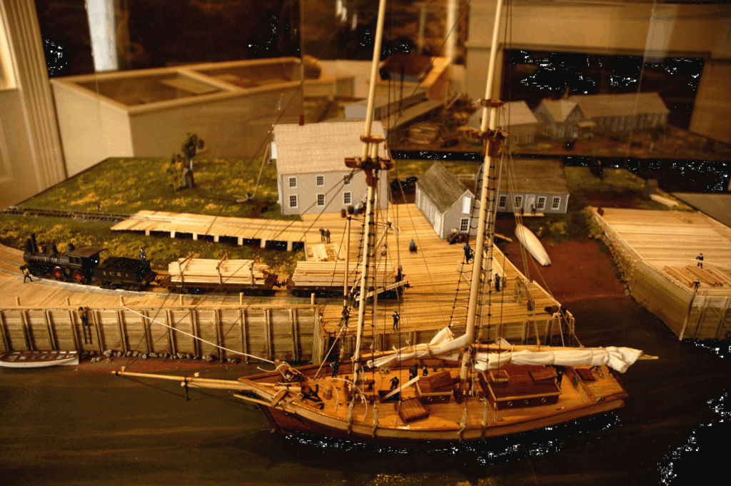
Figure 10. The well-known photo of Pickard’s steam locomotive backs up to the quarry. All the men in suits suggests this was a special occasion, perhaps the opening. Courtesy of Tantramar Heritage Trust

Figures 11 & 12. Showing the machinery required to drive gang saws that sliced down through blocks of sandstone. Courtesy of Tantramar Heritage Trust

THE RAILWAY SPUR: Speaking of railway cars, we’ve long known from the photo so many have seen that there was a spur line serving to transport heavy stone from the quarry. But it has never been clear just when that handsome steam engine began making this run. It turns out it must have been a frustrating challenge for Pickard, as there are reports he had in mind such an addition to his enterprise from the very outset. As it happens, it was many years that the output of the quarry had to be trundled down to the train station (or directly to building projects in town) by horse-drawn wagon and loaded onto flatcars near the station for shipment away.

The earliest report implies Pickard was anticipating that the investments made via incorporation would help cover the expense of a spur line. This was still the era when new railway ventures were often a private business. The line to PEI was just such a private business until it was later taken over by the Intercolonial Railway. It is not until a newspaper account in 1905 that we learn Pickard’s earlier plans were never realized. He had grown up with Bowser Brook running from the quarry along what would become Quarry Lane, across Salem, and down through open pastures and across Main Street; it is hardly surprising this was the route Pickard had been planning to use. However, in the very years his quarry operation was beginning, these pastures had been acquired by Mount Allison and playing fields were quickly established there,23 the same playing fields we see today although the game is now football and no longer rugby. In addition, by 1902 Sackville had been incorporated as a municipality, and while they could not restrict how a rail line might cross private property, they now controlled what crossed Town streets.

Figure 13. A photo from the ’02 Special Edition of the Tribune capturing blocks of sandstone (cushioned by seaweed?) ready for horses to haul down to the railway station.

Pickard’s alternate plan was to have his spur cross York Street, skirt around the cemetery and work its way downhill to cross at a different stretch of Main Street. This route would take the spur line close to, if not directly through, the Fawcett Foundry, and while this might prove a considerable advantage to Charles Fawcett as well as Charles Pickard (and provide an additional source of financing), these arrangements would all take time.

Figure 14. The rugby field that blocks Pickard’s plan. Photo thanks to Mary Baycroft

It was not until November of 1910 that an early Town Minute Book records the resolution passed, unanimously, to permit crossing these two streets24 at which time Pickard was serving as the Town’s second Mayor (and Fawcett, too, had been an Alderman). The tracks were finally laid sometime thereafter, curving into the PEI & NB line (right about where we enter the Waterfowl Park from Clarence Street) and requiring the engine and flatcars we see in the well-known photograph to back up the hill to the quarry. This not only greatly facilitated the hauling of blocks and cut stone down to the station being shipped to distant parts from there but encouraged Pickard to plan for his little train to chug along to the harbour at Cape Tormentine where they could load stone onto steamers for a much less expensive shipment to the western end of the Great Lakes.

Figure 15. At the quarry end of the new spur line they constructed a trestle right out over their excavation, allowing the derricks with their manoeuverable cranes to left heavy blocks and set them directly onto the flatcar. Courtesy of Tantramar Heritage Trust

SIZE AND SHAPE: Several accounts describe the Sackville Freestone Company as working on 50 acres and Pickard’s own claim that there remained good stone under all of it. That seemed like quite a claim, so a quick check relying on the province’s GeoNB website (with handy measurement tools, see Fig. 2) shows that 50 acres was the size of the full farm purchased originally from the Bowsers, including what became the Pickard homestead. Of this, Pickard’s quarry operation impacted about 11 acres (the amount he actually transferred to the Sackville Freestone Company) while the actual excavation spread out over 4 or 5 acres at most, and the ponds we know covered less area than that.

On the other hand, the shapes these excavations have taken has been more challenging to recapture. The earliest reports suggest that within the first four years the Sackville Freestone Company’s operation was digging north from their initial excavation, and reports over the next ten years repeatedly emphasize that the best materials lay to the west. There are descriptions of spending the fall months clearing off up to 20′ of “overburden” to get down to good stone underneath. But once cleared, they could count on another 40′ of useable sandstone. One report tells us that dynamiting the earth and shale while still frozen in early spring was the most efficient means of clearing it away!

If we trace these descriptions back through several years, it suggests that excavations had begun to the east and to the south, which is to say right along where Bowser Brook ran. After all, it makes sense that over its long life the brook had exposed some of the sandstone bedrock underneath and along its sides, and that this is where they would have begun exploring and excavating, especially back in Thomas’s day, and then again when Charles began operations in 1898. From there, quarrying expanded north, and then, and for many years to come, shifted towards the west.

Figure 16. Based on a later aerial photo, the black line indicated the path of Bowser Brook. What was most likely the location of the earliest excavation was followed by excavating north, and thereafter to the west.

Figure 17. Portrait of Charles Pickard after ten years of growing success. Photo thanks to Mary Baycroft

In addition to these many newspaper reports, there are articles in The Busy East, The Canadian Architect and Builder, and, sometime after 1910, the Company’s own “prospectus,” all praising both the quality of “Sackville Red” and the well-equipped operation that combined to make this quarry the equal of any in Eastern Canada. And then, there is another government report, this time by Wm. Parks in 1914, reporting to the federal Department of Mines, which is easily the most informative and likely the more objective source we have to rely upon.25 Published at what seems to have been the highpoint of quarry output, we should review what he reported at that time.

In large part, Park’s report indulges in what we might regard as “too much information,” unless you are keen to know the crushing strength of “Sackville Red” (which makes it excellent building material), its percentage of Ferrous and Ferric Oxide (which accounts for its reddish colour), and its mineralogical composition (lots of quartz, feldspar and bits of mica).26 More broadly, Parks confirms what Pickard himself had been assuring customers up to the time of his death just prior to Park’s visit:

• That the full 50 acres of property is “almost entirely underlaid by red sandstone.”

• “The quarry itself is about 200 feet square and 60 feet deep. The upper 20 feet is soil, beneath which is 40 feet of red freestone in beds up to 5 feet thick. The various layers are horizontal and are remarkably continuous… the [natural] joints are from 75 to 100 feet apart and are developed with remarkable perfection, forming clean vertical walls of the greatest assistance in quarrying operations.”

• “Rougher stone, with numerous plant remains [the same fossils we see elsewhere in our area] occurs beneath the lowest workings… belongs to the Permo-Carboniferous age, and lies at a much higher level geologically [and therefore younger] than the stone exposed at Wood Point.”

• “The company has installed an up-to-date plant [summarized as follows:] Four derricks. operated by one large engine and boiler and one small engine and boiler, two steam drills, one pump, two gang saws operated by electricity, also used for one of the derricks. Twenty-five men are employed.”

Parks mentions the spur line, and the use of black powder where necessary but that otherwise blocks are worked up by use of picks and “gads,”27 and that the gang saws could cut through a block 5 feet thick in a day of ten hours. “The total output of the quarry is from 8,000 to 10,000 tons per annum.”

And he then concludes: “This quarry must be regarded as one of the most important producers of building-stone in the Maritime Provinces. The red Sackville stone is largely used throughout the eastern part of the country, and notwithstanding freight charges, it is able to compete successfully with other stones for buildings of the best type in Ontario.”

Transition to Mount Allison

Once we move past Charles Pickard’s death in 1912 and the Park’s report of 1914, we have almost no information whatsoever for the remaining years of the Sackville Freestone Company. The last excavation of which we can be quite sure was to provide the stone for Mount Allison’s Memorial Library in 1926. The next project seems to be for the New Science Building (later named the Flemington Building) in 1931. During the transition between these projects, Mount Allison acquired ownership of the quarry, ending the thirty years of the Charles Pickard era and beginning a period during which the quarry would remain comparatively idle for years at a time.

From property records alone we can see that control of the quarry slipped out of the hands of the Sackville Freestone Company by 1927. The Company had dissolved at the latest by that point. Curiously, the property ends up in the hands of Thomas Dwight Pickard who was Charles Pickard’s son. Having inherited some stocks and other holdings at his father’s passing in 1912, Thomas Dwight moved west, becoming a lumberman and did quite well.28 It is he who took ownership of the quarry, the land surrounding it, and all the buildings, engines, equipment and remaining blocks of excavated stone.29 The quarry site and land surrounding it, a total of about 13 acres, he passed along to the Regents of Mount Allison University in 1930, but none of the equipment required for a quarrying operation.30 So, Mount Allison took over the resource in red sandstone that remained, but nothing more.

Figure 18. Thomas Dwight Pickard, the youngest of Charles’ children. Photo thanks to Mary Baycroft

The equipment was likely disposed of by Thomas D., although we have no way of knowing for sure; soon thereafter the spur line tracks and sleepers were taken up, and the main powerhouse left empty for another decade or two. The section of spur line from the Fawcett Foundry down to the ICR line to PEI, however, was kept intact for the Foundry’s continued use. The aerial photo in Fig. 19 just happens to catch the lower spur line still in use! One can make out the newer engine and three box cars, and you can also see from the smoke it leaves behind that it still has to back up to its destination. All this begs the question: how did Mount Allison manage to continue to add buildings on campus – the New Science Building already mentioned in 1931, the fourth Male Academy (later known as Palmer Hall) in 1934, and, after ten years of inactivity, Trueman House beginning in 1944? After all, Mount Allison may have owned the quarry, but it no longer retained the equipment required nor employed the quarrymen needed to extract and cut the stone their buildings each required.

The Argosy Weekly for 9 March 1946 wonders, rather wistfully, “Could it be spring? “I haven’t seen a crocus, or a rosebud; or a robin on the wing”—but there is certainly something in the air these days which is putting a come-hither look in the girls’ eyes, and which is causing the young men to think fond thoughts of love, the co-eds, and the quarry.”

The answer is that they contracted with the Smith Cut-Stone & Quarry in Shediac. While this company had been quarrying stone of its own for many years, by the 1930s it seems to have shifted its strategy to excavating sandstone, under contract, for the owners of other quarries.31 This is a story to which we’ll return.

Figure 19. Aerial from the 50s that catches three boxcars being pushed back toward the Fawcett Foundry. The quarry’s spur line had been taken up twenty years earlier, but Fawcett held on to the lower portion. Thanks to Mike Cullam’s “The CNB Sackville Spur in O Scale Trains, Nov/Dec 2015

Figure 20. The very top corner of a 1931 McCully aerial reveals the quarry when still active, above Bowser Brook and amidst farm land. Excavation seems all to be at the north and nearest the power house. Courtesy of Mount Allison University Archives

The later 1920s and even the early 1930s must already have seemed a quieter period at the quarry, leaving weeds and shrubs the opportunity to work their way up through stone rubble, and attracting non-quarry-folk to explore. In the decade between mid-30s and mid-40s there was no quarrying activity at all. After the stone needed for Trueman House was extracted, there was a period of fifteen or more years when Mount Allison had no call on its resource of “Sackville Red”. These quieter periods allowed the quarry to become a destination for generations of Mount Allison students, as a venue for art classes, as well as to become a playground for so many who lived in the neighbourhood. In short, “The Quarry” took on a very different persona, coming to be thought of as a public resource for recreation… much as the Town is hoping to regain today.

Among those who retain local memories of the quarry area from those years, however, they don’t quite match what we find there today. Despite the substantial growth of trees, shrubs and multi-flora rose tangles, there are clearly two ponds of water echoing earlier quarry operations, but no remains of buildings or derricks, and hardly any remnants of excavated sandstone at all. But the stories I’ve been told over and over are of only one pond and substantial mounds of huge and heavy blocks of sandstone.

Figure 21. From the 1939 Yearbook.

Figure 22. One of three photos of an art class taken in 1950 or thereabouts. Courtesy of Mount Allison Archives

These stories agree with the handful of photographs that remain from these periods of inactivity. The students, in the rather poor photo from the yearbook of 1939, are skating around an island in the middle of a pond substantially larger than what we see today. In part, that can be accounted for by a much higher level of water at that time filling an excavated cavity. The three photos of the art class from 1950 also reveal only one quarry pond and depending on the direction from which the photo was snapped, it also shows substantial piles of sandstone building blocks that we simply don’t find today. Finally, we have a couple views of the larger powerhouse constructed in 1908, one from the rear but after operations had likely ceased (in the 1920s or 30s, perhaps?), and then one of that building in ruins behind the portrait of a young woman (from about 1951). When did that powerhouse finally come down? Today, it takes careful examination on the ground to even find where it once stood!

The answers to many of these lingering questions can be sorted out by examining a series of aerial photographs. Beginning with the very earliest aerials we know of for our area, taken in the 1930s by McCully (like the 1931 aerial in Fig. 20) we can compare aerials taken by the government on a regular basis and still preserved in government offices. From these I have selected samples that just happen to include Sackville’s only quarry, from the 1940s, and through each decade until 1971.

From these we can note some startling changes. While the 1945 aerial photo still hints at where stone for Trueman House came out on the north side, from 1953 through 1962 there is hardly any change at all in the outline of the quarry itself. Until the rapid growth of Mount Allison’s campus beginning in the mid 1960s there was no need for further excavation of “Sackville red.” These three aerials all reveal a single large pond, with an island in the middle, and perhaps a small change in water level. They also hint at substantial piles of building blocks (as seen in Fig. 22) and give us a better idea when the powerhouse finally collapsed.

Figure 23. Photo of powerhouse from 1920s or 30s. Courtesy Mount Allison Archives

Figure 24. Photo of powerhouse from 1951. Courtesy Mount Allison Archives

But there are the more significant changes these aerials reveal: just outside of the quarry in the 1950s we see Quarry Lane appearing for the first time, in the 1960s we see Pickard Place has replaced the lane that had long served the quarry site, and only in the 1971 aerial do we see the development of West Avenue. But perhaps most dramatic of all is the new excavation the 1971 aerial reveals. Those building blocks that had been piled around since the 1930s seem to have been the first to be harvested for new building projects on campus, and substantial further excavation has created a completely new crater, which becomes the northernmost pond we find today. Moreover, the digging out of this new area primarily to the north has created around its perimeter a roadway for trucks (with no need for old-style derricks and trams let alone the spur line) and elbowing material over into the earlier quarry pond to the south, explaining why we no longer find a southern pond as large as images and stories suggested from the 1930s through the 1950s.

As mentioned earlier, Mount Allison’s solution for extracting the resource it owned was to hire the Smith Cut Stone and Quarry Company to do the work. This amounted to their bringing in experienced quarry workers and their more modern digging and hauling equipment to excavate what was needed, trucking large blocks of “Sackville Red” over to its facilities in Shediac, where the blocks were cut down to the sizes needed by masons and then hauled back to Mount Allison’s campus. For many years one could see stacks of building stone waiting for the next building project, stored at the end of Rectory Lane next to the playing field and the Sackville Waterfowl Park.

This new arrangement was in place when the request came from the Ontario legislative buildings’ refurbishers to once again use “Sackville Red” to restore those buildings in Queen’s Park in Toronto. That was likely at the very time the flyover photographed the quarry in 1971. Mount Allison had just completed its new Library when it agreed to this one final shipment of building stone for an off-campus project. They likely had in mind other possible projects on campus but having themselves encouraged the development of the West Avenue area just beyond the western edge of the quarry, Mount Allison should not have been too surprised at the outcry, from the owners of new homes right next door, that blasting and digging was doing damage to their foundations. Mount Allison’s response was to have Smith Cut Stone secure enough additional sandstone from the quarry for the anticipated Crabtree building and then shut the operation down. At the end, the University quarry produced the building stone for one further Mount Allison building plus the one off-campus, just as Charles Pickard had done at the outset of his operation by supplying the stone for one off and one on campus some eighty years earlier.

Figure 25. From 1945: shows quite dramatically how the spur line approached the quarry, and the powerhouse still casting a shadow. York St. crosses tot he north and Charlotte St. to the south. Courtesy the NB Dept of Natural Resources

Figure 26. From 1953: shows only the footprint of the powerhouse, and Quarry Lane has appeared to the east. Courtesy the NB Dept of Natural Resources

Figure 27. From 1963: still little change in the quarry pond, but Pickard Place has replaced the old lane to the quarry. Courtesy the NB Dept of Natural Resources

Figure 28. From 1971: West Ave. is now there, and a big change in the quarry, the birth of 2 ponds! Thanks to a donation to the Tantramar Heritage Trust

The quarry has lain dormant since 1979. Nature, however, will never simply lie dormant, so the quarry area has seen substantial re-growth in these last forty-five years, obscuring much of what there is to see. And human nature, too, has not simply left it alone, but has continued to find ways (as both locals and students have done for many decades) to enjoy the extraordinary landscape bequeathed to us by three eras of quarry operation. What could be better than for the Town to have gained ownership, and begun the modest steps needed to make “The Quarry” into a park for our continued enjoyment.

Buildings known to have been built from “Sackville Red”
Sackville
• Centennial Hall
• Second Man’s Residence
• Royal Bank
• Ladies College ell 1903
• 9′ pillars for Hammond studio
• Hart Hall 1909
• Memorial Library 1926
• New Science Building 1931
• Fourth Male Academy 1933
• Trueman House 1944-1946
• (others from mid-1960s)
Saint John
• Carnegie Library
St Andrews
• Wm van Horne’s large fireplace
Moncton
• Bank of Montreal
• First United Baptist Church
• Central United Church
• Higgins Block
• Sumner Building
Fredericton
• People’s Bank
Halifax
• Customs House
Maccan
• RR Station
Digby
• (unnamed)
Truro
• Bank of Nova Scotia
Ottawa
• Dominion Observatory
Toronto
• New Wing of Parliament Buildings
• (several others, unnamed)
Fort William
• Customs House
Waterloo
• Customs House
• (also in Hamilton, London, Chatham, and St. Thomas)

Figure 29. Pickard’s train around 1913, this time with quarrymen busy loading stone. Photo thanks to Mary Baycroft

Acknowledgements

This kind of research would be lonely indeed without the generous assistance of friends and colleagues and would not get half so far. I need particularly to thank David Mawhinney, University Archivist at Mount Allison, and his colleagues Jane Heys and Alex Nay. I have benefitted from fruitful discussions, recently, with Donna Sullivan, contacts arranged by David Stewart, with Richard Elliot, and with Mary Baycroft (a direct descendant of Thomas D., Charles and Thomas Pickard); and then more distant discussions with Bill Hamilton and Gwen Martin. And finally, from more distant sources: Jennifer Longon, Archivist at the New Brunswick Museum, Keith MacKnight, Photo Archivist with the Provincial Archives of New Brunswick, and Sharlene Raymond, NB Department of Natural Resources and Energy Development.

Endnotes

1. Actually, the extraction of grindstones began even earlier, a story that is already told in The Cumberland Basin Grindstone Industry: A Compendium of Sources & Illustrations, (Tantramar Heritage Trust, 2022).
2. I owe a debt of gratitude for all the discussions I had with Bill and for this Flashback as my starting point. He would have been glad to learn that the dream of its transformation into a park for the Town is finally being realized. Find at: https://tantramarheritage.ca/ 2002/11/an-overlooked-sackville-landmark/
3. Westmorland County Registry of Deeds: entry #28096, Aug. 28, 1869.
4. See John Reid’s Mount Allison University: A History, to 1963, (University of Toronto Press, 1984), Vol. I, p. 161.
5. Mount Allison University Board of Regents minutes, 13 December 1882 (Vol. 1, p. 245, 246).
6. The St. John Telegraph, 7 June 1883 and 2 Oct. 1884.
7. The Argosy Weekly, Vol. X, No. 1, Oct. 1883, p. 6; they report that the foundations had been dug in June 1882, the cornerstones laid in June 1883, and by October all stonework was complete except the tower.
8. A good example would be CN’s Train Station using buff-coloured sandstone from Rockport and in this case the somewhat coarser, browner sandstone from Wood Point. While Cranewood shows the two colours of stone both available from along Mary’s Point, two closely linked quarries that happened to be owned in part by Wm. Crane.
9. More olive in colour when first excavated, it was known that building stone from Rockport turned to buff as it cured. This is the same source that provided sandstone for the Owens Art Gallery and for the University Men’s Residence.
10. Relying here on Gwen Martin’s For Love of Stone, Vol. I: The Story of New Brunswick’s Building Stone Industry. NB Dept. Natural Resources, Mineral Resources Div. Misc. Report No. 8, pp. 60-62.
11. Indeed, this is the story told widely within the Pickard family and repeated over many years. It could, of course, have begun as easily with Thomas.
12. Winthrop Pickard Bell, A Genealogical Study, (Tribune Press, 1962), p. 195. Bell went on to say how much he admired Charles, “a man with a young and increasing family to give up a business he was used to and venture his small capital in the development of an undertaking of which he had no experience whatever.”
13. R. W. Ells, Report on the Geological Formations of Eastern Albert and Westmorland Counties, New Brunswick, and of Portions of Cumberland and Colchester Counties, Nova Scotia, Geological Survey of Canada, Annual Report (1885) Volume I, Section E, p.9.
14. By the early 1900s that western boundary of the North Ward had been shifted out beyond Kirk Street, which means by that time the “rural” cemetery, the quarry and the spur line that served it, were all inside the Town boundaries.
15. Westmorland County Registry of Deeds: Book V4, p. 59.
16. Westmorland County Registry of Deeds: Book X4, p. 389, 391.
17. For Love of Stone, 1990, p. 61.
18. A Vision in Wood and Stone: The Architecture of Mount Allison University by John Leroux and Thaddeus Holownia, (Gaspereau Press, 2016).
19. The Mount Allison Record, Vol. 58, no. 2/8, Spring/Summer 1974, pp. 12-13.
20. Sources such as the Record and For Love of Stone, already cited above, and articles in The Busy East, vol. 5, Oct. 1914, p 12; The Contract Record, Toronto, Oct 5, 1910 (cited in the Company’s own Prospectus, held by the NB Museum), The Canadian Architect and Builder (quoted in Bill Hamilton’s “Flashback”), the Parks Report of 1914 (cited later), and the NB Department of Natural Resources and Energy Development – Industrial Minerals Summary Data 2024 (available online).
21. Mount Allison University’s Library holds microfilm for back issues of The Sackville Tribune, and I am drawing from 1902: 15 May, 10 July, 25 Sept., 18 Dec.; 1903: 11 May, 2 July; 1904: 24 Nov.; 1908: 11 June, 21 Dec.. They also contain back issues of the St. John Globe, and I am drawing from 1901: 8 April, 10 June, 24 June, 22 July, 14 October; 1902: 12 May: 1903: 27 April, 9 Nov.; 1904: 29 Aug., 19 Sept, 3 Oct.; 1905: 10 July; 1906: 29 Oct.; 1907: 13 May, 10 June; 1908: 30 March, 20 April, 8 June, 16 Nov.; 1909: 15 March, 12 April, 19 July.
22. These saws, as show in Fig. 9, did not have “teeth” as we might expect, but simply wore slots through the stone with a slurry of water and gritty sand.
23. The Argosy Weekly, Vol. XXVII, No. 1, Oct. 1900, p. 33.
24. Town of Sackville Minute Book, 1909-1914, pp. 107-109.
25. Wm. Parks, Report on the Building and Ornamental Stones of Canada, Vol. II, Maritimes Provinces, (for the Canadian Department of Mines) Ottawa: 1914; pp. 64-67.
26. For those who would indulge in such detail, the Parks Report is available through Internet Archives, online, or https://publications.gc.ca/collections/collection_2019/rncan-nrcan/M34-41-1912-2-eng.pdf
27. “Gads” were a standard quarryman’s tool consisting of a wedge and two “feathers” (steel pieces that were fitted on either side) so that when driven into a crevice, to crack the stone, the wedge would not get jammed.
28. Winthrop Bell’s Genealogical Study states Thomas D. was a Civil Engineer, whereas the Registry documents list him as a lumberman.
29. Westmorland County Registry of Deeds: Book R10, pp. 566-569.
20. Westmorland County Registry of Deeds: Book C11, pp. 599-601.
31. This much is made clear in Martin’s For Love of Stone, vol. I, pp. 149-153, including her story of the important role of the LeBlanc family of quarrymen from Memramcook.

Announcements

2025 Memberships
Renew your THT Membership for 2025 now

Your membership gives you free admission to our museums, research centre, and archives, a vote at our Annual General Meeting and copies of The White Fence sent directly to you. Plus you get the satisfaction of knowing you’re playing an important role in preserving the heritage of the Tantramar region.

The cost is: $20 for individuals, $30 for families/businesses, and $5 for students. Visit our website, www.tantramarheritage.ca/join, to pay your membership dues online.

The easiest way to renew is to send an e-transfer to tantramarheritage@gmail.com and email Karen to  let her know you’ve done so, with any changes to your contact information. You can also print and mail the form with a cheque or credit card number or drop by the Boultenhouse Heritage Centre in Sackville.

Do you know someone interested in local history? A membership can make a great gift, so please consider purchasing one for someone else.

Thank you for your support!

Interested in Historical Photographs?

Did you know the Trust maintains a database of over 400 historical photographs? This database is available on our website, tantramarheritage.ca. Just go to the Resources tab and click on the Research Centre link. The link to the database is there.

Seeking Photographs for Exhibits

We’re in the final stages of a big exhibits renewal project at the Boultenhouse Heritage Centre.

We’ve had tremendous help from many people in our community already (Thank You!), but we’re still seeking photographs of the following:
• exterior and interior photos of Vienna Coffeehouse;
• nurses at the old hospital;
• interior photos of the bowling alley (preferably with bowlers in action);
• Deware’s Grocery Store;
• Vogue Cinema and Imperial Theatre interiors;
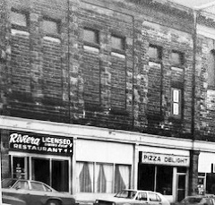
• and any other restaurant photographs or menus.
If you can help, please contact Karen at tantramarheritage@gmail.com or (506) 536-2541.


The White Fence, issue #110

White Fence #110 PDF
October 2024

Editorial

Dear Friends,

You are in for a treat! Colin MacKinnon presents us with a most innovative reconstruction of a vessel, the remains of which Colin found many years ago trapped in the muddy waters of Cumberland Basin in the Bay of Fundy. Colin’s research is a very interesting process in itself but you may be quite surprised to discover how a relatively small boat could have been of important use in the grindstone industry in the mid- to late-nineteenth century. The fact that that the special rock to make grindstones could be found under tidal waters may not be a complete surprise, but the means by which large slabs of rock weighing over a ton could be extracted from tidal waters and brought to shore at high tide is a remarkable feat. A very special vesseI and the ingenuity of its builders and users were required. I will not get into further details as Colin’s work fully describes how it all came about and how tides, imagination, and human effort made it possible. It is a fascinating read.

Enjoy!
—Peter Hicklin

An assortment of Cumberland Basin, upper Bay of Fundy, grindstones on the Pearl Street Wharf, Boston. The sign over the door reads “A. SEAMAN & Co., GRINDSTONES.”

The Upper Bay of Fundy Grindstone Industry
What is a Joggins boat?

by Colin MacKinnon

INTRODUCTION

Much has been written about the grindstone and building stone industry in the Upper Bay of Fundy. Works by Gesner (1840), Snowdon (1972), Latta (1985), Read (1999), Heap (2009), Ward (2009) and the recent compendium by Bogaard (2022) published by the Tantramar Heritage Trust, quickly come to mind, if one is interested in this aspect of Tantramar’s history. For a broader understanding of stone quarrying in New Brunswick, the work For Love of Stone by Gwen Martin (1990) is the definitive source. Traces of this past activity can still be seen at places such as Lower Cove and Ragged Reef in Cumberland County, Nova Scotia, as well as Wood Point, Rockport, Grindstone Island, and Mary’s Point (Grindstone Point), New Brunswick. There is, however, one facet of the story that has so far eluded researchers: the “Joggins Boat”. The following article will explore what we know about these specialized craft and hopefully expand our knowledge a bit on who built them, how they were constructed, and even what one may have looked like. Some of this speculation will be based on an interesting old photograph of a boat at Lower Cove as well as observations on the fragmentary remains of a mystery vessel I found in 2017 on the shore of Cumberland Basin.

Figure 1. Stone cutters at Slack’s Cove, Lower Rockport, New Brunswick, c 1895. The two men on the far left are (L to R) Mariner Ward (1859-1924) and Henry Ward (1839-1913), while the engineer (partly hidden in the shed) is Henry’s son-in-law Arthur E. Thurston (1871-1952). Note the size of the grindstones in the foreground. Photograph courtesy Sharon Bainbridge and Edna MacDonald.

Figure 2. Minnie Martina “Tina” (Cole) Bowser (1901-1993) sitting on Bedford Milledge Cole’s shad board at Harvey Creek, Upper Rockport, New Brunswick, c1920.

A critical initial step in the making of large grindstones from upper Bay of Fundy sandstone was the extraction of a suitably-sized rock (often weighing a ton or more) from off-shore reefs and ledges at low tide and then transporting these stones to a suitable work station along the shore (Figure 1). Abraham Gesner (1840) provided us with an early description of this process: “The reefs are broken at low water, and masses of rock are secured to large boats; at high water they are brought to shore, where they are cut by the workmen with great facility, into grindstones from four to eight feet in diameter, and from six inches to a foot thickness.” The sturdy crafts that moved these stones were called “Joggins Boats” (also known as “Grindstone Boats”) and it is an important distinction that, at this stage of the operation, the rough stone was not loaded into the boat but suspended underneath the hull by a system of cables and chains. Fortunately, we have another account on the use of grindstone boats by Harry Ellis Ward (1893-1978) who lived for many years at Wilbur’s Cove, New Brunswick. In an interview conducted by historian Jim Snowdon (1947-2008), he asked: “How did they get the grindstone in?” Harry replied: “Years and years ago they used to get them out of the water when they used the grindstone boats. The grindstone boats, they was a boat bigger than the shad fishing boats used to be, or as big (Figure 2). And they went out and found under the tide, when the tide was low, you see. They went out and found the rock there, the size big enough, and then they’d pry it up and put a chain around it and a buoy to it and when the tide came, they’d float the boat to the buoy, pick up the chain and put it around this boat as tight as they could, and wait there till the tide raised up and raised up the stone. And then they had a certain bed at a different place—they knew just where they wanted it, and they’d float it, take the boat to this, and trip their chain and down would go the stone [and up would go the boat, that must have been exciting]. Of course, they wasn’t very much water under it, understand. Soon’s they got this stone lifted. Why, they’d take poles or oars and try and get the boat to its place. Well later on they used to carry their chain way up ‘n down the shore, it was a great big chain, big as an anchor – it had to be a strong chain. And when the tide went down they’d start their stone,… look at it, we’ll that’s alright, that’s big enough, it looks alright. So they would start and scabble it off, what we call level it off. They had pick, ‘tisn’t a sharp pick, – that’s the scrabblin’ ax, we call it.” (Tantramar Heritage Trust archives)

We also have a further description, provided by Peter Latta, that focuses a bit more on the boat’s characteristics. He says: “The Joggins Boat, named for the locale, was a little larger and more solidly built than a fishing dory. It measured roughly twenty feet and drew about five feet of water. It also had a relatively flat bottom and was propelled by a single oar at the stern or by a line to a winch on shore. Once a stone block was taken from the reef, a marker was set beside it. At high tide a Joggins Boat would be taken to the designated spot an anchored. Later, at low tide, the boat would be set directly over the block. A wooden rail would be placed across the width of the boat in the middle, and chains were attached to each end. Meanwhile, hooks would be set into the sides of the block and the chains fastened to these. On the next tide, this arrangement would be brought in very close to the factory on the water’s edge.” (Latta, 1985, p. 68). These descriptions set the stage for further questions, and speculation, about Joggins boats.

THE BUILDERS

Not only do we have a good idea on how these Joggins boats were used and why a special design was required, we also know a bit about who built them. On the 25th March 1865, a partnership in the “Grindstone and General Merchandize business” was established between Joseph Bedford Read Jr. (1830-1907), James Stevenson (Boston,) and John W. Lowe (New Bandon, New Brunswick) (New Brunswick archives, MC224, Rockport Ledger). This Joseph Bedford Read Jr. was listed as a Merchant at Wilbur’s Cove in the 1871 census. According to the agreement, the trio were to do business for seven years under the name “Read, Stevenson & Co.” A store was initially opened in Joggins, Nova Scotia, (written as “South Joggins” in the ledger) but on 10 October 1866 the business records show that they had moved across the bay to “North Joggins” (Rockport), New Brunswick. This new store, according to tradition, was located at Wilbur’s Cove. In December of 1866, the company conducted an inventory of their “Joggins Boats” with the details recorded in the Rockport store ledger (Figure 3). We see that two of the boats were made in 1865, the year previous to the inventory, and were appraised at $72 and $74; these were presumably commissioned by the newly-formed company. Another boat, built by Isaac Boles, was 10 or 12 years old (with no chain) and was now worth only $32. Furthermore, it is rather disconcerting that one craft, presumably still in use by 70-year-old John McGovern, was described as an “old boat” and was not considered to be worth anything; it must have been in deplorable condition. An addendum to the list mentions three new boat cables ($25), one for Allen Hoar’s boat and two for Joseph Gough’s “boats”. I wonder if the above-mentioned boat cables and chains were part of the kit required to float the stones from deep water to fabrication sites closer to shore. From the wording, I get the impression that Hoar and Gough may have owned their own boats.

Figure 3. Inventory of “Joggins boats” by Read, Stevenson & Co, Rockport store ledger, December 1866, page 412. Read Stone Co. Ltd MC224, New Brunswick Archives.

Using mostly census and cemetery records, I have also attempted to trace some details on the background of these boat builders. Of interest, the accessor of the “Joggins Boats” was Amos Mills (1819-1898), a stone cutter who lived between Joggins and Ragged Reef, Nova Scotia, while his younger brothers, Calvin Mills (1827-1870) and Hiram Mills (1824-1875), were both stone cutters and shipwrights (listed as C & H Mills in the ledger entry, Figure 3). They were the sons of Robert Mills and his wife Lydia Eleanor Read (1797-1846). Lydia was the daughter of Joseph Read (1775-1832) and Hannah Salisbury (1775-1868) of Minudie. Of significance, Lydia’s younger brother Joseph Bedford Read Sr. (1803-1866), of “Glenburn” house, Barronsfield, was one of the grindstone entrepreneurs of that place and an uncle to the three Mills brothers thus making Amos, Hiram and Calvin Mills cousins to Joseph Bedford Read Jr., the partner in “Read, Stevenson and Co.” In 1871, Amos Mills (age 52), as well as his sons George (22) and Rufus (19), were employed as “stone cutters”, likely at Ragged Reef. Calvin Mills died in 1870 and I can’t find Hiram Mills in the 1871 census. However, at some point, Hiram moved to nearby Shulie where he was working as a “millman” for the lumber industry where he died on 8 August, 1875, of pneumonia.

Another builder of grindstone boats was Isaac Boles (sometimes spelled Bowles) who was born about 1814. In the 1851 census, he is listed as a stone cutter (age 37) and, based on the names of his neighbours, it looks like he was living in the Wilbur’s Cove area of Lower Rockport. The household included his wife Mary and six children along with visitor Gideon Halfkenny (age 21). I cannot locate Isaac in any later census and some genealogies have him deceased prior to 1861. However, Abraham Bowles, one of Isaac’s sons, died 6 December 1908 and was buried in the old Read family cemetery in Barronsfield suggesting some long-standing ties to the grindstone family.

GOUGH FAMILY OF STONE CUTTERS

The above-mentioned Joseph Gough (1820-1903), often written as Goff in the census, appears to have been an independent contractor for the stone industry whereas he owned his own “Joggins Boats”. He may have built Grindstone boats as well. In May 1867, the ledger suggests that he received a $128.00 credit for “two New Boats”; this being the same value (per boat) as a vessel made by C. & H. MILLS in 1865 (Figure 3). The family had boat-building experience as David Goff Sr. (1796-1881), Joseph’s father, was also a “stone cutter” and half-owner of the schooner William that he built in 1841 (Registry No. J853129, Saint John, New Brunswick). In a collaborative working arrangement, Joseph Gough with his brothers James (1824-1911), Nelson (1826-1910), David (1830-c1920), Oliver (1831-1903), William (1842-1928) and brother-in-law Hector MacKinnon (1831-1910), were heavily involved in the grindstone trade around Cumberland Basin and Shepody Bay. For example, in the 1861 census for the Harvey area, Albert County, James, David and Joseph Gough were responsible for 79% of the grindstones produced while only two others, John Tipping and Obediah Wilbur, were responsible for the remaining 21% (Figure 4).

Figure 4. Master Miners from the Harvey area, Albert county, New Brunswick, 1861 census. *This would be the quarrying operation on Mary’s Point.

On 12 November 1868, the store records show that the Gough brothers, along with Hector MacKinnon, were paying rent for the island (presumably Grindstone Island). The amounts varied, possibly reflecting piece work for the quantity of stone extracted; Oliver Gough paid $6.50, followed by Joseph ($6.00), James ($5.00), Nelson ($4.00), and William ($3.00). Hector also paid $4.00 for his portion of the lease. It is unclear if the rent was being paid directly to Read, Stevenson & Co., or was just being collected by the business on behalf of St. Paul’s and St. Ann’s Church, in Sackville and Westcock, respectively, which owned the island since 4 April 1823. Three years later, the 1871 Lovell’s Directory lists David Goff Sr. and sons Joseph, Nelson, Oliver and William still working on Grindstone Island. By the mid 1880s, only David Gough’s son-in-law, Hector MacKinnon, was still working in the stone trade. Hector was said to have been a “master miner” and “time-keeper” at the Mary’s Point quarry where he lived in 1881. He moved, with his family, to work at the Wood Point quarries around 1887 where his wife Rosannah would run a boarding house for the employees.

WHAT DID A GRINDSTONE BOAT LOOK LIKE?

Now that we have some details on how grindstone boats were used and who built them, we are still left with the question, what did one look like? From here on, we are delving into a bit of speculation. A small, problematic sketch of a presumed Joggins Boat appeared in the Canadian Illustrated News in 1872 (Figure 5). However, appearing nearly inconsequential to the scene, there is a larger vessel, resting on the beach, that better fits the description of a grindstone boat (Figure 6). At this point, it is worth noting that a grindstone six inches thick and 6 feet in diameter was considered to weigh about one ton (2,000 pounds/ 907 kg). Thus, the even larger, industrial-sized stones, would weigh considerably more. Therefore, the small row-boat, as shown in the 1872 sketch, would be hardly capable of floating a stone of any significant size while the larger craft pictured resting on the shore appears much more suitable for the task (Figures 5 and 6).

Figure 5. An artist’s rendition of a “Joggins Boat.” The caption reads: “Floating & cutting away at high water.” Canadian Illustrated News, 1872, from a sketch by F.K. Blatch.

Figure 6. Under the caption “What They Are Doing At Cape Maringouin While The Tide Is Out,” note the large boat pictured resting on the beach near some grindstone cutters. Canadian Illustrated News, 1872, from a sketch by F.K. Blatch. Courtesy Jeff Ward collection.

To estimate how large a vessel might actually need to be, I used a standard formula for determining the safe carrying capacity for modern small craft (number of people = vessel length (ft.) x vessel width (ft.) ÷ 15; where one person equals 150 pounds). As an example: to safely float 2,000 pounds of stone, a boat would need to be roughly 28 feet long and 7 feet wide (8.5 x 2.1 m). I say “safely” as considerably more weight could be raised if one was willing to take risks and the vessel was designed with modifications such as higher sides.

I think the best example of an actual “Joggins boat” is in a photograph recently shown to me by historian Dara Legere (Figure 7). Believed to have been taken around 1870, the image shows the quarry wharf at Lower Cove, near Joggins. What caught my attention was a long, open-topped boat on the beach surrounded by stone cutters who were plying their trade. Using these people as a scale, I estimated it to be about 26 feet (8 m) long. It is far larger than a typical row-boat and appears more comparable, at least in size, to a shad boat from that era (note the similarity in size to the craft on the Rockport shore in Figure 6).

Figure 7. Lower Cove grindstone wharf c1870. The boat in the left foreground, possibly a “Joggins Boat,” was estimated to be 26 feet (8 m) long. Photograph courtesy of Dara Legere.

Figure 8. Sketch of a possible “Joggins Boat” as traced from the Lower Cove photograph (see Figure 7). See text for discussion of salient features corresponding to the above letters.

Although the resolution in the photograph is not the best, I have traced the outline and some distinguishing features of the boat and can suggest the following details (see Figure 8 for corresponding letters below). The boat looks to have a large stem post in the abruptly rounded bow that extends above the horizontal line of the gunwales (A). There is a small deck in the bow with a reinforced hole, presumably for placement of a small mast (B). A small compartment (cuddy) likely lies under the deck (C); otherwise, the boat is open to the weather. The craft has a series of small vertical frames (ribs) (D) that are attached on the interior to a wide riser (E). It is fitted with two, and possibly three, seats (as a portion of the bow section is partially hidden from view) (F). On the inner starboard side that is visible, the aft seat is supported by two hanging knees while the forward seat has only one (G). The gunwales are also quite noticeable in the photograph suggesting they were purposefully made larger and more robust (H). Finally, the long poles lying in the boat could be oars and/or possibly a mast and boom. Putting all of these details together, I think this photograph provides the best evidence yet of what an actual grindstone boat probably looked like.

A POSSIBLE JOGGINS BOAT

In 2017, I found hull fragments of a wooden boat below Fort Beausejour/Fort Cumberland on the shore of nearby Cumberland Creek. Named the “Cumberland Creek boat” after the location, it was situated on the tidal side of a dyke that bordered the western shore of the creek and was buried about 52 inches (132 cm) below the level of the marsh (Figure 9). The strata above the boat was divided into two levels: an upper 36 inches (91 cm) of mostly red clay followed by a lower 16 inches (41 cm) consisting of a thick turf/clay mix. The region below the vessel was so-called “anoxic,” “blue clay.” A linear deposit of small pieces of woody debris, some showing evidence of axe work, was found just below the level of the boat at the interface between the red and blue clay. There is some speculation that this debris line may represent deposits following the Saxby gale of 1869 although I am not aware of any studies that may offer confirmation. As the boat was found on the edge of a tidal creek, depth alone is not a good indication of deposition age.

Figure 9. Location of the “Cumberland Creek boat,” buried approximately 52 inches (132 cm) below the level of the marsh (dyke top in the background). The four parallel lines indicate where the boat was situated.

Figure 10. Composite photograph (interior view) of the Cumberland Creek boat: four planks, 58 treenail holes, and up to 10 pairs of frames (ribs). The lowest plank may have been attached to a keel (as indicated by rust-stained bolt/rivet holes). Inset at right: bolt/rivet hold with one dollar coin for scale.

The scant remains consisted of four substantial, two inch (5 cm) thick, wooden planks laying parallel to each other (Figure 10). They were connected by a series of comparatively small frames (ribs). The longest plank was 14 ft. 7.5 in. (4.5 m). Starting from what was later believed to be the bottom of the boat (suggested by three or more, rust stained, bolt/rivet holes), the width of the planks measured 10.5 (26.7 cm), 7 (17.9 cm), 9.5 (24.1 cm), and 9.5 (24.1 cm) inches, respectively. The width of each plank was not uniform suggesting some shaping was required to make the joints tight and waterproof. No sealant, such as oakum, was found between the planks; however, a small fragment of what appeared to be pitch (tar) was found covering the exterior of one of the bolt holes. The buried end of the planking was later determined to be the bow section as evident by the shape of the bottom plank (Figure 11); other planks were lost to tidal action. A series of 58 holes indicated the location of fasteners (treenails) that would have supported at least 10 parallel pairs of frames. Six frames were found (in three parallel sets of two each); all the others were missing. As mentioned, these ribs were quite small, considering the size of the planking. The most intact example, except those shaped into knees, being roughly 2.5 inches (6.4 cm) wide and 2 inches (5 cm) high. For the frames, the builder used the natural grain of the tree to maximize strength (Figure 12). The treenails were roughly 15/16 in. to 1 in. (2.38-2.54 cm) in diameter. Of interest, they were secured in place by the application of tiny, elongated, and pyramid shaped, wedges that had been driven into both ends of each fastener (Figure 13).

Figure 11. Bow profile (exterior view) on the lowest hull plank; dimensions 2 x 10.5 inches (5 x 27 cm).

Figure 12. Frames (ribs) from the Cumberland Creek Boat. Inset: fragment of rib maximizing the natural curve and grain of the wood. Note: The upper portion of the left frame was shaped into a knee.

Figure 13. Wooden fasteners, known as treenails, 1 in. (2.5 cm) in diameter, as well as tiny, pyramid shaped wedges from the Cumberland Creek boat.

Paul Bogaard was able to facilitate the analysis of wood samples through the expertise of dendrochronologist Ben Phillips at Mount Allison University. Samples from a plank, rib and treenail were provided for inspection. Ben provided the following analysis for the plank and rib: “after reviewing the higher resolution micrographs created on the SEM [Scanning Electron Microscope], the scalariform perforation plates and minute intervescular pitting identified in the pores turns out to be a dead-ringer for birch. I can’t be sure which species of birch, but my hunch leans heavily toward yellow birch.” For the treenail, he added: “Although the tree nail had been severely compressed and the few flakes we pulled off looked like an old worn out sponge microscopically, there was enough cellar composure to identify simple perforation plates and slightly larger intervescular pitting, as well as slightly wider rays typical of sugar maple.” (Ben Phillips, pers. comm.) Regrettably, it was not possible to get an age of the plank. However, Ben was able to add an important observation: “I don’t believe either cut contained the exterior surface of the tree, so even if measuring was possible on all rings, an accurate kill-date would still not be produced. Given the missing rings on the outer and inner edges of the plank, the yellow birch tree was easily over 100 years old when cut, possibly closer to 150 (Ben Phillips, pers. comm.). One final hint at deposition date is suggested by a few small pieces of pottery found in the mud adjacent to the hull planking. A fragment of stoneware was decorated with a pattern called “Adams Rose,” with a manufacture date from about 1820 to 1860. This detail, combined with other evidence, suggests the boat fragment came to rest on the shore of Cumberland Creek sometime in the mid 19th century.

CONCLUSIONS

Although no Joggins boats are known to have survived, the Lower Cove photograph might be a match. The boat in the image is in the right location (resting next to a quarry wharf) and of the appropriate size to float heavy stones. Best of all, it appears to be in the company of stone cutters. The story on the Cumberland Creek boat is less clear. As the longest plank was over 14 feet (4.3 m), it is reasonable to think that the craft could have been maybe double that length. However, I think the small frames argue against a large vessel. Considering that grindstone boats were designed to work near reefs and ledges, a place that other ships purposely avoid, the combination of thick hull blanking and small ribs would likely result in a rugged, yet comparatively light, craft. I have talked to a number of people about the Cumberland Creek boat and it has been easier to say what it is not, as any obvious comparisons to other small craft of known designs are lacking, and similar-sized shad boats were not built the same way. I suppose the boat fragment could have floated in from any place although the build materials of Yellow Birch and Sugar Maple suggests a Bay of Fundy/Maritime Canada construction. Sadly, as so little of the boat was found, it is hard to provide any definitive answers. However, I think there is a good possibility that what we have found represents an upper Bay of Fundy “Joggins Boat”. I would be interested in thoughts and observations from our readers.

ACKNOWLEDGEMENTS
I would like to thank the following people for their assistance: Nancy MacKinnon and Don Colpitts accompanied me on numerous trips to photograph and measure the Cumberland Creek boat. Paul Bogaard and Ben Philips provided important details on the boat’s construction materials. Dara Legere, Sharon Bainbridge and Edna MacDonald provided photographs while Ken Tower helped with genealogy questions and Jim MacDonald provided information about the old quarry sites. A special thanks to Andrew MacKinnon, Nancy MacKinnon, Ken Tower and Jeff Ward for reviewing this article.

LITERATURE CITED
Bogaard, Paul (ed.). 2022. The Cumberland Basin Grindstone Industry, A Compendium of Sources & Illustrations. Tantramar Heritage Trust, Sackville, New Brunswick, 248 pages.

Canadian Illustrated News. 1872. Rockport NB and the Grindstone Trade. Vol 5, Feb. 10, P. 84.

Gesner, Abraham. 1840. Second Report on the Geological History of the Province of New Brunswick. Henry Chubb, Market Square, Saint John, New Brunswick.

Heap, Jamie. 2009. Lord of the Land: The Reign of Amos “King” Seaman. Tantramar Heritage Trust, Sackville, New Brunswick.

Latta, Peter. 1985. The Lower Cove Grindstone Quarries. The Journal of the Society for Industrial Archaeology, Vol. 11, No. 1, pp. 67-72.

Martin, Gwen L. 1990. For Love of Stone. The Story of New Brunswick’s Building Stone Industry. Volumes I & 2, New Brunswick, Department of Natural Resources and Energy. Mineral Resources Division, Miscellaneous Report No. 8, 176 p.

New Brunswick Archives, Read Stone Co. Ltd. MC224,

Read, Herbert C. 1999. Grindstone History. Tantramar Heritage Trust, The White Fence, Issue No. 8.

Snowdon, James Dean. 1972. The Cumberland Basin Grindstone Industry. Thesis (B.A.) Mount Allison University, Sackville, New Brunswick.

Ward, Jeffrey P. 2009. Head of the Bay, A History of the Maringouin Peninsula. Tantramar Heritage Trust, Sackville, New Brunswick, 240 pages.

The White Fence, issue #109

april 2024

Editorial

Dear Friends,

In 2012, Colin MacKinnon wrote an article entitled “Mysteries Carved in Stone on Mary’s Point and Grindstone Island” for The White Fence No. 57 in which he presented a photo of a large flat stone at Mary’s Point with the name “R. Hale” engraved on it. Dr. Robert Hale was a graduate of Harvard University and began the practice of medicine in 1723. An adventurer and a trader as well as a medical man, he sailed from Boston on 6 June 1731, on his way to the Bay of Fundy. He arrived at Annapolis Basin on 20 June where there were mainly French and few English inhabitants, except at Fort Anne. Throughout his travels he kept extensive notes on his experiences and observations. Colin was familiar with Hale’s journal and in his 2012 article he wrote that “It is quite plausible that he [Hale] might have landed at Mary’s Point although, as far as I know, this is not mentioned in his journal.” And now, Al Smith sent me excerpts from Dr. Hale’s journal that were compiled by W.O. Raymond and published in 1906. I must warn you – Dr. Hale does not mince words! He makes some critical comments on the French population in the area – just note his views on the priest in the delivery of religious services – not unbiased or especially sensitive. Nonetheless, his commentary on the behaviour of the French people, their clothes and their small homes is, overall, generally positive and gives a first-hand account of Acadian life at this early time. Some of the details in his observations make for very special reading. Dr. Hale’s spelling of words and place names before the standardization of the English language, has been left as originally written. Where spellings may confuse today’s readers, Al Smith has clarified within square brackets. I must admit to you that for me, as editor, it wasn’t easy to leave the text untouched! Al and I preserved the original text which captures the flavour of Hale’s journal and his time. I hope that you find these extracts of the journal as interesting as we did. And, like me, you may have to read it more than once to absorb it all. But the most important thing, as always,

Enjoy!

— Peter Hicklin

(Extracts from)
Journal of a Voyage to Nova Scotia in 1731

by Robert Hale (Beverly, Mass.)1

Describes conditions around Cumberland Basin in 1731

Compiled by W.A. Raymond

The last number of the Essex Institute Historical Collections, (Vol. XLII), printed at Salem, Mass., is of some interest to the people of the Maritime Provinces. The opening contribution – a “Journal of a Voyage to Nova Scotia, made in 1731 by Robert Hale, of Beverly” – is printed from the original manuscript now in possession of the American Antiquarian Society.

Robert Hale was born at Beverly, Mass on February 12, 1702-3. He graduated from Harvard in 1721, and began the practice of medicine in his native town in 1723. He filled many positions of public trust and for thirteen years represented Beverly in the General Court of Massachusetts. He commanded a regiment at the siege of Louisburg in 1745 (See Stone’s History of Beverly, pp. 38-53). Colonel Hale, as he was termed in his later years, seems to have been a man of extraordinary versatility. In addition to being a practicing physician, a legislator and a military commander, he was capable of navigating a vessel. His journal – from which we shall quote – shows that he sailed as master of the schooner Cupid, (of which he was part owner) in the voyage to Nova Scotia in 1731. He had as mate Wm. Haskell, and William Nicholson was his pilot. The rate of wages, paid monthly, was as follows: to the master £6, to the mate £5, to the pilot £9. The schooner sailed from Boston about the 6th of June, and on her way to the Bay of Fundy called at Portsmouth and at Pemmaquid (or Frederick’s Fort) on the coast of Maine. Owing to various detentions the vessel did not arrive at the Annapolis Basin until the 20th of June. “Just after our entrance,” says Hale in his journal, “2 Frenchmen came on board us, one of whom had wooden shoes on, the first that (to my remembrance) I ever saw.” At Annapolis there were, at this time, no English inhabitants, save those who lived in or near the fort. The French were settled in small villages in the vicinity of the fort, and up the Annapolis Valley for a distance of thirty miles. The presence of Governor Philips and his garrison served to impart some little stir to the place. Hale mentions in his journal, under date Tuesday, June 22: “Yesterday one of the Drummers at the Fort was buried, at whose interment (as is the custom) 12 men fired 3 volleys. Today a soldier was whip’t 20 lashes for getting drunk last Sabbath. There are now 3 schooners and 6 sloops in the Harbour.” He adds: “We went ashore & I seeing some Firr trees endeavoured to get the Balsam which is pretty plenty, but the Knats and Muskettoes being very plenty also, I was soon forced to give over; as I was going down I saw 2 speckled snakes like Adders, upon the beach, such as I never saw before, which I killed. The Water where wee anchor upon trial wee find to ebb & flow 20 feet & 8 inches and no more.” The next day the schooner weighed her anchor and set sail for the coal mines at the head of the Bay of Fundy, near “Checnecto” [Chignecto]. At sunrise on the 25th June the schooner passed Cape Enragé, which Hale calls Cape Anroshia, and was soon at her destination, Granchoggin, in the vicinity of the Joggins coal mines. In describing the location, Hale observes: “Wee past by the Coal Banks & a little farther came to the place where Coal is taken in, which is about 5 leagues below Meskquesh [Missequash] the chief place of Checnecto.” After no little difficulty the schooner was brought in to the wharf and as much coal put on board of her as she could float at the wharf with at high tide. The incidents that occurred during the next few days are valuable as throwing light upon the manners of the Acadians one hundred and seventy-five years ago ago [in 1906 when W.O. Raymond did the compilation]. Robert Hale shall tell us the story in his own words:

“Sat. 26 [June] 1 A.M. Made a second Attempt to gain the Wharff but gott aground a Boats Length from it.

“2 P.M. Wee got our Vessel in to the Wharff, & took our Cask out of the Hold, & Capt. Foresyth’s Hands went to Loading & put in as much Coal as wee tho’t our Schooner wou’d float with.

“Sab. 27. 2½ A.M. It being the highest Tide wee cou’d expect wee hawl’d off into the Creek, but when the Tide went out, wee had like to have oversett, because she lay on the side of the Bank. The Coal which they dig about 7 miles below the Place, they bring hither in 2 Lighters [small boats] & throw up into Cribs which they have made in the Edge of the Marsh, close to which they have cut down the Sodd or Marsh so as to make a Wharff & so low that a Vessel can go in a little before highwater. The Persons now concern’d in this Affair are Maj. Henry Cope of Annapolis, Capt. Alexr. Forsyth, Mr. John Liddel, and Mr. John Carnes, of Boston. They have permission from Govr. Phillips at Annapolis & began to dig last April. Only 2 Vessels have loaded here before us. This Creek is the nearest place to transport the Coal to where a Vessel may ride or lay Safely all Weathers, for tis dry half a Mile below the Wharff at low water. Coal has been dug here this 30 years, but they alwayes us’d to land it up below high water mark, but now they dig it out of the Cliff near an 100 feet above. Capt. Belcher of Boston, formerly caus’d coal to be dug here, & brought to the very place where the Wharffe now stands, & a large quantity of it lyes there now, which was sett on fire (being mixed with much dirt) about 3 weeks agoe, & the Fire is not out yet. They suppose this Mine of Coal reaches to that at Spanish River,2 it being but a few leagues across the Land from one to the other. One man will dig many Chaldron of this Coal in a day. They have a House at this Creek which they call Stanwell Hall, & the Creek is call’d Gran’choggin. No other House is within 2 Leagues of it. They have a Serjeant (who is also impowered as a Collector for the Port of Granchoggin) & 6 Soldiers more from Annapolis; they imploy besides about 10 or 12 Frenchmen, besides the men who go in the Lighters. There is abundance of Muskettoes here – so that in a Calm hot day, tis almost impossible to live especially among the Trees. There is no such thing as an Oak, Walnut, or Chestnut Tree in these parts, & the Land is so poor, that no other Trees grow to be above a foot or a foot and a half over & very few so large. Spruce & Birch is the chief of the Wood, which the Land is covered with & where there are no Marshes, the people don’t pretend to settle. All the whole Bay above Cape Checnecto is called by that name, & the little Villages of 3 or 4 or half a Score Families have other Denominations. This Bay seems to mee to be as Subject to Strong winds as (Near Annapolis) it is to Calms, for besides that the Shores are washed higher, & that the people build all their Houses low, with large Timber & Sharp Roofs (not one house being 10 feet to t he Eves) you see in abundance of Places, spots of Land of phaps 2 or 3 Acresin a Spot, which have not a Tree Standing, only perhaps here & there a trunk of a large tree, 10, 15  or 20 feet high, but the Ground all covered with trees blown up by the Roots & multitudes of young trees 10 or 15 feet high all of near an heighth. I cou’d not find that the Water flows at Checnecto about 8 or 10 fathoms at most, which is about 50 or 60 feet.

“1 P.M. I took my Boat with 2 hands designing to go about 2 Leagues up the River to the nearest French Houses (my Pilott being an Interpreter) but as I had got about the middle of the Bay the Fogg came in very thick, & we row’d an hour and a half before we saw Land, & then wee discover’d it on the opposite shore about 3 Leagues above our Vessel. Soon after wee got on, the Fogg clear’d up & wee saw near our Boat an Indian Wigwam on the Beach, & at about 2 Miles distance a Small Village of 3 or 4 French Houses called Worshcock [Westcock] & lyes up Tantamar River, to which wee went, & the French entertain’d us with much Civility & Courtesy & when we came away one man would needs accompany us to our Boat, & conduct a nearer way over the Marshes than that by which we came.

“8 P.M. When wee came to our Boat (which we left at highwater) wee found her aground near 1/4 of a Mile, but as the Shore was all descending, Muddy & very Soft & Slippery with our Guide’s Help wee made a Shift to Launch her, and it being by this Time young Flood wee put away for Meshequesh [Beaubassin]3, a Small Village about 2 Leagues farther up the River, tho’ indeed it is the largest in this Bay; but as it was now dark wee were obliged to keep in with the Shore lest wee shou’d miss the Crick [Missaguash River], up which wee were to go about ¾ of a Mile to the Town; but the wind blowing very hard and right on upon the Shore, wee were put to much difficulty, & once got upon a Rocky flat a considerable distance from the Shore where wee had like to have Stove our Boat to pieces, but at length wee espied the Creek & thrust our boat in & soon had Smooth Water, & about 11 P.M. wee got up to the Town, to the House of one William Sears the Tavern Keeper, who let us in & gott water to wash our Legs & feet (bedaubed with Clay in coming ashore) & other Refreshments.

“Monday. 28 5 A.M. I rose & after Breakfast walk’d about to see the place and divert myself. There are but about 15 or 20 Houses in this Village, tho’ it be the largest in the Bay, besides 2 Mass Houses or Churches, on one of which they hang out a Flagg Morning & Evening for Prayers, to the other the Priest goes once a day only, Habited like a Fool in Petticoats, with a Man after him with a Bell in one Hand ringing at every door, & a lighted Candle & Lanthorn [Lantern] in the other.

“3 P.M. Wee had design’d now to down to our Vessel, but the wind blowing very hard at S. W. wee were Oblig’d to quit our purpose till next Highwater for ’tis impossible to go against the Tide. I went to see an Indian Trader named Pierre Asneau, who lately came from St. John’s in Canada River [Prince Edward Island] with Furs & Seal Skins; they go up this River till they come to a Carrying place [Missaguash River portage route to Baie Verte] of about 10 miles over & then they are in that River, so that tis not half so far to N. found land that way as to go all by water. When I came to enquire into the Price of things, I found their Manners is to give no more (or Scarce so much) for our Goods as they cost in Boston, so that all the Advance our Traders can make is upon their Goods. All this Province are oblig’d by Proclamation of Gen. Phillips to take Massachusetts Bills in Payment, except where it is otherwise agreed between Buyer & Seller. But tis no Profit to our Traders nor theirs to take any Money except Just for Change, & Money is the worst Commodity a Man can have here, for as our Traders sell as cheap or cheaper than they Buy, it will be but loss to take money to bring away, &the pple hear don’t care to take it, because in the 1st place our Traders will not take it of them for the aforewrited reason; 2nd, the Indians with whom they Trade will not take it, for all the Furs &c. which they get will scarce pay for what Cloathing they want, & that they take up when they deliver their Furrs.4 They have no Taxes to pay & 4th They trade but little amongst themselves, every one raising himself what he want, except what they have in Exchange from the Traders, & as a proof that they are govern’d by this Maxim, I need only say, that when I came to pay my Reckoning at the Tavern, the Landlord had but 5d. in Money, tho’ he is one of the wealthiest in the place. I can’t understand that there are more than 400 Families in the Government of Nova Scotia (Exempt of Georgia) who live all either at Annapolis Menis & Checnecto, except a few Families at St. John’s & some other places. This Night wee lodg’d at Sears’s again & at supper were regaled with Bonyclabber, soop, Sallet, roast Shad, & Bread & Butter, & to day we din’d with Mr. Aneau at his Brother’s upon roast Mutton, & and for Sauce a Sallet, mix’d with Bonyclabber3 Sweetened with Molasses. Just about Bed time wee were surpriz’d to see some of the Family on their Knees paying their Devotions to the Almighty, & others near them talking, & Smoaking, &c. This they do all of them (mentally but not orally) every night & Morning, not altogether, but now & then another, and sometimes 2 or 3 together, but not in Conjunction one with the other. The women here differ as much in their Cloathing (besides wearing of wooden Shoes) from those in New England as they do in Features and Complexion, which is dark eno’ by liuing [living] in the Smoak in the Summer to defend themselves against the Muskettoes, and in the winter against the Cold. They have but one Room in their Houses besides a Clockloft, Celler, & Sometimes a Closet. Their Bedrooms are made something after the manner of a Sailor’s Cabbin, but boarded all round about the bigness of the Bed, except one little hole in the Foreside, just big eno’ to crawl into, before which is a Curtain drawn & as a Step to get into it, there stands a Chest. They have not above 2 or 3 chairs in a house, and those wooden ones, bottom & all. I saw but 2 Muggs among all the French and the lip of one of them was broken down above 2 inches. When they treat you with strong drink they bring it in a large Bason & give you a Porringer to dip it with. The Gait of these people is very different from the English for the women Step (or rather straddle) further at step than the Men. The Women’s Cloaths are good eno’ but they look as if they were pitched on with pitchforks, & very often their Stockings are down about their heels. Capt. Blin of Boston who has ben a Trader to Nova Scotia this many years, died about a month ago at Musquesh & lyes buried on the plain below the Town not far from the Pool, where he used to lay his Sloop.

“June, Tues. 29. 3½ A.M. Wee rose and went down to our Boat & made the best off our way to our Vessel, but the wind being against us it was past 8 aClock before wee got down, where when wee came wee found our vessel loaded.

“3 P.M. Wee endeavour’d to haul off our Vessel intending to go out this Tide, in doing which wee ran aground 4 times sometimes on one side of the Creek and sometimes on the other, however at last wee got her into the Road but the Wind blowing half a Storm right against us, we dropp’d Anchor. The wind still increased with Thunder, Rain & excessive Lightning & blew most violently, so that wee took in water over our Side. About 10 a Clock I saw what the Sailors call a Corprisant on the Head of our Foremast & before 12 the Storm was pretty well over.

“Wed., 30. 5 A.M. It being high water wee weigh’d Anchor, the wind at W.N.W. but in about an hour & half it shifted about to S.W. (where it has blown hard almost continually ever since wee gott within Cape Checknecto, except a few hours this Morning) however wee gott down half way between Cape Anroshia & Grindstone Island, about 5 leagues below Granchoggin & here wee dropp’t Anchor about ¾ of a mile from the shore.

“6 P.M. Wee hoisted Anchor and Sail, the wind at S.W., a strong Gale and our due Course W.S.W. It looks like foul weather the Clouds blacken & gather thick at the W. The Sun sets in a Cloud. The wind grows stronger still, & tho’ it be now low water & Tide of Flood & wind both against us wee can’t anchor, but must busk [tack] it from side to side of the Bay till High water in the Morning.

“July, Thurs., 1. 5 A.M. The wind holds still at S.W. right against us, but it being now Highwater wee are in hopes to gain something. The Sky is overcast still. We are now on the N. Shore opposite to the River of Pome,5 which is about a League above the N.Point of Cape Checnecto.”

The remainder of the journal is of considerable historic value, but the length of this extract leaves no room for further remarks.

FOOTNOTES
1. In Acadiensis, Vol. VI, No. 4, October 1906; Book Reviews; pp. 262-270 by W.O. Raymond
2. Spanish River is now known as Sydney in Cape Breton.
3. This Village was at or near the site afterwards known as Beauséjour, or Fort Cumberland [actually Beaubassin, now Fort Lawrence].
4. Bonnyclabber is a name applied to milk that has formed into a curd by souring quickly in warm weather.
5. The word Pomme in French means Apple. The river is still called Apple River.

Volunteer of the Year 2023

by Kathy Bouska

Kathy Bouska presenting Volunteer of the Year Award to Charlie Trenholm, May 28, 2023

May 28, 2023—Today we’re recognizing Charlie Trenholm for the myriad contributions that he’s made to the Tantramar Heritage Trust that have had such a major impact on all aspects of one of our biggest projects. He’s done this through his knowledge, expertise, connections in the community, work he’s done for us, and by taking untold other hours of his time to educate the rest of us. Since he lives near the Boultenhouse Heritage Centre, when we call him you barely hang up the phone and soon after he’s standing right in front of Karen’s desk ready to yet again give us guidance, answer questions, or chip in and help. Sometimes, this is an almost daily occurrence!

Little could we have imagined this outcome when a couple of years ago Karen excitedly told me that she’d just ran into a guy while walking to the museum who had been a moulder at the Enterprise Foundry; after telling him about our new Oral History Project on the Sackville Foundries, he gave her his contact information. But more than just that amazing interview he did for us, he became the key to the success of this project and every other aspect of the THT’s goal to document, preserve, and promote the history of both of our major foundries.

With the Oral History project, Charlie had an extensive network of former foundry employees as he had kept in touch with his friends (and he has many!) and he literally tracked down people he hadn’t seen in decades and told them all about the project and got them to come in for interviews. Many of these people we would never have been able to track down nor likely convince them to speak to us – but Charlie did it better than Sherlock Holmes!

From these wonderful interviews and all the items Charlie brought to us, we received many fabulous artifacts made and used at both of our foundries and even some amazing archival materials! But Charlie (being Charlie) then took it to the next level and because he and Danny Bowser of Bowser Construction had been moulders together, he approached him to obtain permission to take us on a tour of the Enterprise (that Danny now owns) and to select artifacts for the museum. Of course once wasn’t enough to accomplish all of this so Charlie took us multiple times, most recently to rescue some remaining records from the foundries, and, as usual, Charlie pitched right in and helped! On top of this, Charlie has cleaned up and preserved a number of the artifacts and our new summer staff already have fresh questions for him, so get ready Charlie!

But this is just my experience working with Charlie; don’t even get Susan Amos started on all the knowledge he shared with her for her hot selling foundries book, as we’d be here all day!

So to Charlie, we couldn’t have done any of this without you and for this and also because you’re one of the nicest people around who always brightens our days and gives us a good laugh, this award is for you!

What’s in a Name?
Charlotte Street

Sackville streets named after women are a rarity as only seven of the 133 town streets are so named. The oldest town street named after a local woman is Charlotte Street which was in place by 1862 as it appears on the Walling map. According to oral information passed down by the Wheeler family, the street was most likely named after Charlotte Wry (1795-1872). Charlotte was the eleventh of eighteen children of John Wry (1750-1824) and Phoebe Maxwell (1763-1824). John Wry was a weaver from Yorkshire, England, who arrived with other emigrants from Yorkshire on the ship Two Friends in 1774. Charlotte Wry married Daniel Wheeler (1804-1851) in 1824 and they had six children. Daniel died in 1851 and there is no record of Charlotte remarrying.

Much of the land along present-day Charlotte Street was owned by the Wry family. The original John Wry purchased 130 acres from his father-in-law William Maxwell, so Charlotte Wry would have grown up on the street that was later to bear her name. The last Wry family descendants living on the street were Charlie and Arnold Wry who resided in an old farm where the present day Autumn Lee Retirement Home is located.

This section of the Walling Map of 1862 shows the road now called Charlotte Street and the house of Mrs. Wheeler between Salem and Lansdowne Streets.

The 1862 Walling map shows a Mrs. Wheeler residing on the northerly side of the street, the only house between present-day Lansdowne and Salem streets; possibly that was Charlotte (Wry) Wheeler. The 1861 census records a Charlotte Wheeler, age 66 years, as head of household in which also resided her 76-year-old brother John Wry Jr., 20-year-old niece Frances Weatherhead and two-year-old Jane Weatherhead.

For many years the street was known as “slab lane,” a reference to the fences made of slab wood on both sides of the street. The name Charlotte was in use as early as 1883 as it appears on a survey plan of the area by C.L. Lund. The 1899 Stewart & Company map of town streets shows it as Charlotte Street.

Source: Smith, Allan D., Aboushagan to Zwicker—An Historical Guide to Sackville NB Street Nomenclature. Publication of the Tantramar Heritage Trust (2004).

ANNOUNCEMENTS

Annual General Meeting
Saturday, May 25 (2 pm)
Campbell Carriage Factory Museum
Guest speaker: Garth Zwicker, “The Veterans Banner Project Story”
Join us for a short business meeting, presentation of the Volunteer of the Year Award, and a presentation from our guest speaker. Reception to follow. All are welcome.

Official Opening of Carriage Factory Museum
Sunday, June 16 (12-5 pm)
Includes entertainment, games, blacksmithing demonstrations, and the very popular annual
Plant Sale.

Canada Day Social
Monday, July 1 (2-4 pm)
Boultenhouse Heritage Centre
Join us for games, tours, music, and delicious homemade desserts.

Make It Workshops
July and August
Heritage-themed children’s workshops – details TBA.

Under the Sky Events
July and August
Community events at our museums – details TBA.

Heritage Field Day
Sunday, August 11 (12-5 pm)
Campbell Carriage Factory Museum
Blacksmithing demonstrations, live music, dancing, snacks, artisan demonstrations, tours, and much more.

Annual Fall Fundraising Dinner
Sunday, September 22, 2024, 6 p.m.
Sackville Legion
Theme: “Sackville: Southeastern New Brunswick Seafaring Centre”
Further details to come!

To keep up with what’s happening at the Trust, follow us on Facebook or Instagram
(tantramarheritagetrust) or contact the office at tantramarheritage@gmail.com and ask to be added to our email list.

The White Fence, issue #108

february 2024

Editorial

Dear Friends,

For those of you interested in aspects of the history of Sackville’s streetscape, this issue should be of special interest. It deals with one street: Weldon Street. I, for one, found the investigative talents and common interests of Paul Bogaard and Al Smith especially captivating. Every street in every New Brunswick town has a story to tell. The investigative talents of our two authors have uncovered interesting details illustrating how much there is to learn in the many streetscapes of our communities. Paul’s article goes into considerable detail on the architectural features of a section of houses on Weldon Street, while Al informs us about the man after whom the street is named. Once you have completed reading this issue, I am quite certain that many of you will feel that your own neighbourhoods have similar stories to tell. And, if so, send us your stories which may find their own place in later issues. I look forward to reading more about our local streetscapes! In the meantime, may you learn something new about the town of Sackville and, as always,

Enjoy!

– Peter Hicklin

2024 Memberships

Renew your Membership for 2024 now

Your membership gives you free admission to our museums, research centre, and archives, a vote at our Annual General Meeting and copies of The White Fence sent directly to you. Plus you get the satisfaction of knowing you’re playing an important role in preserving the heritage of the Tantramar region.

The cost is: $20 for individuals, $30 for families/businesses, and $5 for students. Visit our website www.tantramarheritage.ca/join to pay your membership dues online. You can send an e-transfer for the payment and email Karen to let her know you’ve done so, with any changes to your contact information. You can also print and mail the form with a cheque or credit card number or drop by the Boultenhouse Heritage Centre in Sackville.

Do you know someone interested in local history? A membership can make a great gift, so please consider purchasing one for someone else.

Not sure if you’ve already renewed? Contact Karen at (506) 536-2541 or tantramarheritage@gmail.com to find out.

Thank you for your support!

John E. Hickey and the “Four-Square” at #14 Weldon Street

by Paul Bogaard

Every once in a while, the Tantramar Heritage Trust receives an inquiry about an older house in town. Such was the case with the “Captain Pringle’s Victorian House” featured in issue #101 (October 2022) of The White Fence. Fortunately, there are a number of other members of the Tantramar Heritage Trust I can turn to for help and advice in these cases and the Research Centre has built up a most useful set of resources.1 And, there is always the Westmorland County Registry of property transfers. So, when we were approached about the house at #14 Weldon Street, all of these came into play. Moreover, what began as an investigation into one interesting house grew into a story about how streetscapes develop over time.

Fig. 1 The “four-square” house at #14 Weldon Street, likely built in the early 1900s.

The first thing we check in such cases is the architectural style of the house and its location. These we can see already by a quick look using Google maps… and then driving by to snap a photo from the street. It turns out that #14 Weldon is a classic example of what is often called a “square” house or even “four-square” referring to its footprint. Since they are almost always two stories high (or 2½ if finished under the roof) they form a cube. On this square shape sits a hipped roof (that is, sloped from all four sides) usually with a small central dormer looking out to the street and a porch extending across the front. As with most house “styles” these details can vary from one builder and/or owner to another. Architectural historians say that this style in particular was a conscious stepping away from the exuberance of the late Victorian styles: with cleaner, simpler lines, an efficient use of materials producing affordable, comfortable living on a fairly standard floor plan.

Fig. 2 View of the houses up Weldon Street from #14, including two other four-square houses and the earliest house remaining along this street.

Wikipedia like sources online will say this style began to appear across North America in the 1890s and carried on into the 1930s. In our area, they are first seen in the early 1900s along with the appearance of another somewhat smaller and plainer “cottage” style, shaped more like a rectangle with its entrance in the gable end facing the road; after WWI and into the 1920s we find a few “bungalows” around town more consciously drawing upon features from the Arts & Crafts tradition. Of these post-Victorian styles, however, the four-square is by far the most common with at least 50 to 60 I have counted still standing in Sackville.2

When we look up Weldon Street on the same side as #14, one can see the next house is also “four-square”, and (even though add-ons make it more of a challenge) the one beyond seems to be as well. These three provide useful comparisons: whereas #14 includes a one-story bay window on the side (and a small bay bump out to the right of the front door), the next house up includes a two-story bay. It also sports a different style of dormer and at some point a second-story porch was added. If you look closely you might notice that the house next to #14 has a hipped roof that comes to a short ridge, while #14 does not come to either a point or a ridge but leaves a small flat area. The third house in this set shows yet other choices in dormer, roof and porch, and the dimensions of all three houses are a bit different. Of these three, the siding has been changed on both second and third four-square houses which has taken away some of their original detailing, whereas #14 still has what I take to be its original clapboard siding and therefore still shows its original corner boards, a frieze board just under the eaves, and other moldings around windows, front door, and on the front porch. (We will return to the question of when these three houses appeared in this streetscape.)

The next house up cannot be seen in this photo. It is a brick bungalow in a style built a bit later (with some wonderful Arts & Crafts features still intact) but, just beyond that, the house that emerges from behind the tree, sits at the top of the rise of Weldon Street and has proven to be the oldest remaining house along this street – that is, #22 Weldon.

I had occasion to examine that house, invited by the current owners of #22, at a time when I was working closely with Ben Phillips who was trained in dendrochronology at Mount Allison. That meant we could not only note the manner in which timbers were used to form posts and beams as the core structure of that house but had permission to take samples from some of the larger timbers: Ben could date them quite accurately by examining the tree rings revealed in these samples. That house proved to have been built in 1858, which fit nicely into a broader chronology that sets the context for this whole street.

Al Smith’s book on the origin of names we find on our various Sackville Town streets3 had identified this street as named after Richard Weldon, a professor at Mount Allison University (see below). However, we know Weldon was still a student at Mount Allison during the 1860s and was not fully employed on the Faculty until 1875 by which time a house had already been built in this area. A look at the Walling map of 18624 shows a house in the right area, identified with G. Bulmer, but no street as yet opened up to the public.

Fig. 3 A portion of the map of Westmorland County published by H. F. Walling in 1862, the first to include all buildings. The arrow added indicates G. Bulmer whose farmhouse was located in the area that later became Weldon Street.

From other documents, and Bulmer genealogy, we know that G. Bulmer grew up in a house in this area, which he eventually inherited from his father, James. James is recorded as obtaining a house near here (with barn and other buildings) in 1839, through the Harris and Cornforth families, and it seems likely that this would still have been a log home. James died in 1852 and their home farm passed through the family on to his son, George. In all likelihood, it was George who built the house at what is today #22 on this street, in 1858, when the street itself was still the farm lane that ran from the Bulmer farm to Bridge Street.5 Bulmer passed away in the 1860s and we think Weldon purchased the whole farm in the 1870s.

There was still a farm lane during the eight years Richard Weldon lived there and only after he accepted a position at Dalhousie University in 1883 (where he helped to found the Dalhousie Law School) did this property pass into the hands of the Trueman family. Or, to be more careful, Weldon sold the farm house and buildings with a sizable portion of the property (towards Bridge Street) to the Truemans but marked out a “right of way” that ran along the southeastern edge of the farm, which allowed him to sell other lots to the north. Registry entries show there were at least three of these plus another lot sold to Doull at the Bridge Street end of the property. It is this right-of-way that became Weldon Street, and along with the farm place, the lots Weldon sold would have allowed for up to five homes established along the northwest side of the new street.

I have provided this information in some detail because the next map we have available that actually shows houses along Sackville streets, is the one produced by the local business Stewart & Co in 1899. Fig. 4 shows Weldon Street and includes houses on both sides. At first I wondered if that might include #14 despite my assumption that, as a “four-square,” it was more likely to have been built in the early 1900s. It shows five houses on the northwest side of the street, rather squeezed in between the new railway to PEI, and what we know as Morgan Lane. However, the information from the Registry of property transfers suggests that Weldon’s initial efforts to arrange for a new street and subdivide some of his farmland for residential lots could account for all these houses. In which case, the Stewart map fits in all the houses, at the time, but it is not to scale and is too squeezed to show there was still room for more houses.

Fig. 4 A portion of the map of Sackville published by Stewart & Co. in 1899. The arrow added points to the new Weldon Street intersecting with the new railway line to PEI, and squeezed in between are five houses.

The next property transfer we were able to find was from the estate of Edward Trueman who had passed away and whose heirs seem not to be interested in continuing to farm, since, in 1901, they sold a sizable portion of the farm downhill from the farmstead to Stephen B. Atkinson.

This proved to be another distraction because the Trust is currently working on the memoir of Stephen B. Atkinson, a successful sea captain who we know purchased the home of Christopher Boultenhouse – now the office and museum of the Tantramar Heritage Trust. While it struck me as odd that Captain Atkinson would invest in this property on Weldon, the timing made it seem possible. But a little searching through the “Descendants of Early Tantramar Families” (which you can access on the Heritage Trust website) showed there were two Stephen B. Atkinsons! The middle name of Captain Atkinson was Barnes and the Registry transfer for the Weldon Street purchase indicated a middle name of Bamford. This Stephen B. Atkinson was actually a farmer from Dorchester and he was apparently doing well enough to engage in a little land development in Sackville. By 1904 this Stephen B. had sold one lot from his recent purchase to his brother, Arthur Atkinson, and Arthur then turns around and sells it to John E. Hickey, in 1906.

I think we can conclude that it was John E. Hickey who had the house built at what is now #14 Weldon.6 There the Hickey family stayed until John’s own passing in 1921 and, by 1924, his daughter had inherited it (along with his business) and already by 1926 it had become the home of the Avards, many years later the Crofts, and thereafter several other owners.

Fig. 5 A portion of the map of Sackville published by C. E. Goad for assessing Fire Insurance. This page dates to 1911. The arrow added points to the farmhouse of R. Weldon who in 1883 set aside a right-of-way past his farm to the three lots in the oval, and in 1901 the lots in the square were sold, including what becomes #14 marked by the star.

One document that helps confirm some of our story about Weldon Street’s development is a page from the Goad Fire Insurance book.7 The page shown in Fig. 5 has eight houses along the northwest side of Weldon (in remarkable detail), whereas the Stewart map had shown five. The arrow points at the original farmhouse of Bulmer and Weldon. The oval above indicates three of the lots sold by Weldon in 1883. These all had Victorian style houses built on them in the 1880s or 90s as did the lot at the lower end. That would account for five. Then, the square marks out the portion purchased by Stephen B. Atkinson in 1901 and subdivided, selling the lot with the star to his brother. From this we can see that for a time the farmhouse still had some land with it that the Truemans continued to work. With the Atkinson subdivision we can see the infilling that occurred which explains the difference between the Stewart map’s five houses and this Goad map showing eight, plus confirming that these three four square style houses were all built after 1899 and prior to 1911. At what is now #14, that would have been John E. Hickey building his four-square in (or shortly after) 1906.

Our investigation of #14 Weldon has led to an interesting case (of which there must have been many) illustrating how an early farm was developed into a town street with the lots along it blossoming into a full streetscape, complete with infilling of houses that can still reveal that they were built at different times with different building styles.

Fig. 6 A portion of the article published in issue of #17 of The White Fence (Dec. 2001), which transcribed and reprinted several of the featured businesses including that of John E. Hickey.

And our story doesn’t end there because John E. Hickey not only was listed in the Registry entry as a “merchant” but had at the time been recognized as a successful store-owner for over two decades. In 1902, the local Tribune published a special edition of “Sackville Illustrated” featuring several of Sackville’s local businesses.8

Fig. 7 Photo of article from Chignecto Post Supplement, April 12, 1894, provided by Phyllis Stopps.

John Hickey had grown up amongst the Irish settlers along the “Emigrant Road” just beyond Port Elgin and his “present stand,” as they say, was (as we will show later) at the corner of Main Street and Wellington. This is right where many of us will have seen the Sears Insurance Building standing. This 1902 account also fills us in on the range of goods Hickey was selling. Since we have also found Hickey’s emporium noted a number of times in the student newspaper at Mount Allison – the Argosy – we can also say that his line of dry goods, hardware and glassware in 1884 had expanded to include earthenware by 1891, and then by 1902 included china, trunks, bags, and a new line of gent’s furnishings.9

Fig. 8 A photo provided by Phyllis Stopps catches only a corner of the Hickey Store.

Fig. 9 A painting of the Harness Shop by local artist Rod Mattatall that coincidentally captures the rear end of the Hickey store; provided courtesy of Charlie Scobie.

Curiously, the Hickey store is also mentioned in an 1893 Argosy as located on Bell’s Corner. I must
confess I’ve puzzled about this “corner.” You may have heard of “Crane’s Corner” (and you should be able to guess where that one was, especially if you frequent Cranewood). And there used to be references to “Boultenhouse Corner” (and now that the Heritage Trust has its office and a museum in Boultenhouse’s residence, we rather wish the corner of Main and Queens was still referred to this way). We knew there was a Bell family in Sackville but had not put together the connection until Phyllis Stopps revealed a short article she had found in the Chignecto Post from 1894.10 From it we learn a bit more about John Hickey – a “genial proprietor” – and that his store had been originally founded by a Mr. Bell. So, even if we still do not fully understand how this particular Mr. Bell fit into the Sackville family (James Bell, perhaps?), we now know that for a time “Bell’s Corner” was located where we now find Wellington meeting Main Street. But, about that intersection there is still a layer of local history to uncover.

For many businesses in Sackville that have faded away over the years there are photos we can turn to that help recover where they were located and what they looked like, even if they were caught inadvertently in the background of something else that caught the photographer’s attention. This almost happened with the Hickey store but alas only a peek at the corner. Behind this parade (can you date the cars?) on the very right-hand side of the photo we see the front corner of Hickey’s store (see white arrow pointing at it) and even that is not very well in focus.

And then we can find the opposite corner of the same building, also caught coincidentally. In his painting of the Harness Shop, a well-known local graphic artist (especially appreciated for his sketches and paintings of local buildings), Rod Mattatall managed to provide a glimpse of the rear corner. Interestingly, he also decided to add a team of horses pulling a wagon. This was most apt for bringing the role of the Harness Shop back to mind and happily adding to our story as well. Apparently, the arrangement with these two buildings was that they were placed so as to leave an alleyway between them just wide enough to allow a double team of horses to pass, pulling a wagonful of commercial goods. That alleyway eventually became a full street. For that reason, I suspect, long before there was a “Wellington Street,” folks were already referring to this location as Bell’s Corner.

To capture this development we will, once again, rely on the detailed information contained in the Goad Fire Insurance maps for Sackville, especially because we have a number of them and they capture the facts on the ground at different time periods.

The location of the store John Hickey took over from his former employer, David Dickson – the son-in-law of Samuel Black, one or the other of whom must have obtained the store from Mr. Bell – is shown in the map in Fig. 10 (just follow the arrow). Directly below it is another building that came to be known as the Harness Shop. This situation is what Rod Mattatall depicts in his painting, including sufficient space between them for a team of horses. But what this map, published in 1914, also shows is that Wellington Street had not yet been developed.

Fig. 10 and 11 Both of these are portions of the same page, but from different editions of the Goad Fire Insurance maps. The information imbedded in the map to the left is from 1914, while on the right is information as of 1947.

Fig. 11 is from the same page of the Goad book of insurance maps, but a later edition published in 1947. Here we can see that what was once an alleyway had been developed into Wellington Street which Al Smith’s Aboushagan to Zwicker tells us happened around 1920. However, the space needed to squeeze through a team of horses could not provide the 50’ needed for the new street, so the Harness Shop had to be moved! It was not moved far since it still stands rather close to Wellington Street but not nearly as close as the new street skimmed by Hickey’s store, and to this day it barely skims by the Insurance Building. Now we know why!11

By the time of this later map in 1947 it was John E’s daughter Amy who was carrying on the Hickey tradition. And she did so for some year’s more although she had sold the house at #14 Weldon soon after her father passed away. And so we will conclude our story at this point, having not only uncovered what we hoped to find out about both the Hickey house and store, but also something of how streetscapes in Sackville – both residential and commercial – developed from their earlier configurations as lanes and alleyways to the streets we now take for granted.

Endnotes
1. In this case that included Al Smith, Phyllis Stopps, Donna Sullivan, Karen Valanne, plus my thanks to David McKellar for making so much of the Research Centre available through the THT website, including an increasingly valuable genealogical tree of Tantramar descendants. Unless otherwise indicated, all the photos used are my own and I have edited and annotated all the maps and other photos.
2. By comparison, there are well over 200 Victorian houses still standing in Sackville and of the several distinct styles that arose during the Victorian period, there are more with a central gable – which I wrote about in White Fence issue #101 – than all the other Victorian styles combined.
3. Aboushagan to Zwicker: An Historical Guide to Sackville, New Brunswick Street Nomenclature by Allan D. Smith (Tantramar Heritage Trust 2004). Currently out of print.
4. An important feature of this map published by W. F. Walling in 1862 is that it shows every house, school, mill, church, business etc. It is the first map of our county that does so. A map of Sackville published by Stewart & Co. in 1899 (which we will use further down) also shows many buildings but only a portion of them is identified. Both are available at the Boultenhouse Heritage Centre.
5. I am relying on a series of entries that are recorded in the Westmorland County Registry and will list all of them here [Book #/page#]:
1839 Q/377 J. Harris to J. Bulmer
1852 SS/86 J. Bulmer to George Bulmer [not actually registered until 1863 when Geo. died]
1883 O/425 R. Weldon to C. B. Trueman
1901 B-7/650 Estate of E. Trueman to Stephen B. Atkinson
1904 N-7/540 Stephen B. Atkinson to Arthur Atkinson
1906 T-7/63 Arthur Atkinson to John E. Hickey
1924 I-10/354 Will of John E. Hickey leaving house and store to daughter, Amy
1926 O-10/6 Amy Hickey to Avards
6. It is just possible that Arthur Atkinson built this four-square house and then immediately turned around and sold it. I have not found documentary proof one way or the other but under the circumstances, it seems more likely to have been John Hickey, already a successful merchant in town, who built the house in this new style for himself and his family.
7. Chas. E. Goad was a civil engineer with offices in Toronto and Montreal who produced “Fire Insurance” maps that included enough detail about streets, all insurable buildings (both commercial and residential), along with water supply, fire alarm boxes, etc. that insurance companies could determine risk of coverage. The Mount Allison University Archives holds several of these books as does the Archives at the Tantramar Heritage Trust. This one includes information dating to 1911. They were often revised and the latest one we have dates to 1947.
8. Original copies of this edition from 1902 are held by the Tantramar Heritage Trust but the easiest way to access this special edition is to check out issue #17 (Dec. 2001) of The White Fence at: https://tantramarheritage.ca/2001/12/white-fence-17/
9. These are listed in a sequence of Argosy issues: Oct. 1884 (vol.11:1), Nov. 1891 (vol.11:2), and Oct. 1902 (vol 29: 1), all held in the Archives at Mount Allison University as is the issue (vol.23:3) from Dec. 1893. These were found by Angela Hersey during a summer she was doing research for the Heritage Trust on local merchants.
10. Chignecto Post Supplement, April 12, 1894. Richard Chapman Weldon
11. Once again I am indebted to Phyllis Stopps for this story about the Hickey store. The research she conducted for the Town back in 2003 was captured on 3 CDs which are now held in the collections of the Tantramar Heritage Trust: RC 2020.5. See articles Phyllis wrote in the Tribune-Post for July 22, 1998 and June 11, 2003 that help provide context.

What’s in a Name?

Richard Chapman Weldon

Weldon Street was named after Richard Chapman Weldon (1849-1925) who owned the earliest house and most of the land in the sector of town that was later to become Weldon Street. The earliest map of Sackville produced by Stewart & Co. in 1899 shows the street as Weldon Street.

Richard Chapman Weldon, educator, lawyer, and politician, was a descendant of Yorkshire Settlers John and Ann Weldon who purchased property in the Dorchester area circa 1775. He, along with his seven siblings, was born on a farm in Penobsquis, NB, and educated at Upper Sussex Superior School. Richard attended Mount Allison Wesleyan College graduating with a BA in 1866 at the age of 17. Following graduation he taught school in the Sussex area later returning to Mount Allison to earn his MA in economics in 1870. He studied constitutional and international law at Yale College in New Haven, Conn. and graduated with a doctorate in political science in 1872. Interested in furthering his knowledge of international law and being fluent in German, he studied at the University of Heidelberg in Germany.

He returned to Sackville in 1875, having accepted an offer to come to Mount Allison and teach mathematics and political economy. He was the first PhD on Mount Allison’s faculty. He quickly became known as an excellent educator and during this time he also apprenticed himself to Sackville lawyer Christopher Milner.

When the Dalhousie University’s law school was established in 1883 with an endowment to establish a chair in constitutional and international law, Dr. Richard Weldon was deemed to be the most suitable person to head the Law Faculty. Weldon accepted the Board’s offer to head up the school and thus became the first full-time professor of law in post-confederation Canada.

Soon after getting the law school up-and-running he launched into a second career as a federal MP. He ran and won a seat for the Conservatives in the 1887 election and won again in the 1891 campaign. The law school year at Dalhousie University was altered to accommodate his absence in Ottawa. He became a very highly regarded parliamentarian and apparently at one point was considered as a potential candidate for Prime Minister.

During his entire 31 years as Dean of the Dalhousie Law School he was the sole full-time law professor. Weldon was highly successful in attracting students from across Canada and due to his interest in public affairs was able to instill a sense of public service in his scholars. It is indeed fitting that the law school building at Dalhousie University is named in his honour.

Sources: Smith, Allan D., Aboushagan to Zwicker—An Historical Guide to Sackville NB Street Nomenclature, 2004, publication of the Tantramar Heritage Trust; Dictionary of Canadian Biography; Tantramar Heritage Trust website Descendants of Early Tantramar Families.

The White Fence, issue #107

december 2023

Editorial

Dear Friends,

Come sail with us through familiar waters in the 1830s with Captain George McAllister. Captain McAllister kept a diary in which he described day-to-day living, battling the weather and the exceptionally high tides of the Bay of Fundy. The time frame is late fall 1831, including Christmas and the New Year 1831-32. The editing of Al Smith has made it possible for us to experience first-hand Captain McAllister’s voyages through difficult winter weather conditions likely typical of marine travels during the Age of Sail. Some sections make for difficult reading, especially when Captain McAllister had to leave his ship and walk relatively long distances through rough terrain or take his lame horse through demanding winter conditions. I have only great admiration for the many commercial sailors who transported much-needed agricultural products and lumber to new settlers. I salute Captain McAllister’s horse in particular! The experiences described herein were probably not unusual in these times when the Maritime Provinces were experiencing considerable growth as immigrants arrived.

Also included here is the story of a very special donation made in 2016 to the Tantramar Heritage Trust: a portrait of the namesake of the Boultenhouse Museum, Christopher Boultenhouse. Alex Nay presents us with a short but detailed description of the work, its origins and the presentation to the Trust. We are most grateful to the donors of this very special and meaningful donation to the public building and museum which now honours his name.

To complete this issue of The White Fence, Al returns us to the interesting exercise of naming streets in Sackville; this time it’s Squire Street’s turn.

I am especially grateful to Al for bringing us the day-to-day experiences of Captain George McAllister via the Captain’s diary. Following my first reading of this article, I felt that I truly experienced a slice of life in the Maritimes during the Age of Sail. May you find it as interesting as I did.

Enjoy!

—Peter Hicklin

Purchasing the Brig WOODBINE from Christopher Boultenhouse in 1831

by Al Smith

Charlie Armour and I wrote Shipbuilding in Westmorland County in 2008 and during the researching for that book I was frequently in touch with Norton Wyse, a volunteer with the New Brunswick Museum. Norton came across a copy of The Journal of Captain George C. McAllister1 a sea captain from St. Stephen, Charlotte County, NB, and sent me a copy. Contained within McAllister’s journal was an account of his purchasing a vessel from shipbuilder Christopher Boultenhouse in 1831. McAllister’s vivid journal entries of his four trips to Wood Point are fascinating and in the narrative that follows I have copied relevant journal entries here in quotation marks. Square bracketed insertions are my own additions/explanations.

Captain George McAllister had recently lost his vessel the Brig KEZIAH2 and was actively looking for a replacement. He visited shipbrokers in Saint John in mid-October 1831 and enquired into a vessel that was advertised at Wood Point.

October 19th, 1831: “Got a letter from Mr. Kinnear3 to Christopher Boultenhouse the owner and builder of the vessel at Wood Point, and took passage in the Brig BILLOW for Shepody—Hopewell River—being the nearest conveyance I could get to the place.”

October 20th: “At 5 am the BILLOW came to anchor and we went ashore as soon as the tide would permit. Landed upon a dyke which enclosed about a thousand acres of land. Made an unsuccessful attempt to get a horse to ride to the ferry [at Hopewell Cape]. At 11 am started and walked to the ferry at Petitcodiac River, leaving my trunk behind. Arrived there at 2 pm too late to get the ferry on that tide. At 11 at night high water, when I should again have been disappointed had it not been for another person wanting to go across. Although it was a very (?) [possibly dark] night and not much wind, the Ferryman was afraid that he should not be able to get back again alone, the wind blowing direct down the river. Therefore he gave us the Boat fitted out with an old sail and an oar to steer her with and sent us off, the distance being about 3 miles, neither of us knowing where the landing was.”

October 21st: “Got across the river without much trouble and after walking almost three miles got to a public house [in Dorchester] a little before midnight, the people being up, having a stranger (from Chaleur Bay) there very far gone with the dropsy [swelling caused by heart failure], and suffering extreme pain. Immediately after came three more persons (from Sussex Vale), one having a broken shoulder. When after discussing various subjects amongst ourselves, being all strangers, we retired to bed, the Old Lady of the house arranging us in pairs in the best manner she could for our comfort. At 9 am having breakfasted, I set out alone for Wood Point in Sackville, being now in Dorchester, the Shiretown for the County of Westmoreland, having passed by the Court House, and a very large free stone house4 owned by Lawyer Chandler, I entered a wood, which continued with little exception to Wood Point, where I arrived at 12. Saw the owner, and examined the Brig building. She is nearly finished and appears to be good work and material, with not so much depth of hold, as advertised, say 12 feet, and tons 192 tons about. Made an agreement [to purchase] for her at £4 per ton5 delivered afloat as his agreement specified—payable ½ down, ¼ in six months, and ¼ in twelve (one fourth in West India produce at St. John at three months prices). Stopped all night at his house [in Wood Point]. Gave him dimensions of the Spars.6 The vessel has a pine deck and hackmatack [Larch] Top. An advantage over most of them built here, as they generally build with Spruce altogether.”

October 22nd: “Mr. Boultenhouse took me in his carriage about ten mile, during the ride we passed Judge Botsford’s house7 and farm, and had an extensive view of the Dykeland for which this part of the Country is noted, extending in some parts from ten to fifteen miles in width and yielding Hay in abundance. The upland here appears very good, being very level and free of rocks, but said not to be strong or produce well unless it is well manured, which is easily done as the Dykeland does not require any. The roads are very good, the best I ever saw in New Brunswick, turnpiked through the woods8 at a trifling expense, one evil is they are crooked without any apparent cause of it. After leaving Mr. Boultenhouse [likely at Dorchester] I walked down to the point [Cole’s Point] and made a smoke, the usual signal for a ferryman. After a long time he came. We had to beat back against a strong breeze, the tide favoring us running strong, and it flows 50 to 60 feet [a bit of an exaggeration], and the ferry only goes an hour and a half before and after high tide. Got dinner and walked back to Shepody to get my trunk, and seek passage to Saint John. Stopped at a tavern kept by a Mr. Rogers.”

Captain McAllister was forced to stay in Shepody for five days due to high winds, but finally on October 28th took passage with a Captain Cole on his vessel (he does not identify the vessel’s name, only that it was a vessel carrying plaster). Captain Cole took him to Lubec, Maine where he made his way back home to St. Stephen. Over the next month McAllister acquired various materials for the new Brig including working up the rigging, purchasing an anchor and chain, etc. He also hired a crew of four men and engaged the Schooner JAMES CAMPBELL to carry the gear and crew from St. Stephen up to Wood Point. The Schooner was loaded on November 22nd and 23rd and departed for Saint John. Additional supplies were loaded at Saint John and he left his father (John McAllister) in the city to arrange the payments for the Brig and departed for Wood Point at 2 am, Nov. 26th.

November 26th: “A moderate breeze at North to N.E., passed Quaco at 7 am and at 9 pm came to anchor at the Grindstone Quarry to wait the tide.”

November 27th: “Got underway and drifted up the Bay early and at daylight was opposite Wood Point when we found that the vessel was launched upon the 22nd. Discharged the cables and anchors before the boat grounded, then shored her up, and put the remainder of the stuff into a cart and hauled it to the vessel [the new Brig]. Found that Mr. Boultenhouse had almost given up looking for us. Concluded to go to Saint John with Mr. Boultenhouse that he might settle with Father, while in Saint John. Went on board the Schooner JAMES CAMPBELL and sailed at 6 pm.”

They arrived in Saint John late in the evening of November 28th and the next day started loading materials aboard the little 87-ton Schooner TEMPERANCE, a vessel that Christopher Boultenhouse had built for the Anderson family earlier in 1831. Captain Titus Anderson of Coles Island was master of that vessel that made regular trips into Saint John. The purchase agreement that Christopher Boultenhouse and Capt. George McAllister made on October 21st must have stated that the vessel would be outfitted (sails, rigging, anchors, etc.) by the McAllisters, rather than by Boultenhouse’s shipyard men.

November 29th: “Shipped sails and rigging in Schooner TEMPERANCE. Father settled with Mr. Boultenhouse and arranged all his business so as to leave Town in the Steam Boat [for St. Andrews]. I was collecting and getting such things as was necessary. Received instructions [from his insurance broker] to make known the time of [his new vessel would be] passing by Saint John, as the vessel is to be insured from thence, 1% premium asked to Saint John. About 5 in. snow fell. Called the Brig WOODBINE.”9

December 1st: “Went on board the Schooner TEMPERANCE at 3 pm and sailed at 6 pm. A fresh breeze and squally. Passengers sick.”

December 2nd: “At 7 am got up to Wood Point, very cold. Landed all sails and rigging. The masts [are] in the Brig, the people doing but little waiting for the spars and iron work. A strong gale at West.”

For the next 18 days Captain McAllister gives daily accounts of the very slow progress in getting sufficient rigging and sails installed to enable passage down the Bay. They are beset by extremely cold weather, high winds, and two severe snow storms, but most upsetting was the very slow work of the black￾smith who was often drunk and the iron shackles, cleats and chains were essential to complete the rigging. Possibly worst of all was the rapidity of floating ice filling the Bay (Cumberland Basin). With the highest tide expected on December 21st, and possibly sufficient rigging installed, they decided to depart.

December 20th: “Dug some stone Ballast out of the bank, hauled it and put it on board, thought to be sufficient to go down the Bay with. At high water hauled her off and at 1 pm got underway, the wind at West. Got a cask of water out of the Boat, the end of the chain on board, etc. Two Topsails set, had to wear [do for now?]. Got down 5 or 6 miles and were surrounded with ice. Drove down with the tide about 12 miles, came to anchor off Squaws Cap [just southeast of Slack’s Cove, Rockport]. Held on a short time the wind dying away, the ice came up [incoming tide] and carried us back 2 mile above Wood Point. At high water hove up the anchor and found it unstalked [disconnected ?]. Bay full of ice, wind S.E. light and drove ashore on the [mud] flat 2 mile below Wood Point. Grounded on a smooth place and lay very well. Very cold, up myself all night.”

December 21st: “Wind very light with snow. At high water was much inclined to attempt down again but was afraid the body of ice was so extensive and the tide so strong. Nothing doing, sails unfurled. Did not attempt to go ashore. … Very cold.”

December 22nd: “At midnight the wind strong at West and very cold. Got up and got breakfast at 10 am. Gave up all hopes of getting down while the Bay continues to be obstructed with ice, and at high water got underway and ran up to Wood Point to haul the vessel up for the winter. The wind driving the ice offshore a little, making a vacancy. She grounded upright. In the evening got a hawser [heavy rope] ashore and cut away the ice and at high water hauled her in as far as we could when she grounded nearly upright and settled down, the ice giving way under her. Stopped on board all night, slept very little.”

The following day the crew managed to haul the vessel farther in along with getting the anchor chain ashore and secured. That evening they had a discussion on what was best to do: stay in Wood Point for the winter or try to make their way back home. It was concluded that they would try to buy a horse and some of them would go. The next day Captain George gave two of his crew some money and they started the long walk back home to Saint Andrews, while the remainder commenced to build a horse sled.

Totally discouraged with the situation at hand, Capt. George recorded in his journal entry of December 24th, 1831: “This is a most singular place, the highest and the strongest tide of all North America, no harbours nor even shelters free from the tide, and at the present time is filled with moveable ice. All of which together make it bad, even to winter here, and impracticable to get out.” Nonetheless he did seem to have a decent Christmas Day 1831 as he had dinner “with old Mr. & Mrs. Boultenhouse”,10 as Christopher and Rebecca were away.

After Christmas he purchased a 3-4 year old horse from William Lawrence for £19.10 along with a half-ton of hay and a bushel of oats. An agreement was made with Christopher Boultenhouse to hire two of his men for two months and that Christopher would be in charge of the WOODBINE for the winter. So on December 27th, after securing the vessel and everything onboard, Capt. George and his crew member Abner departed Wood Point at 4 pm and traveled as far as Dorchester (Charters) that first day. Just as they were about to depart from Sackville they discovered that the horse had a bad hoof but it was too late to go see William Lawrence for some compensation.

His diary records that they traveled between 20 and 35 miles each day often enduring periods of snow and sleet. They stopped mostly at taverns to overnight, however on New Year’s Eve they were in Saint John and “put up at the Market Inn”. He records in his diary “Thus was the year 1831, which we took farewell of with a glass of brandy with Mr. Condle [a friend] and others about midnight. I have experienced some very remarkable incidents this year, but hope for something better the year to come.” After eight days of travel they arrived home in St. Stephen on January 4, 1832, having traveled a distance of 220 miles. Despite having a bad hoof the horse made it all the way.

Capt. George McAllister spent a relaxing two months at home but despite there still being periods of snow and sleet, on March 3rd “concluded to go up the Bay after the Brig.” Two days later he departed using a borrowed sleigh and presumably the same horse, to follow the same route that he traveled in late December/early January.

March 5, 1932: “Leave for Sackville at 9 am, Abner going with me. Received of John McAllister £ 34— to pay necessary expenses. Received £ 3—of Stephen Lovejoy which together with the proceeds of the sale of his sleigh [in Sackville] are to be paid out in the purchase of Free Stone (for building) at Sackville or some other produce. Took dinner at Joseph Clendinnings. Stopped at Burns Tavern on the Digediguash, poor enough and abundantly filled with Irish.”

Road conditions from St. Stephen to Saint John were heavy at times especially in drifted in areas. Captain George bought an Ensign for the Brig in Saint John and departed traveling 35 miles on January 8th. Road conditions continued to improve as on January 9th they covered 50 miles.

March 10th: “Very soft in the morning, though the threatened storm passed over and the weather became fine. Made a short stop at Bend of Peticodiac [Moncton]. Got to Dorchester at 3 pm and arrived at Wood Point at 6 pm, found all safe as we left. Tides very low and the Bay full of ice as far as you can see, and no prospect of a vessel going out for a month. Probably there is a million or more acres of ice moving up and down the Bay at present. Expenses coming to Sackville about £ 5.”

The next day being a Sunday they went to church and the following day the crew11 shoveled the snow off the deck of the Brig and commenced installing sails and other small jobs with the rigging. The process of attaching the sails to the spars and rigging went on for three days despite the rainy weather. Once the sails were installed they commenced loading a large quantity of firewood into the hold which served as ballast and would be sold later in St. Andrews.

March 14th: “Bending [attaching to the rigging] sails and making ready to take in wood, having about 50 cords on the bank of Mr. Boultenhouse. Tides still low. Mr. Boultenhouse at work on the vessel. Made and set up some stanchions [upright posts] in the hold, bent foresail. Snow storm.”

March 15th: “Very cold in the morning. Put on board about two cords of wood. Bending topsails very heavy work and I am nearly sick from hauling and pulling them. Wrote to Mr. McKenzie to have insurance effected from the 17th on £ 1500. Went to the Post Office with the letter. Got a shoe set on my horse. Tried to engage some people to go down the Bay in the Brig, could find none.”

Captain George continued to be very concerned with getting the vessel floated and hiring more crew to man the vessel on its trip down the Bay. Finally on March 17th a tide 18 inches higher than before, floated the vessel and he was able to anchor her about “60 feet off on the flats.” He hired teams and more men to load the wood in the hold which was completed on the 20th. He was also successful in hiring extra crew, “Engaged B. Outhouse [Benjamin Outhouse]12 to go down to St. Stephen in the Brig for £ 5, helping to load and discharge her.”

Two others, T. Robinson and Japhet Cole, were hired on the 20th and 22nd completing the complement of crew he needed.

March 22nd: “Settled with Mr. Boultenhouse and paid him as per Bill £ 24.3—Wrote a letter to Father. Went to see Wm. Lawrence respecting the horse’s foot, who acknowledged that he sold him for a sound horse but did not consider his foot a defect. Looked at some chimney place stones, but they did not suit me, too rough, price was 20 shillings a set. Sleighing very bad. Wind constantly up the Bay, very cold.”

March 23rd: “Received a half ton of hay of Wm. Lawrence who though he agreed yesterday to make some recompense for the lameness of the horse, refused to do it today. Put the hay in the hold.”

March 24th: “Brig hardly floated. Bay full of ice. Went with Mr. Boultenhouse to Tantramar [Middle Sackville] to the Oat and Barley Mills. Bought a ½ cwt. of Oat Meal and a ¼ cwt of Barley @ 12/6 & 20/ per cwt. Mr. Morris [Morice], the owner has a large and profitable establishment and is himself an improver in machinery. His establishment consists of a large Joiners shop, Blacksmith shop, hulling mill for wheat and barley, turning lathe, oat mill, corn mill and saw mill. Sleighing very bad in the afternoon and snow running fast away. Tides very low and wind S.W.”

March 27th: “Brig did not float. Took the horse on board. A severe snow storm. Sent to the people engaged to be in readiness, if the vessel floated, to sail. Looking after the vessel every tide. The wind N.E. Mr. Atchison [Atkinson] came down to go down the Bay in the Brig, passenger. Sold to Mr. Boultenhouse Stephen Lovejoy’s sleigh and my harness for £ 6.00.”

March 28th: “At 9 am the Brig afloat. Two of the people engaged not ready although one had his bed and chest on board, rather than lose a fair wind I chose to leave him and risk the consequences. When we were 12 mile down the ice was solid about us, and we went with it. In the afternoon the ice separating a little and we got across the Petitcodiac tide, and anchored under the north shore to await the next ebb tide. The ice carried a long distance back. The next ebb we drifted with the ice, the wind being down the Bay made it favorable.”

March 29th: “Enclosed with ice till 9 am when it separated a little and we got the wind and ran through it, striking some very heavy lumps, one of which broke the iron anchor stalk. At noon got down 30 mile from where we started, almost the whole distance being compact bodies of ice and it still remains as far as we can see though not so close. At noon the wind changed ahead, when we beat down on the ebb tide a long distance, the vessel striking bodies of ice very heavy and having much difficulty avoiding them. In the evening the wind fair, but could not carry as much sail as we otherwise would for fear of ice.”

Finally on March 30th they got clear of ice but were concerned that the Brig might have some leaks due to the blows received from hitting the ice. The vessel fought headwinds and made slow progress westward, however, on April 3rd they entered St. Andrew’s Bay and tied up at the harbor to discharge the wood. Captain McAllister paid off the temporary crew members. Brig WOODBINE’s maiden voyage was a difficult one, but one has to marvel at the skill, determination, and hardship of the men who built, rigged, loaded, and sailed the vessel during such harsh conditions. It is not known how long the McAllisters sailed the Brig, but it was reregistered in St. Andrews in September, 183613 with John and George McAllister still listed as owners. Curiously the shipping registers record that the vessel was lost in Barbados (no date), the same geographic region that their previous vessel, the Brig KEZIAH, was wrecked in a hurricane in August, 1831.

Endnotes
1. The Journal of Captain George C. McAllister, January 1, 1831 to July 27, 1833. Copied from the Captain’s original notebooks by Mary Hill in 1931 and published privately in St. Stephen.
2. Brig KEZIAH, built by John Haws Sr. in Saint John in 1829 and purchased by John McAllister (father of Capt. George). The vessel was wrecked at Barbados in a hurricane in August 1831. This information was provided by Norton Wyse.
3. Saint John Shipbrokers John and Harrison Kinnear.
4. Rocklyn was built by Edward Barron Chandler in 1831.
5. £ 4 per ton was an excellent price as Boultenhouse got the equivalent of 765 pounds ($750,000 in today’s money) for the Brig. This Brig was only his sixth vessel as he had earlier built three schooners and two brigs. So even at a young age (he was 29 in 1831) he had obviously earned a reputation as being a quality builder.
6. Spars are the wooden poles attached to the masts that carry and serve to deploy
the square sails.
7. Westcock—a large stone and brick mansion built by Amos Botsford in 1790, located on the Hospital Loop Road in Westcock and later used as a Marine Hospital.
8. The section of road between Westcock and Dorchester was part of the old Westmorland Road, a key connecting road between the Nova Scotia border and Saint John. It was surveyed through in 1786 and was part of the Great Roads initiative of the Province. Unfortunately not much was done building those key roads until early in the 1800s. The opening of the new “turnpike” road from Westcock, starting at St. Ann’s Church, through to Dorchester was opened in 1818. Reference: Aboushagan to Zwicker— an Historical Guide to Sackville NB Street Nomenclature by Allan D. Smith, THT publication, 2004.
9. 191-ton Brig WOODBINE, built at Wood Point by Christopher Boultenhouse, launched Nov. 22, 1832, dimensions 81′-4″ x 23′-4″ x 12′-6″”; registered at St. Andrews as vessel #9, May 3, 1832; owners John McAllister 43 shares and Capt. George McAllister 21 shares; ref. Shipbuilding in Westmorland County, THT publication 2008; New Brunswick Shipbuilders Checklist—Westmorland County by L. Norton Wyse & Charles Valpy, New Brunswick Museum, revised edition 17 April 2017.
10. Bedford and Charlotte Boultenhouse, Christopher’s parents.
11. At that point he had a crew of four: Captain George, Hugh Murchy and Thomas Mitchell who had stayed at Wood Point for the winter and Abner who had returned with George.
12. Benjamin Outhouse was a resident of Wood Point—source Bill Snowdon.
13. New Brunswick Shipbuilders Checklist—Westmorland County by L. Norton Wyse &
Charles Valpy, New Brunswick Museum, revised edition 17 April 2017.

An 1850 Painting of Shipbuilder Christopher Boultenhouse (1802-1876)

by Alex Nay

Christopher Boultenhouse is one of the most prominent names in regional shipbuilding history. He was the builder of 60 vessels over the period of 1825-1876 which was a feat not attained by any other shipbuilder in New Brunswick. One of the only two known representations of Christopher Boultenhouse’s likeness comes in the form of a 13 cm x 15 cm water-colour/gouache portrait. Some readers may recognize this depiction of Christopher from the entranceway of the Boultenhouse museum, and that is because it is
indeed the same painting!

This portrait was donated to the Tantramar Heritage Trust in 2016 by Gillian Godfrey. Bill Evans, the grandson of Clementia, as well as Gilian’s nephew advised that his great-great-great grandfather, Charles Pickard was married to Sarah Boultenhouse, the daughter of Christopher Boultenhouse. According to correspondence with Mr. Evans, the portrait of Christopher was passed along the side of the family that descended between Charles Pickard and Sarah Boultenhouse, to their daughter: Mary Elizabeth, who was the wife of Thomas Pickard, the first professor of Mathematics at Mount Allison University.

The portrait itself (by an unknown artist) was done in Dublin, Ireland, as indicated by the writing on the verso of the painting: “Uncle Christopher Boultenhouse in Dublin according to Grandmother Pickard (Mrs. Thos.)”. The painting is a watercolour portrait that, at first glance, seems to have had its detailing done in graphite or lead. Additionally, Christopher’s suit appears a much darker black or dark grey than what a watercolor could generally achieve. Upon meeting with the conservator of the Owens Art Gallery, Jane Tisdale, she was able to determine the mediums—watercolour, oil paint, graphite, etc.—that the portrait employed. Jane examined the portrait under a series of microscopes and was able to ascertain that it was primarily water-colour with the detailing in the face also being done in watercolour. Those sharp lines would have been painted with an incredibly fine-tipped brush. Further, the depiction of Christopher’s suit and the darker shading and detailing were done using a dark grey gouache for the body of the suit and a black gouache for the detailing.

This portrait of Christopher Boultenhouse is an iconic piece, a real prize for the Tantramar Heritage Trust, and is memorialized in the entranceway of the Boultenhouse Heritage Centre. Come stop by and take a look for yourself!

What’s in a Name?
Squire Street

Did you ever wonder who was the Squire after which Squire Street was named? Well, the person was Squire Jessie L. Bent (1812-1889), a somewhat unique character. Bent built (or occupied) one of the first homes on the south side of the street (presently 27 Squire Street) just east of the Methodist Church “Mission House” (manse built in 1812). The 1862 Walling Map shows J.L. Bent residing on the north side of Main Street (now Queens Road) between Bulmer Lane and Salem Street. Sometime after 1862 he relocated to Squire Street, then known as Back Road, meaning the back road to Middle Sackville. The 1851 census lists Jesse Bent as a merchant. Thomas Hutchinson’s New Brunswick Directory for 1865-66 shows him as a magistrate and farmer. The 1871 census simply lists him as “gentleman.” The first known map of Sackville streets was published by Stewart & Co. in 1899 and the street is shown as Squire Street.

Membership 2024

Don’t miss the next issue of The White Fence!

If you haven’t already done so, it’s time to renew your Trust membership.

It’s only $20 per person or $30 per family. As a member, you get free admission to our museums, access to our Archives and Research Centre, a vote at our annual general meeting, and every issue of The White Fence mailed or emailed to you. Not to mention, you’re supporting the mission and ongoing work of the Trust.

Membership forms are available on our website tantramarheritage.ca. You can fill it out online, email it and send payment by e-transfer to tantramarheritage@gmail.com. You can also print it and send it by regular mail with a cheque or credit card information. If you’re in the area, you can drop by our office at 29 Queens Rd., Sackville, NB. Any questions, please give Karen a call at 506-536-2541.

Thanks so much for being a valued member!

The White Fence, issue #106

November 2023

Editorial

Dear Friends,

In this issue we present two articles which, by their titles, may appear unrelated. They were sent to me separately without notification of any connection between the two authors. But they are in fact interestingly connected. In the mid- to late-18th century, much construction in the Tantramar area would have been required to accommodate the waves of newly-arrived Planters, Loyalists and Yorkshires. Sawmills and gristmills were needed to make lumber for homes and to provide flour for food for the inhabitants. In this issue, Paul Bogaard presents a detailed account of sawmills and gristmills in the Tantramar area in its early years of development in the 1700s. The interesting relationship between the two articles presented here is that sawmill workers would surely have had to deal regularly with sawdust and woodchips that would, in some cases, have found their way into workers’ unprotected eyes. Calum Pamenter informs us of the practice of using eyestones to remove such unwanted debris from the eyes. I’m sure that many millworkers were most appreciative of the availability of eyestones to relieve them. There is always something new to learn about our region’s history, as the two articles in this issue demonstrate.

Enjoy!

—Peter Hicklin

BOOK LAUNCH

Indifference and Remissness
English Language Education on the Isthmus of Chignecto 1760s-1870s
by Rhianna H. Edwards

Sunday, November 26, 2023, 2 pm
Anderson Octagonal House
27 Queens Rd., Sackville, NB
Light refreshments will be served.

To keep up with what’s happening at the Trust, follow us on Facebook or Instagram (tantramarheritagetrust) or contact the office at tantramarheritage@gmail.com and ask to be added to our email list.

The Earliest Mills on the Lower Mill Creek

by Paul Bogaard

This is a brief account of what may have been the earliest sawmills and gristmills within the Township of Sackville. The context (and inspiration) for this particular story has been gathered together and made available by other local historians.

My long-time friend and colleague, Gene Goodrich, has filled the June 2023 issue of the Westmorland Historical Society Newsletter1 with “Down by the Old Mill Stream” — a detailed account of early mills in our area. He has spelled out the use of mills to grind grain, saw lumber, work up wool, and provided an introduction to how water-powered mills worked.

Remarkable detail is included in his article from material Gene had gleaned from the Trueman papers in the Mount Allison University Archives about the series of mills constructed by the Trueman family beginning in the 1780s and 1790s and which provided for the grinding of grain and sawing of lumber for friends and neighbours over many decades (see Fig. 1). While no other mills in our area have been documented at this level of detail, the Trueman account allows us to glimpse what must have been a similar story for the many mills that sprang up in our area. And there were many. Gene’s account suggests there were more than 60 over the century after Sackville Township was established in 1762. This article will focus on only a few mills that appear to be the earliest water-driven mills on or near the Lower Mill Creek.

Fig. 1. From the Walling map of 1862 confirming that on the stream flowing through the Trueman farm there were both grist and sawmills (note arrows showing the locations of both).

To make sense of “earliest” we need some context: Ten years ago, with the help of many others, Amy Fox and I pulled together The Struggle for Sackville2 — featuring what we argued was the oldest township in all of New Brunswick—which made clear that the Upper Mill Stream and Lower Mill Stream, named as marking the boundaries between the three Sackville villages, also marked the location of previous mills constructed decades earlier by the Acadians. Documents from this Planter re-settlement of Sackville (see Fig. 2) and evidence on early maps (see Figs. 3 and 4) are our only records of the Acadians having established mills here. Documents that record the Mason family settling on the Upper Mill Stream, succeeded by the Ayers, Harpers and Morices, provide a long-known storyline for the mills on what we know as Morice Mill Pond, locally known as Silver Lake. However, we may now have evidence that ownership of these early Planter mills was more complicated, but that will emerge later.

Fig. 2. From the Millidge map of 1791 showing how the Township of Sackville was divided
into Divisions A, B and C. The boundaries were provided by the “Lower Mill Stream” between A and B, and the “Upper Mill Stream” between B and C. Stars have been added to locate the mills and their dams that had been in operation before the Planters arrived in 1760-62.

Fig. 3. From the map drawn by Captain Lewis (on the orders of Col. Moncton) in 1755. His mark just below the lake is thought to be an Acadian mill, on what the Planters called the Upper Mill Stream.

Fig. 4. From a map published by T. Jefferys in 1755 with an icon showing a mill on what the Planters called the Lower Mill Stream. This also had to have been an earlier Acadian mill.

The story behind the Lower Mill Stream has been more challenging to put together. The naming of this stream (or “Creek”) and references to an earlier mill dam have long suggested an additional site of an Acadian mill which Acadian historians have spoken of as being used as a stronghold for prisoners during the conflict of the 1750s.3 But its location has been puzzling with a couple of possibilities having been considered. One is the well-known location at the upper end of Frosty Hollow, where, in recent years, the dam that created Bulmer’s Pond gave way. Phyllis Stopps has provided a well-researched account of the fishing club on Bulmer’s Pond in her History of Bulmer’s Mill Pond and the Bulmer Pond Fishing Club (2012).

Entries in the Westmorland County Land Registry of property transfers, coupled with early maps (see Fig. 5), supports the sequence of owners recounted by both Phyllis and Gene: the Towers, Stone, Barnes, Snell, and then the Bulmers.4

Fig. 5. From the Walling map of 1862 locating G. Bulmer and listing both Fulling Mill and Saw Mill in upper Frosty Hollow.

That sequence takes us back to Benjamin Tower, perhaps even prior to 1790,5 and one might speculate that he built upon an earlier Acadian site. There is another and more likely alternative. The alternative location for an earlier Acadian mill is further downstream on the west side of the Diamond “A” Farm (on NB #106) where Frosty Hollow Creek flows close by. The lumps and bumps of groundwork behind that farm still make visible where a dam and millpond had been situated. I had the pleasure of being guided out to that location some years ago by Dick McLeod and his friend Ken Campbell whose own home and farm were adjacent. This is the location Gene’s article identifies with the Botsfords6 (and we will return to this point at the end). It seems likely that this is where the Botsfords built upon what had been an earlier dam and mill site of Acadian origins. Further evidence has surfaced that helps support this alternative but there may have been others that had already made use of this site before the Botsfords did.

I am most grateful for the help of Colin MacKinnon who has been collecting documents on early mills for many years and which he has generously shared with me. Between us, I think we can firmly identify this early mill site, not just because the Botsfords were said to have rebuilt mills there7but from descriptions used in earlier registered property transfers. The Registry for Westmorland County retains those records still and they are now available online. For example, there is an entry from 1787 recording that Wm. Cornforth was the highest bidder at an auction for “a certain tract of marsh land containing three acres…on the south side of Lower Mill Creek and adjoining to the Abois D’Eau and also one other tract containing seven acres…lying on the south side of the said creek extending up the same as far as the Old Mill Dam.”8 By mapping out these two parcels of marshland along the Lower Mill Stream, we can firmly establish the location of the older “aboideau”9 (variously spelled) and at a distance upstream the location of an older mill as indicated on the 1791 map (See Figs. 6 and 7).

Fig. 6. The Millidge map of 1791 was surveyed at about this time and shows two parcels of marshland along the lower “Mill Creek” (indicated by the two arrows) and I have added a star to mark what the map identifies as a mill. Where a road is shown crossing the Mill Creek is likely the site of the early aboideau.

Fig. 7. This modern map from GeoNB, showing exactly the same area (adjusted for true North) allows one to confirm that these same two portions of marshland are of the right size, and I’ve indicated where the earlier aboideau was located just to the right and the old mill dam just to the left.

A year later, in 1788, there is an entry for Wm. Cornforth selling these same two parcels of marshland to Zel. Olney10 with a description that, like the previous entry, locates the 3+ acres “a little above the great Abois d’eau” and the 7+ acre parcel “lying from the Brook on which Foster’s Mill stood, up to the old Sawmill Dam.” Here we have another valuable description from which we learn that the “old mill dam” had fed a sawmill (not a gristmill for grinding grain) and that the second marshland parcel began at a brook on which had stood Foster’s Mill. This is a nice example of how one can (most unexpectedly) discover evidence of yet another mill! To be clear: at this point in the 1780s what is referred to as the “old sawmill dam” is the one on the “Lower Mill Stream” (or Creek) marked clearly on the survey map shown above from 1791. There are additional Registry entries that include references to the early aboideau and the old sawmill dam, leaving little doubt as to their locations. And it gave us hope that there might be additional references to Foster’s mill, apparently located on a smaller brook that feeds into the Lower Mill Stream. If so, we may have stumbled onto one of the very earliest Planter mills.

Fortunately, there is another entry in the Registry from 20 years earlier in 1767 recording that Robert Foster paid Ebenezer Barnum 20 pounds for “one Gristmill together with the Stream and Dam and everything belonging to said mill, together with one hundred acres of land adjoining the said Mill in Sackville first Division in letter A… bounded as follows, beginning at a heap of stones in the line of the seven acre Lots in said Division, and running westward over the Stream whereon the Mill stands, to the next small stream to a heap of stones, and from thence by said stream northerly until it falls into the Mill Creek, and from thence by the Mill Creek [back to the first] small steam that falls into the Mill Creek and thence by said stream to the first mentioned Bounds.”11 This entry is worth exploring further.

Beginning at a “heap of stones” doesn’t help us very much after more than 250 years! But we can trace some of the other features mentioned (see Figs. 8 and 9). The map in Fig. 8 takes us back to the survey done in 1791 which actually marks the location of the earlier Acadian mill discussed above and points out the set of 7-acre lots recognized as such at the time. Exactly where “in line with the seven acre lots” places that first heap of stones is not very precise but I have marked the only location from which one can map out 100 acres, going westward, along the lower Mill Creek.

Fig. 8. The Millidge map of 1791, once again, this time pointing out the seven acre lots mentioned in the Registry description, and a possible location along Mill Creek for the 100 acres.

Fig. 9. The modern GeoNB map of the same area, which allows me to mark out exactly 100 acres. The “lidar” data GeoNB adds to their map clearly shows at #1 the stream used by R. Foster for his grist mill. I have marked it with a star, but don’t know exactly where on that smaller stream it was located; it does clearly show at #2 the stream that marks the other boundary of the 100 acre parcel, and I’ve added #3 as a reminder of where the old saw mill was located.

The modern-day map supplied by GeoNB (Fig. 9) allows one to measure out that 100 acres and you can see in the shading of the landscape the Province recently added (relying on “lidar” data) that there might be a number of smaller streams feeding into the Mill Creek but only one significant one that allows for this number of acres. These descriptions may not tell us exactly where Foster’s gristmill was located but it was certainly along the stream as shown. Today, one can still see where a dam had been constructed across that stream but it is difficult to tell how old that might be or whether over 200 years ago it may have been further downstream. In any case, the mill itself would have to have been just at, or just below, a dam to take full advantage of the “head” of water the dam helped create.

And Colin has located additional evidence from early Census information.12 Not only is Robert Foster listed in the census of 1771, it also records the number in his family, that he had come from America, had been granted 500 acres, and was keeping a horse, cattle, sheep and pigs. It also records that he owned one gristmill. What’s more, the same Census lists Sam’l Belew (more often spelled Bellau or Ballou) and John Olney as owning ½ a sawmill each. There is more: this 1771 Census lists Elijah Ayer as owning a gristmill and a number of others who shared ownership in a sawmill. Other documentation that Ayer and these others lived in Middle and Upper Sackville provides strong evidence that those two mills were located on the Upper Mill Stream. Since Ballou and Olney both held land in Division A (which is still called Westcock), it seems most likely that Foster’s mill and the mill owned jointly by Ballou and Olney were located near where their residences were located, that is, on or near the Lower Mill Stream.

There is also a surviving Census from 1770 that is organized in a similar way. However, it does not list Robert Foster as owning a mill and I have found no evidence to help me understand why he isn’t since we know he purchased it in 1767. It does list Ballou and Olney with their ½ shares in a sawmill and theirs is definitely listed as a “saw” mill, not to be confused with Foster’s “grist” mill. I might add that this Census has a slightly different list of folks sharing ownership in the sawmill on the Upper Mill Stream and Nathaniel Mason as owning a gristmill. It has been known from several other sources that Mason owned a mill on the Upper Mill Stream and that he sold it to Elijah Ayer. But whether there was already a second mill for sawing lumber has not been clear nor that sawmills may typically have had a number of owners. (We also find in these censuses that the Upper Mill Stream sawmill was considerably more productive than the one on the Lower Mill stream but this information leads me away from our main story.)

While I welcome the additional evidence these Census listings bring, they also make the story more complicated and with new owners to consider. But they do provide one useful detail: that “grist” and “saw” mills are listed separately, making it quite clear that Foster’s gristmill is not to be confused with Ballou and Olney’s sawmill. The latter must have been on the Lower Mill Stream while Foster’s was on its own little brook. Neither should they be confused with mills on the Upper Mill Stream nor with those developed further upstream in Frosty Hollow.

We have located some Registry entries that further support this account. That the Botsfords (father and son) were involved in rebuilding a mill in this area, a bit later, has already been mentioned and the Registry entry for a transfer of marshland in 1798 from H. King to A. Botsford has already been noted (see Endnote 6). By 1800, Botsford was arranging with Th. Harriot to split a grant of land for which the description begins “…at the centre of Ballau’s bridge, so called, the next to run the general course of that brook to the water…”13

Understanding how this split served Botsford’s purpose depends on knowing just where Ballou’s bridge was located—a mystery over which Colin and I have puzzled. For one thing, we do know where Ballou owned land in this area. The minutes of the Committee appointed for the purpose of distributing the lands of the Sackville Township have been preserved14 and the second meeting in September of 1762 records Samuel Ballou being granted No. 1 in Division A. (It also records John Olney, co-owner of the sawmill listed in the census 8 years later, receiving a grant for lands nearby.)

The Memorial submitted to the new provincial government in 178615 notes that Sam. Bellew was still on the premises of #1, fourteen years after it was first granted to him. The map of 1791 (see Fig. 10) shows clearly where a 100-acre parcel of that grant was located. I have added an arrow pointing to the top of Ballou’s parcel so that you can match it to the arrow on the modern-day GeoNB map featured in Fig. 11. Notice that the roadways we still use, especially that curve which swings around to St. Ann’s Anglican Church, are still following pathways laid out already in the early surveys from the last decades of the 1700s. And some readers will know that long before NB #106 was established to the north of Lower Mill Creek, the original road leading off to Dorchester came through the oval I have added here, swung around St. Ann’s and continued along the dotted line shown by GeoNB.

Fig. 10. The Millidge map of 1791 locates the Wood Lot that was a portion of the 500 acre share granted to Samuel Ballou in 1762. The Registry entry tells us this was about 100 acres and I’ve added an arrow to indicate how the apex of this lot points to an important junction.

Fig. 11. On the modern map provided by GeoNB I have added an arrow pointing to the same junction to which Ballou’s lot reaches where I believe Ballou’s Bridge was located. The oval added locates what was already called Indian Brook, on which this very earliest of gristmills was located. By comparison, the farmstead shown on this modern map helps us locate where Ballou and Onley most likely had their sawmill and the Botsfords thereafter.

The relevant point here is that this early roadway crossed the very stream we have been investigating, which, during the period around 1770, provided the water to run Foster’s gristmill. This roadway crosses that stream just as it swings around the curve (and still does) and so, back in the 1700s, it would have needed a bridge. That bridge crosses right at the point of Ballou’s property (and depending on just how the boundaries ran at that time, may have crossed over onto Ballou’s property). There are other possible locations for Ballou’s bridge but this is the one that makes most sense to me. Lots of folks would have used that roadway back in that day and it would not be surprising that the bridge came to be named in this way. And let me carry this presumption back to other Registry entries for 1800 and 1799 (the LAST two!).

In 1800, Amos Botsford was passing along to his son, William, (for a nominal 5 shillings) land “near the Lower Mill Stream…through the centre of Ballou’s bridge, so called, to the hundred acre Lot number One granted to Samuel Ballou, thence along the same lot…”16 encompassing the land from that line up and along the Lower Mill Stream. Amos was aiming to set up his son with the land needed to rebuild the mill at the “Old Saw Mill Dam.” Starting from Ballou’s bridge and extending toward the Lower Mill Creek, this transfer seems to include the stream on which Foster’s gristmill once stood because this 1800 transfer ends by adding: “…together with the Mill Privilege of Indian Brook.” Even today, the stream we have been investigating is referred to as Indian Brook. The Botsfords acquired the rights to run a mill there, but instead, seem to have had their sights set on the larger site on the Lower Mill Stream, namely, the Ballou and Olney sawmill as marked on the 1791 survey.

One last document may help to settle any doubts: the year before, in 1799, Amos Botsford purchased from Samuel Ballou “…the southwesterly half of my [viz. Ballou’s] hundred acre Lot number one in the letter A Division, in Sackville…also the full and free use and liberty or privilege of turning Indian Brook … and culling such brush, Trees or Timber as may be necessary, and for cutting or digging a Canal for the said Brook through the same.”17 I must confess I am disappointed that with all these recorded transfers; we do not have one transferring the privilege to run a mill on the Lower Mill Stream from Ballou and Olney to the Botsfords. Their mill must have ceased operation sometime earlier.18

As Gene Goodrich pointed out in his Westmorland Historical article, W. C. Milner, in his History of Sackville, had recognized that the location of mills on what we now call Silver Lake was referred to already in 1762 as the “Upper Mill Dam,” implying that the Acadians had long before established a mill there. Then Milner goes on: “At the same time the stream spanned by the Westcock Aboideau was called the ‘Old Mill Dam.’ The mill built at the latter place by Amos Botsford was in the year 1812 to saw timber, grind grain and it was fitted with a carding machine.”19 Of course, Milner was wrong to identify the Westcock aboideau as the Old Mill Dam and we have seen how several registered land transactions referred to them both and located them at a distance from each other along the Lower Mill Creek. But he makes it quite clear that the Botsfords (William more likely than his father Amos, who died in 1812) re-established a mill that was substantial enough to power a sawmill, a gristmill and the first carding machine in this area. This would have occurred at some point after 1800, by which time Benjamin Tower seems to have had a mill operation further up the same stream where the dam later held back Bulmer’s Pond.

From the documentation we have considered, it seems we have a strong case for there having been earlier mills, earlier than either Tower’s or the Botsford’s. One was a sawmill jointly owned by Ballou and Olney and later acquired by the Botsfords, although connecting that to either earlier or later ownership has proven elusive. Another was a gristmill, in this case on the smaller stream that from early on was called Indian Brook. Robert Foster owned and ran it as early as five years after the Township of Sackville was settled by Planters from New England. And he purchased it from Ebenezer Barnum, who just may have had it in operation even earlier!!!

Endnotes

1. Westmorland Historical Society Newsletter Volume 58, Issue # 2.
2. The Struggle For Sackville: The British Re-settlement of Chignecto 1755–1770 is available, along with over 30 other publications, from the Heritage Trust’s website: https://tantramarheritage.ca/publications/books/the-struggle-for-sackville-the-british-re-settlement-of-chignecto-1755-1770/
3. Paul Surette who authored many accounts of the Acadians in our area (and two of whose Atlases THT has published) told of a mill not far from Cumberland Basin being used to hold prisoners.
4. For example, the Registry includes entries for 1853 in Book FF, pages 112 and 122, describing the mill property going to Geo. Bulmer, who, around 1890, passed it along to his son, Seth.
5. Milner’s History of Sackville (p. 44) tells of the “first frame house” in Sackville, adding that this house had been built from rough lumber that came from the Tower mill in Frosty Hollow. That would have been about 1790; see my article in The White Fence #68, May 2015.
6. There is documentation, for example, that Botsford was buying land surrounding this old mill site as early as 1798: Westmorland County Registry, Book B-1, page 221.
7. That this was the location of an earlier Acadian mill also fits better with the map in Fig. 4, even though crudely drawn.
8. Registry Book B-1, page 99.
9. Ken Campbell had warned me some years ago that the existing aboideau was not in its original location but that it was first built further upstream at some point—although, only a short distance.
10. Registry Book A-1, page 131.
11. Registry Book A-1, page 83.
12. Both the 1770 and 1771 Census of Sackville are held by the Nova Scotia Archives.
13. Registry Book B-1, page 347.
14. The Sackville Townbook that includes these minutes is held at the Mount Allison University Archives. A whole display about the role of this Committee is to be found in the Anderson Octagonal House, which is part of the Boultenhouse Heritage Centre.
15. The same “Townbook” includes this Memorial.
16. Registry Book B-1, page 312.
17. Registry Book B-1, page 295.
18. Registry entries do confirm that Ballou (and his Estate) only ever sold his holdings to the Botsfords.
19. W. C. Milner, History of Sackville (1935), p.70.

The Eyestone

Eyestone on Bill Snowdon’s finger

by Calum Pamenter

While the object you see in the photo may initially be mistaken for a pebble, the eyestone is no ordinary stone. Rather, it is an object both practical and mysterious, one that was once commonly used by labourers but now rests peacefully in its jar.

Eyestones were mostly used to remove debris from an eye. Naturally, this meant that they were mostly used in occupations where flying debris was a hazard. Woods workers, mill workers, and miners1 all used eyestones to safely clean out their eyes which would have been especially useful in a time before modern safety equipment.

Eyestones were typically stored in a jar full of sugar. Before use, the eyestone would be washed off then it would be placed on the eye and moved around collecting whatever had made its way in there. According to D. R. MacDonald’s short story, Eyestone, this was a strangely smooth feeling, “like the mouth of a snail” moving across the eye.2 Eyestones are rare these days, which makes it all the more fortunate that Trust member Bill Snowdon from Wood Point, NB, has one in his collection of which he was willing to share the story.

While regular eyestone use was less common in Bill’s lifetime, he does remember one occasion. His neighbour, a quarryman, came over with something stuck in his eye and asked to use their eyestone. Bill’s grandmother got it from the cabinet, took it out of its jar of sugar, rinsed it off, and told the quarryman to lie down. He complied and put the eyestone in for about ten minutes while he was lying down, about enough time for a pleasant conversation. Once enough time had passed, he took the eyestone out and returned it to the sugar, his eye now cleared of debris (Bill Snowden, interview with the author, Sackville, NB, July 22, 2023).

Now you may be wondering about the sugar. For this, one must understand the dual nature of eyestones. There is the practical side—in short, they were a valuable tool to have. However, there is also a mythical element to eyestones, one that Dr. Richard MacKinnon of Cape Breton University mentions in a letter to one of the teachers that worked for Bill. The term Dr. MacKinnon used was “occupational folklore”. The practice of keeping the eyestone in sugar is a great example of this. On the practical side, sugar (sometimes along with some rum) would help keep the eyestone moist and safe. At the same time, this practice was also described as “feeding” the eyestone, which was said to be alive. It held a special animate status deserving of some respect. This characteristic of the eyestone is likely due in part to its origin—they were created from the tip of a conch shell. Traders from the South China Sea would have brought them to Europe where they were then passed down through generations. Seeing as eyestones were such rare, prized possessions from a far-off place, one can understand why they were surrounded by so much tradition.

Despite these traditions, eyestones eventually faded from regular use. This was likely due to the introduction of proactive safety measures such as safety glasses and newer, safer machines. Now they sit in their jars, gathering dust, acting only as a reminder of a different time.

1. Dr. Richard MacKinnon. Letter to Rosemary Pineau. Sydney, Nova Scotia, Canada, June 20, 1995
2. D. R. MacDonald, “Eyestone,” in Eyestone: Stories (Wainscott, N.Y: Pushcart Press, 1988), page 41

Works Cited
MacDonald, D. R. “Eyestone,” in Eyestone: Stories. Wainscott, N.Y: Pushcart Press, 1988. 19-42.
Caplan, Ronald. “The Eyestone.” Cape Breton’s Magazine no. 4, May 4, 1973.
MacKinnon, Richard. Letter to Rosemary Pineau. Sydney, Nova Scotia: Canada, June 20, 1995.